Tullybrick.
The townland of Tullybrick is the largest and most populated of the Sixtowns. It comprises 2257 acres of both arable and mountain grazing land. It was once locally called Moranstown because so many Morans lived there. Later the names like Gillespie, Campbell and McNamee became more numerous.
Like all place names throughout the country, the name Tullybrick can be open to debate as to what it actually means. One school of thought is that it comes from the words “tulach” which means hill and “breac” which means “speckled”, hence “ the speckled hill”. Another possible meaning would be that it comes from the words “tulagh brig”, which mean “the hill of the tomb”.
The “speckled” could refer to the wide array of colours of the vegetation on the hillside or could it be called after stone hill in Boley which at one time, before cultivation in that area, would indeed have been heavily speckled with stones and rocks. Tulach was usually used to name a rounded hill with possibly a fort on the top at some stage. There are no obvious hills in Tullybrick which mostly consists of a long escarpment. Unlike most of the rest of the Sixtowns, the land is very gravely for the entire length of the town land. Its landscape is smooth and moves up in giant steps from the Moyola bed. It is an area of beautiful views, mostly because of its lofty parts.
The town land has two subdivisions in, Altayeskey (the glen of the sand esker) and Boley which gets its name from it having been an area of summer grazing in the days of the Rundale farming. It is believed to come from the Irish word for boy, “buachaill” , possibly meaning boy herd, since the job of herding would be given to the young boys. It is most likely that these two areas were incorporated into Tullybrick at some stage to make up one town land. There are other smaller place names within the town land like Stonehill in Boley and Crockbane at the upper end of Altaeskey.There is Bealnaslaght ( mouth of the burial place) bridge, Magherabrack (the speckled slope) and the Barter field (bairtir means the boundary). Bun na shruthan (the bottom of the stream) is close to Bealnaslaght.
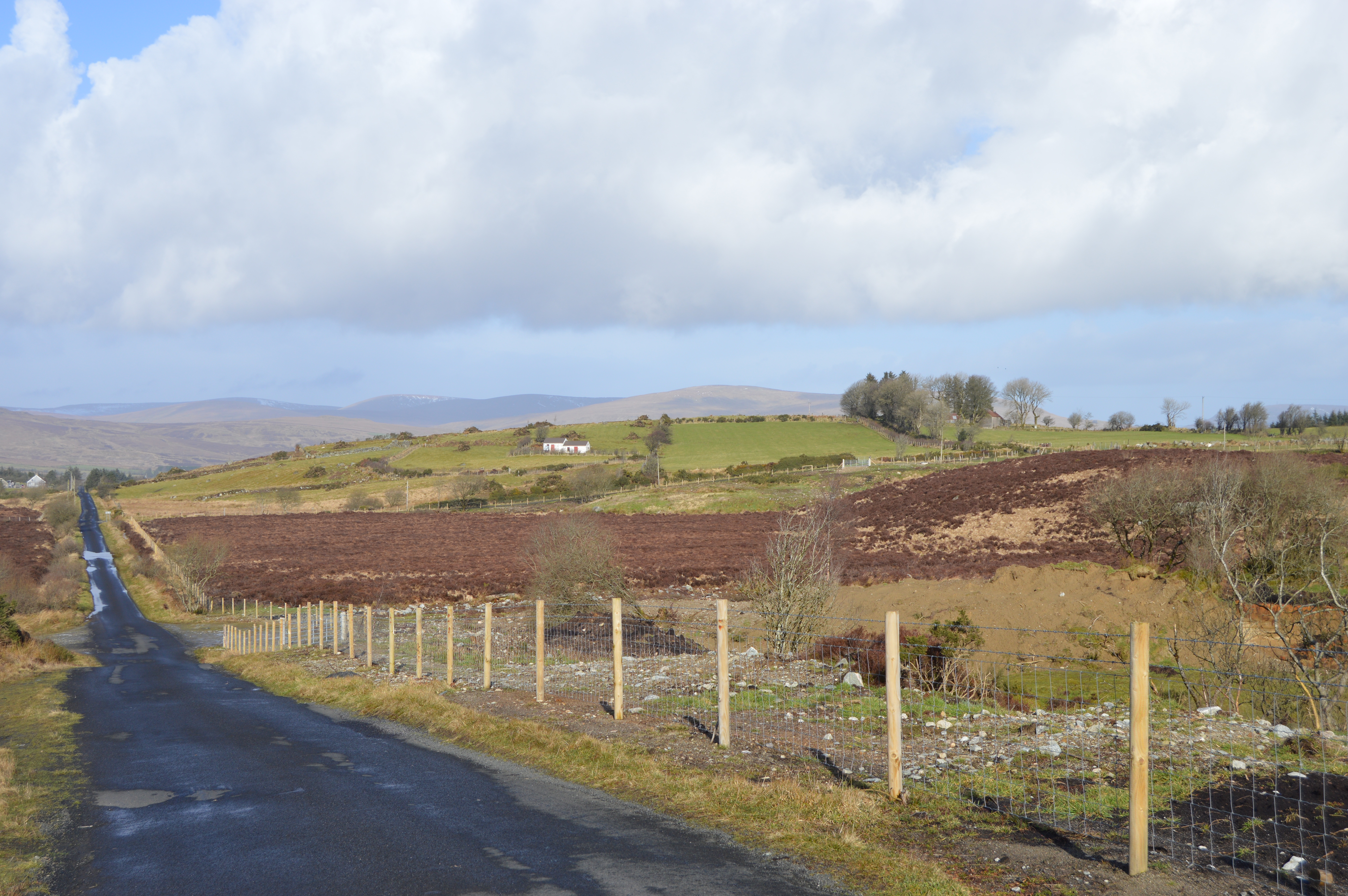
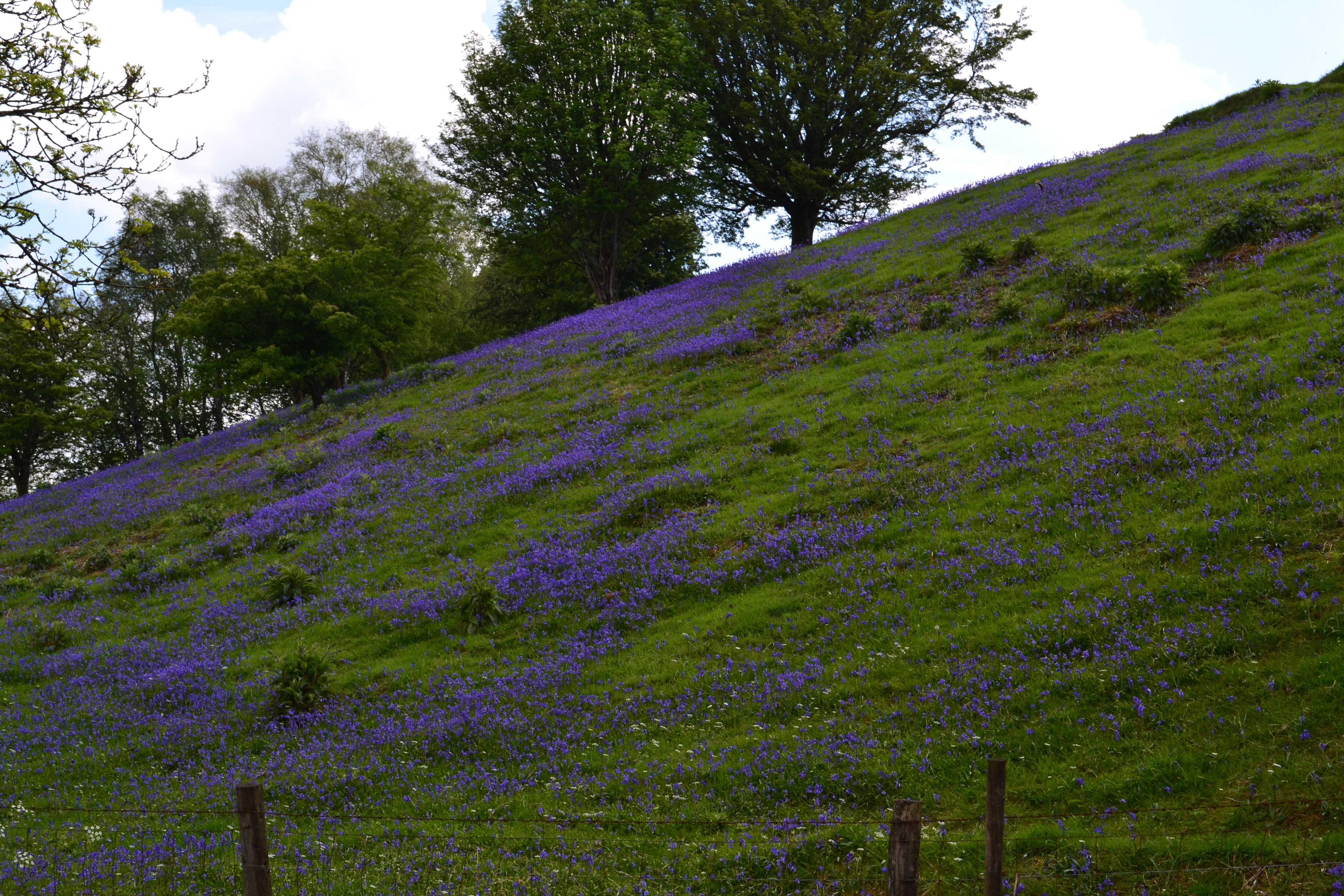
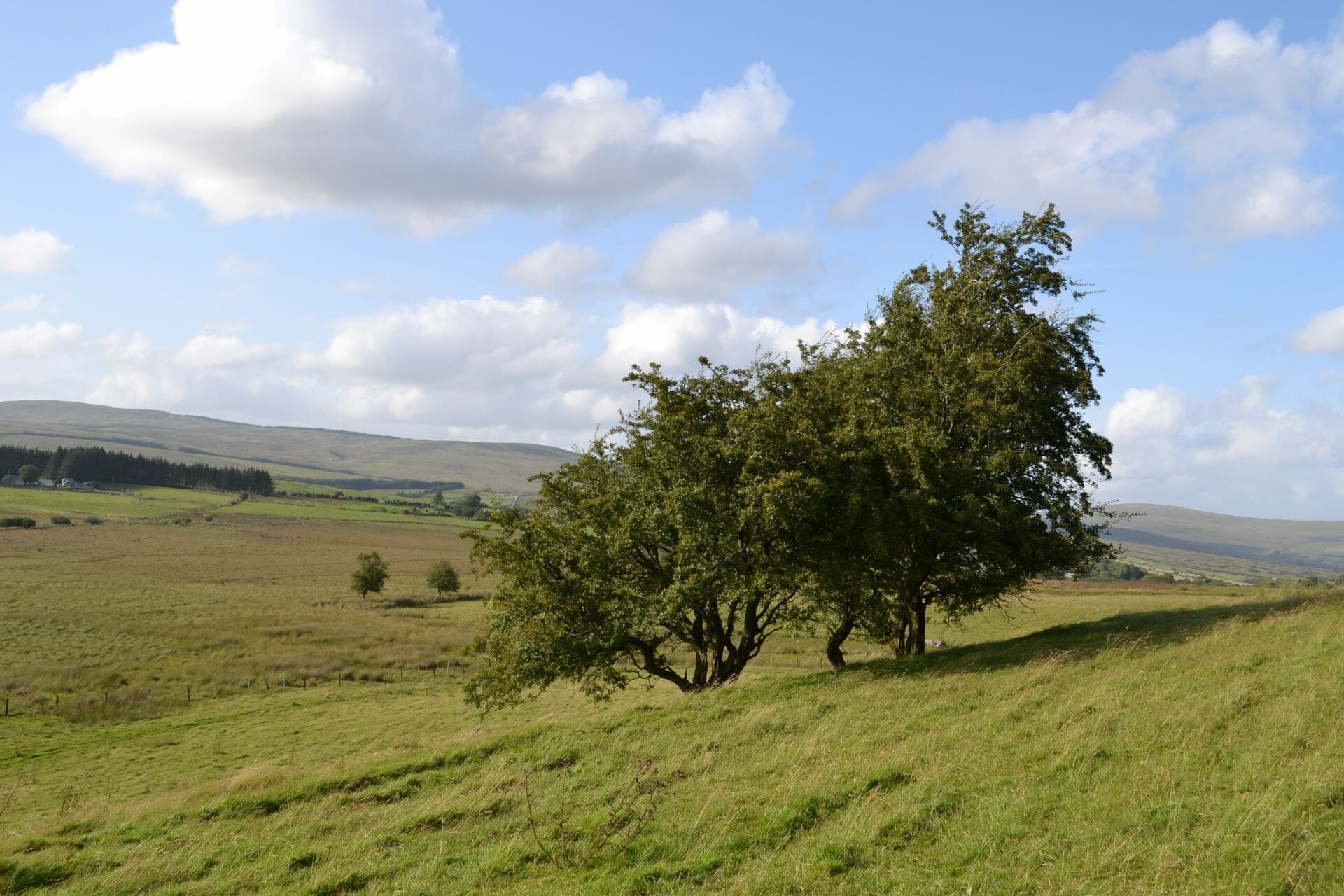
PHOTO – A view north towards Boley.
Tullybrick lies on two levels:
There is the lower level, which consists of the southern slopes of the Moyola valley and the upper level which consists of an area of mostly flat bogland which we refer locally to as a “flough”. This flough runs the entire length of the townland, with the exception of a few sandy hills here and there, from Owenreagh right up to Davagh.
PHOTO – This is a view west over the flough towards Davagh.
With the exception of Boley and Stonehill where the sandy hills allow for arable farmland, the rest is mountain grazing or inaccessible bogland. Some of this bogland is known as `bog flow` and is little better than a carpet of sod on top of a reservoir of peat and water. Many of these areas are extremely dangerous to walk across and quite a few sheep and cows have been lost in them over the years. In the 1970`s during work on a drainage scheme a large tracked digger sank almost out of sight while at work on one of these flow bogs. In another incident at the lower end of this flough near the Blackwater bridge, a sandpit was filled to a depth of 8 or 9 feet when the wall of this underground chamber burst in the middle of the night and swept into the pit below. It seems that, unknown to the sandpit owners, as the sand pit was quarried closer to one of these underground holes, the wall of the chamber grew thinner , eventually bursting causing the entire contents to flood into the sandpit. It was lucky that it happened when nobody was working or there could well have been fatalities. This tells us something of the depth and size of these bog flows. It is most likely that these were lakes over which grew a mat of plants down the ages, and which gradually obliterated them from sight. If you were game enough to approach the banks of Teel Lough you would see this in process. It would seem that the lough is steadily getting smaller as the overgrowth encroaches further and further with time. It is just not safe to walk on the banks of this lough because of the holes in this blanket like surface.
Stone Hill, on the eastern side of the Tullybrick road is the highest point in the town land and is a sandy and rocky patch of land which lives up to its name. There is no doubt that this area is very much undiscovered as a place of Neolithic habitation. Its high position and the abundance of stone would set it out among other parts of the vicinity which has known sites and remains, yet there seems to be little recorded about it.
These high parts of this townland would have been inhabited as far back as the Neolithic times, as the many stone monuments to be found there tell us. The entire southern side of Tullybrick lies alongside an area of extensive Stone Age habitation. We are told that Tyrone was one of the most densely populated areas in Ireland during this age and places like Ballybriest, Slaght, and Davagh would have had the most dense habitation in Tyrone. There for, it is not surprising that Tullybrick would have been quite heavily populated as well. Another factor in this townland being so heavily populated in that era would be that there was an abundance of sandy soil there which these people preferred to the richer and stiffer soils of the river valleys. The tools which these people had to cultivate the soil were crude and only effective in the loose sandy soils .Hence they stayed on the higher sandy soils. It is fascinating to think that people lived in such numbers in an area which today is covered in bogland. In those times, the climate was considerably warmer and there would have been very little bogland in this part. In fact some experts believe that over cultivation of the land by these people led to the development of blanket bog which now covers the upland parts of the townland. It is believed that the first farmers came to Belleevna around 3500 B.C. so it would be likely that they would have settled in Tullybrick sometime after that. There are several reminders of these people to be found today in Tullybrick. In part of Davagh which was formerly part of Tullybrick, there is the site of an ancient burial ground called Temple Moyle and believed to have been a site for a church which was never built. On its summit at present stand a number of stones sunk on their ends in the ground and partly appearing above the surface. These stones are said to stand at the heads of several graves now sunk into the soil. At some period, a couple of centuries ago, on exploring this burial place, a number of bones and skulls were dug up and subsequently buried again on the site where they were found.
The reason why this site now lies outside Tullybrick is that there had been a dispute between a Lady Trench and Captain Stevenson, the two landlords for that particular area, about marches. The end result was that Stevenson lost out and the site became part of Davagh.
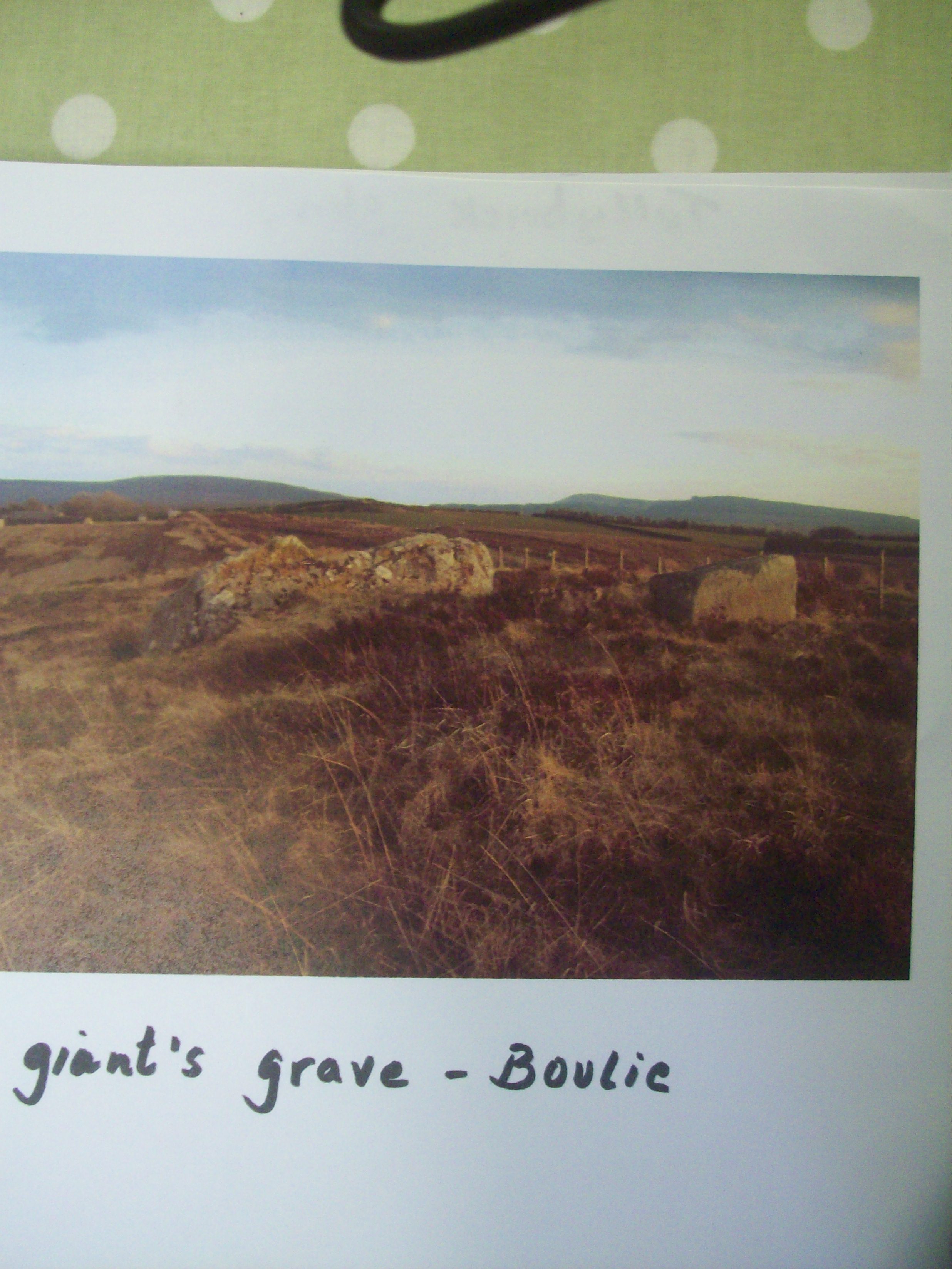
PHOTO – The Giant`s Grave.
In Boley there is a cromlech locally called the Giant`s Grave. It occupies an area of 24 by 21 feet and is enclosed and divided up into subdivisions by large stones set on their ends and sides in the ground and seem to have been covered at some time by a large canopy of stones. In fact, one of the canopy stones still remains in its original berth, supported on columns and other large stones and stands about 2 feet 9 inches above the surface. It measures 8 feet in length, 4 feet 4 inches in breadth and 14 inches in thickness. Several of the stones from this site have been dislodged but there are still several large and well shaped stones still remaining. This is undoubtedly the ruins of a fairly large building and stands in a secluded hollow in that part of the town land. There is a stone burial site in Tullybrick glen. In the south western part of Altaeskey, just behind Pat McCrory`s house there is an area of land which is described by the Archaeological Survey of N.Ireland as :
the remains of an extensive prehistoric cairn field with pre bog walls forming part of a field system, the exact limits of which have not yet been determined. Further work is to be done to determine the limits of this site in the near future.
The cairns are small, roughly circular low mounds and have an average diameter of 2 m. though several are larger at around 4m. There are about 25 cairns and more may yet be discovered. While some appear to be loose ill defined masses of stone, others are kerbed, well defined and still have an appearance of something more than mere field clearance. Several of the cairns seemed to be capped by slabs though inspection is difficult due to heather and grass growth over the cairns. The suggestion of capstones and the well defined kerbs on several of the cairns does suggest that some may contain burials All the archaeological features are in thin cut- away blanket bog and are visible as low heather covered mounds.
There are 2 small sections of pre-bog field wall in close association with the cairn field. Like the cairns they are located in thin cut-away blanket bog. Both sections of wall do run into deeper bog and more work is planned to try to follow them by probing in the deep bog. The most westerly feature (marked with a dot with a circle around it on a map) consists of two slabs set with flat sides parallel to each other approximately 2 m. apart. The slabs may represent an entrance feature or the remains of a once larger structure, though it has been confirmed by the land owner that the site is just as it was uncovered by turf cutting.
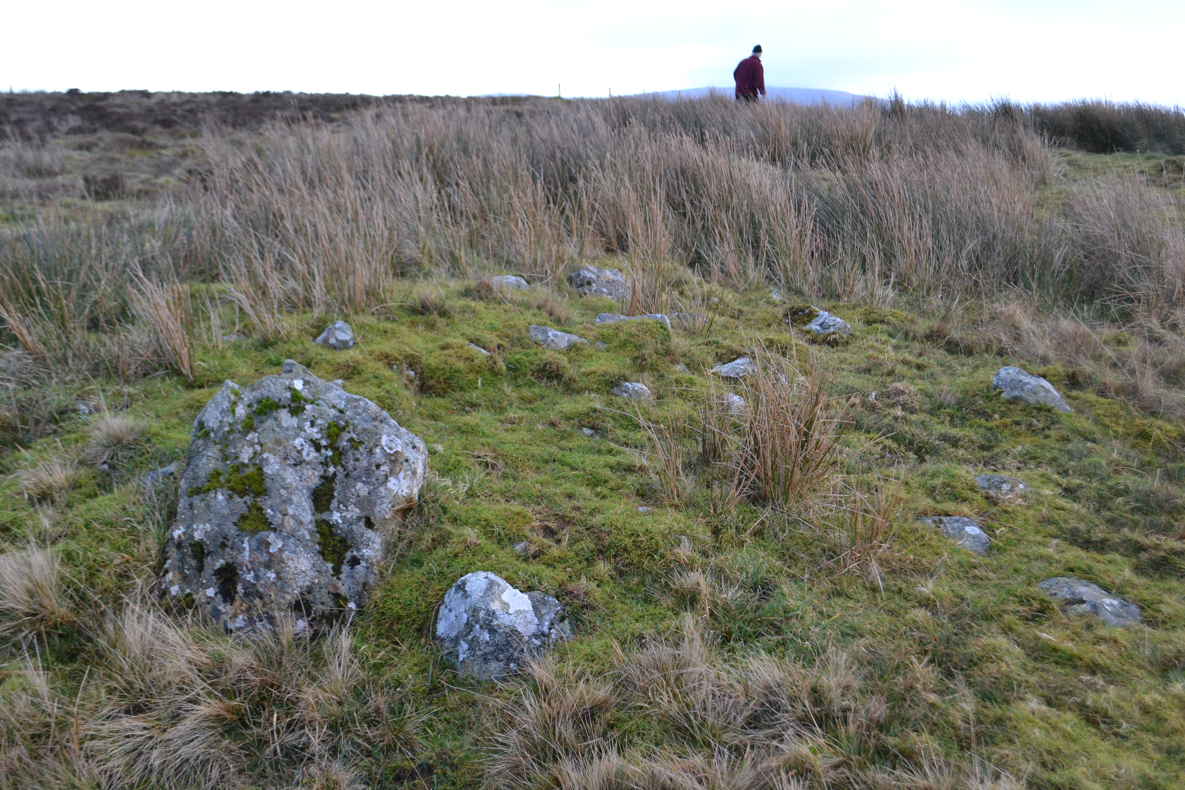
Photo – Stone/Bronze Age cemetery
Here we see one of the many small stone mound graves which are to be found at this site.
There are several areas in Tullybrick where there are great numbers of large stones to be seen and it suggests that there are many sites either many more sites to be discovered or that many have been disturbed over time and used for various purposes. It can be difficult for us to understand nowadays why people should disturb these sites which are such an important part of our heritage. However, people living in days gone by in this area did not have the luxury of our affluence and if a few large stones helped them to build a house or wall to survive in the trying circumstances in which they had live, they took them and did not think much more about it. They were uneducated as to the archaeological value of these sites and perhaps should not be blamed. There can be no doubt that superstitious fears helped save a lot of sites around the country
One example of an undocumented site in the areais the Standing Stone, a landmark which lies alongside the highest part of the Tullybrick road close to Lough Fea. It is most likely to have been a dolmen. The top stone and one of the support stones seems to have been disturbed at some time. The hilly area close to the junction of Boley road and Tullybrick road is known locally as Stonehill, for obvious reasons and is so thickly covered in large stones that it must have been a significant site during this era.
Three families moved up to this part of the town land around the end of the 18th century when the landlord was expanding his estate. This meant that every piece of land was going to be cultivated and fields and stone ditches were to be constructed. Inevitably sites would be disturbed as these people strived to eke out an existence in this rough terrain. When I see old stone walls in these areas I am always looking for stones that may have been part of, and taken from some historic site .
In the Ordinance Survey Memoirs we are told that
“In that subdivision of Tullybrick locally called Bolie Colmcille, and in the holding of Pat Cassidy, there stands a stone column called Bacan na Glisha. It stands two feet and a half high, two feet broad and one foot thick. It is locally said that St. Colmcille had a cow called the glas gelvin which was kept constantly tethered to this stone and that the stone was in consequence called Bacanglasgelvin (the grey cow`s tether stake) There is some impression around the neck of the stone said to be caused by the tether by which the cow was confined.”
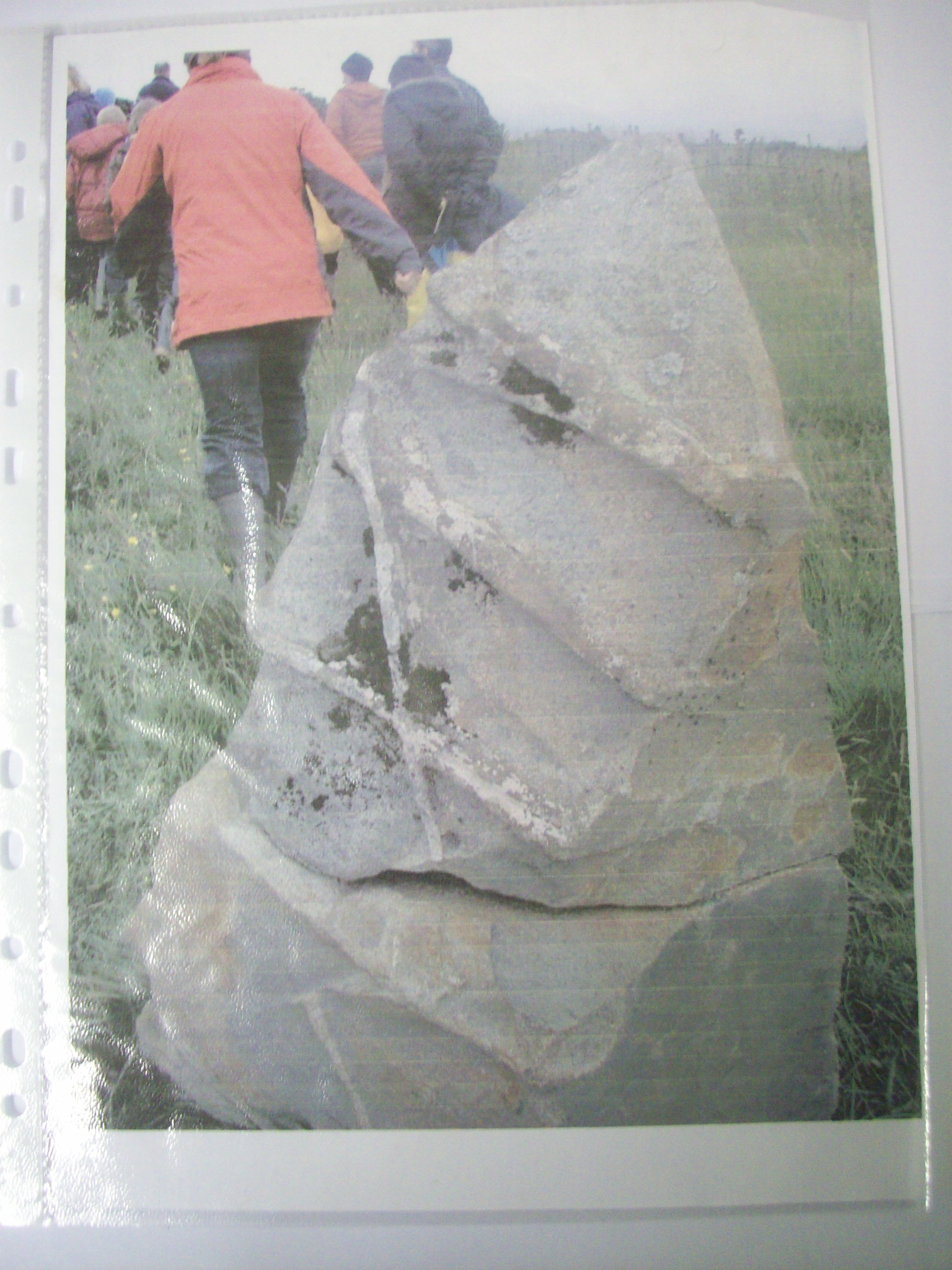
PHOTO – Bacan na Glisha.
This stone matches the exact dimensions of the one mentioned in the O.S. Memoirs. As well as that, the surface has the peculiar shapes and markings on it believed to have been made by the cow. However the truth is that these are like hard seams in the stone which remained intact as the rest of the stone eroded away making it look like the tracks which a rope would make over an extended period of time. It would be easy to believe, when one looks at the stone sitting upright in its original situation, that the marks were indeed made by a rope a long time ago. It may have been used later as a scratching stone for cattle. These scratching stones were common all over the country and are often confused with standing stones but are in fact not from that age at all. This stone was also taller at the time of its use in order to fulfil its purpose and the lower half of it was found recently only a few feet away and buried deep in the soil. It looks as if this stone had been disturbed when the people were digging the lazy beds for potatoes at some stage. Someone perhaps had got tired of digging around it each year and tossed it on its side and it became eventually almost completely covered over or perhaps a cow knocked it over as she scratched on it. This is a typical example of how many other sites in the area may have become disturbed by the progress of man. Some sites were broken up to make stone fences while in other cases the large and accessible stones were ideal for building.
In 2009 while stripping topsoil and peat at Creagh sandpit a 4000 year old cremation site was unearthed a small depth below the surface and was sadly dismantled at the request of Creagh Concrete. This was a treasure belonging to the area and should have been allowed to remain there in situ.
Its position may yet prove to have been very significant as other sites may be found in the future but it will be very difficult to do now that it has been taken away.
All these remnants of Neolithic people, which are to be found and which are also buried beneath the blanket bog in Tullybrick, are a reminder of a civilisation which existed here for a long time indeed. These people chose this part of the landscape because of its sandy soils which were easier to till with their primitive tools.
The high ground of Tullybrick is very sandy and thus it is in that area that we are most likely to find traces of Neolithic habitation in the townland. There are several reminders of this civilisation to be found throughout this townland but we must also remember that most of them are covered in blanket bog and are only exposed when the peat is extracted at various periods down the years.

Photo – St. Patrick`s Church.
The grounds of St. Patrick`s Church lie in the town land of Tullybrick and are over 150 years old. Building commenced in 1853 and the church was opened in 1957.Its origins were rather controversial at the time because the Parish Priest of the time was totally opposed to its construction. It is difficult to understand why he should oppose the building of a local church since the people of the Sixtowns had to travel up to eight or nine miles to get to mass on a Sunday, most if not all of them fasting from the night before.
The people were determined to have their church and began to build regardless of the Parish Priest`s opposition to it. In the traditional manner of the time , someone took on the contract of building the church and the locals all pitched in with voluntary help.
The chapel was called St. Patrick`s, in recognition of the historical connection which was believed to exist with the Old Church at Moneyconey. Its centenary was celebrated in 1957 when it got a bit of a facelift for the visit of the bishop. It received further renovations again in the 1980`s before being fully restored this year, 2005.
The graveyard is now fully used up and indeed so are two new portions. It is interesting to note that the location of the burials in the original part followed a geographical pattern in those days. The Tullybrick and Owenreagh people usually buried in the lower end next to the road while the people from the upper end of the Sixtowns buried in the high part next to the chapel building. Apparently there was a bit of rivalry between these two sets of people and that on fair days there could be the odd bit of banter or stones clodded on their way home from the town. Segregation in the graveyard would be hard to believe but that’s how the graves turned out to be laid out.
There are some fine old headstones in this graveyard, the oldest being that of the Connolly family of Moyard. Again most of the headstones are in the part nearest to the chapel building. There are many graves with no headstones in the lower end and these graves will probably never be identified again since the parish kept no records of where anyone was buried and the people who could point out some of these are dead and gone now. The poor people could not afford headstones in those times and those who could put up a headstone on their family plot either got a legacy to do so or else money was sent from America by members of the family to put one up.
We can see evidence of this on some of the headstones. Then there was the burial spot on the ditch on the eastern side of the graveyard, for the stillborn or the unbaptised babies. This policy has, at last, thankfully been abolished by the Catholic Church and the wrongfulness of it fully recognised by them.
Altayeskey Primary School.
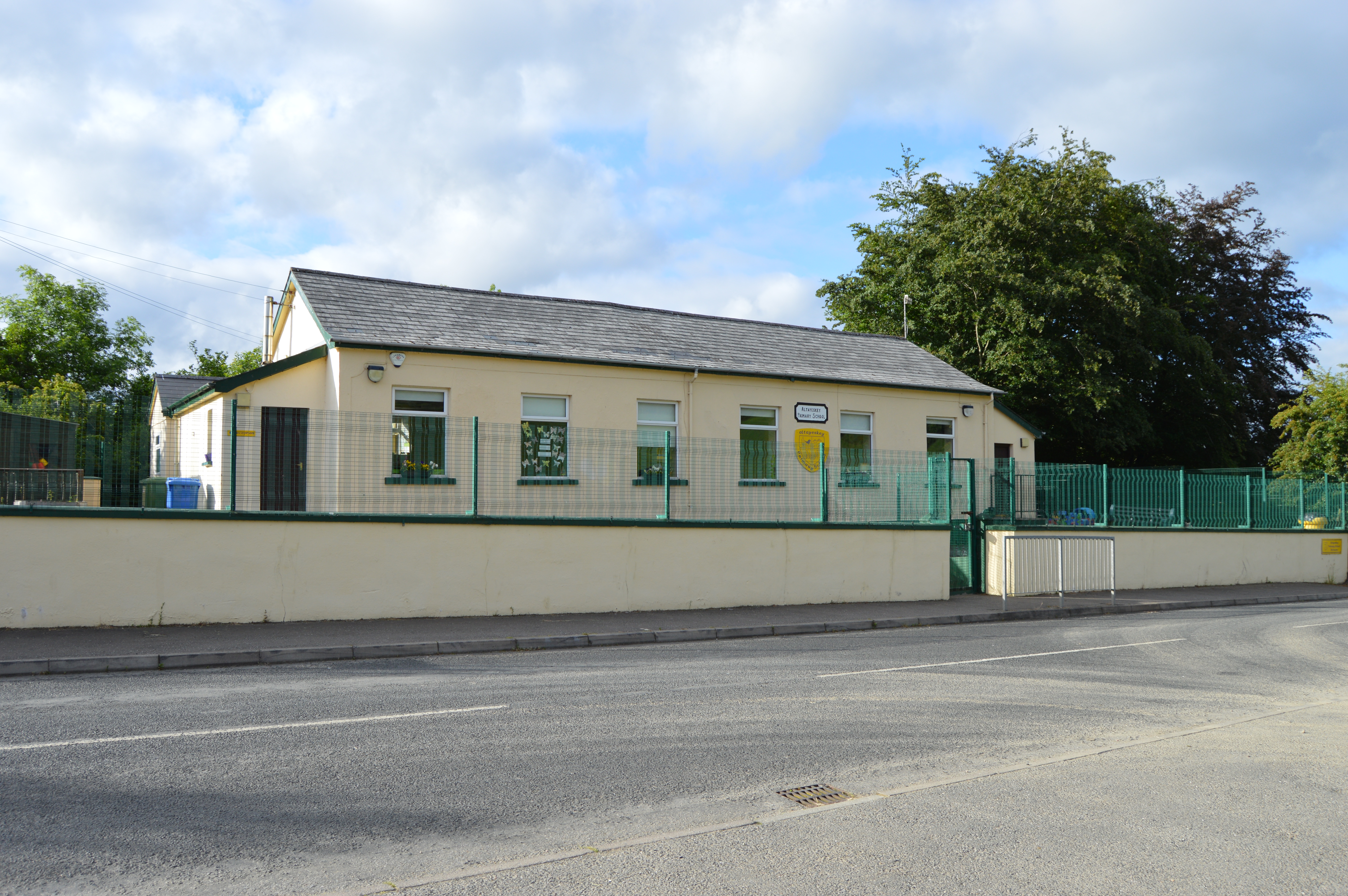
The local Primary School lies in the town land of Tullybrick and must have opened sometime in the 1820`s.The Ordinance Survey Memoirs tell us that in 1832 the school came under the control of the Education Board. The school building was a one storey and thatched building. It measured 25 feet by 12 feet inside and had one door and two windows. The school was of mixed denomination. All catechisms were taught on Saturdays if required and there were regular visits by clergy from the Presbyterian and Catholic churches. The principal was Master Daniel McBride.
It had on its rolls 30 male and 20 female pupils. The total number of pupils was 50 with 47 Catholic and 3 Presbyterian.
Most of these pupils were under the age of ten. In those days the older children were kept at home for herding cows and other farm work during the summer months. James Gill
espie who was born in 1832 an emigrated to America, tells us in his memoirs that when he was at school many of the pupils would only attend school in winter when work on the farm was slack. He tells us about writing his name on his copybook and having a discussion with the master as to how his surname should be spelt. Judging by his writings in his Civil War diaries the standard of education seems to have been good when he attended Altayeskey school. The school register dates back to the year 1903 with Paddy (Dan) Conway the first boy`s name on it.
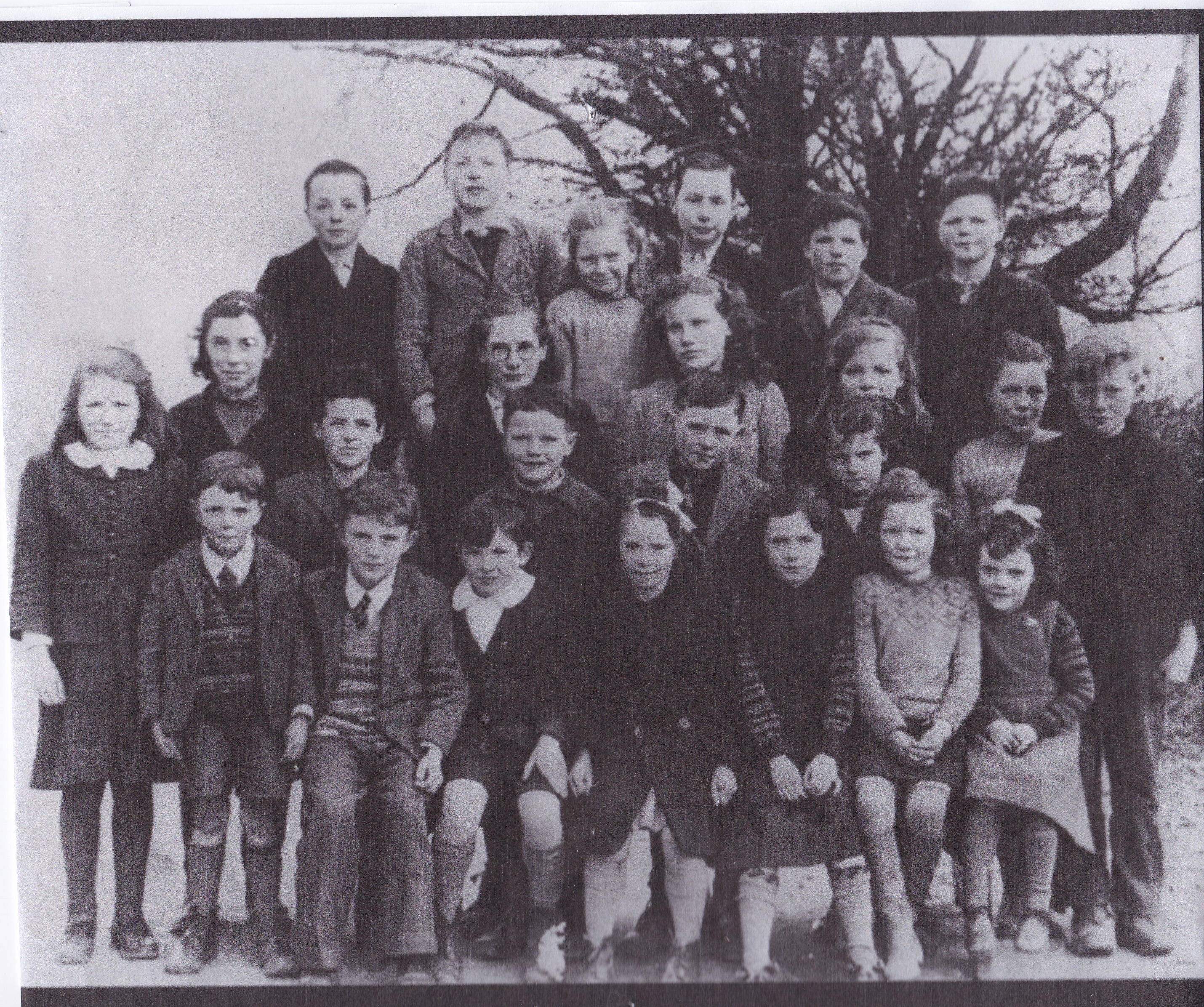
PHOTO – Pupils of Altayeskey PS in the 1950`s.
The road from Sixtowns to Cookstown passes up through Tullybrick glen or as it is more affectionately known “the Big Glen” and rises very steeply from the main road up to the flat top of the townland and Lough Fea.
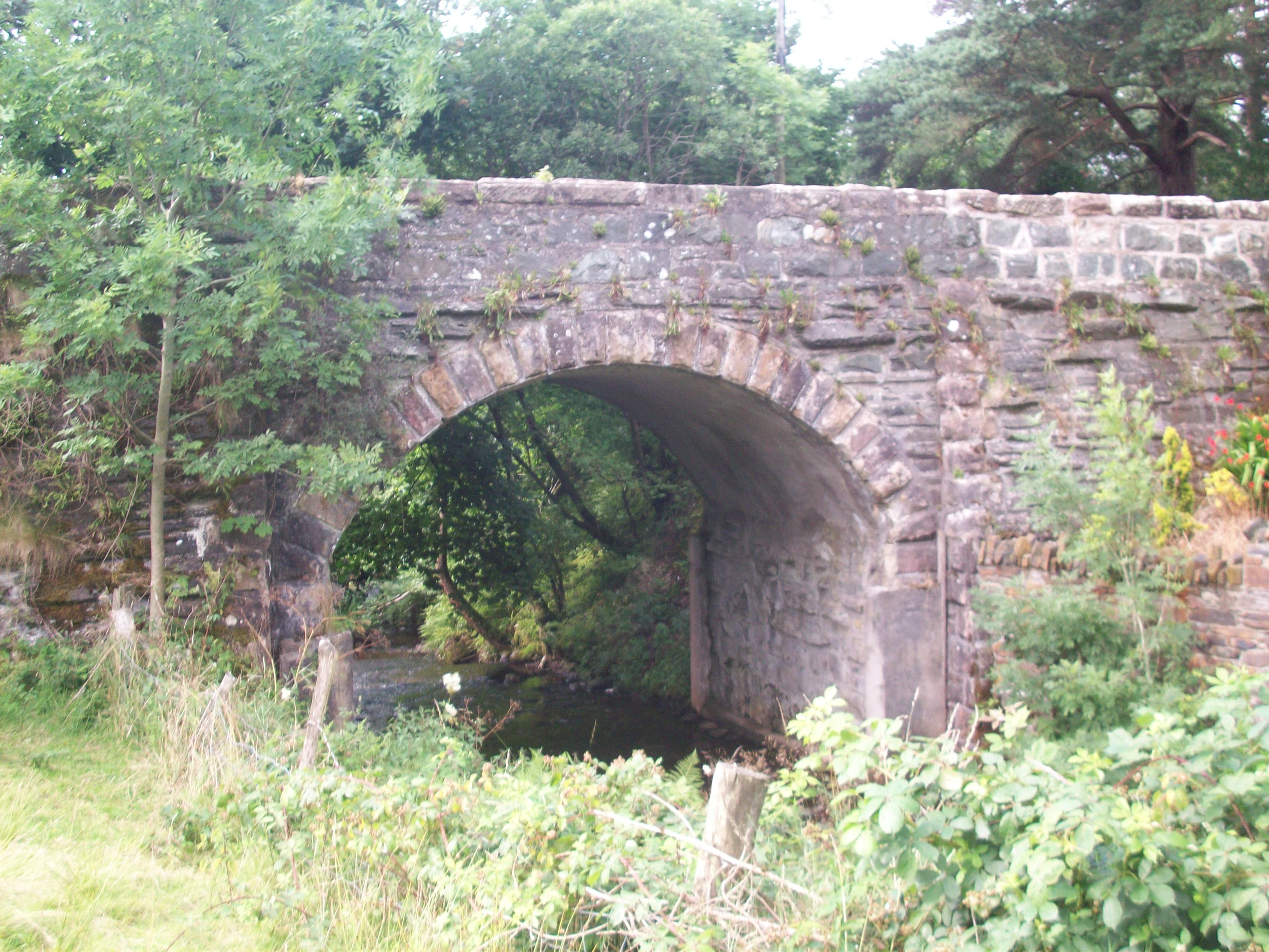
The bridge at Tullybrick/Altaeskey
The bridge at Tullybrick on the main road joins Tullybrick to its sub townland Altayeskey. Local folklore tells that the stone mason who built it brought his wife along to cut the stones and he built them. They did a nice job.
There are still some wonderful ruins of old houses all over Tullybrick, a reminder of people passed on and lives spent many years ago.
The Shilling Hill.
The origin of this place name is not known. Some suggest that it may come from the word for oats that have had their outer sheaths removed in the mill. Perhaps the” shilling” was being transported home from the mill and there was always some spillage on this hill as the carts swung around it. On the other hand it may be an old Irish word for the wild honey bee `siolan` which gives the place its name.

The Sixtowns Cross Community Centre in Altayeskey.
Fairy Trees.
The old people had strong superstitions about the fairy tree. One thing you never did was to cut one down as you would incur the wrath of the fairies. There was a local story of a man who was cutting down a fairy tree in Tullybrick and how the tree began to bleed. The frightened man patched up the tree with all the pieces which he had hacked out of it. Her then tied the pieces in place with his handkerchief and headed for home. The next morning when he got up he looked out and there was his handkerchief tied to the top of a tree in his garden. There are many stories about these trees which still make local people wary.
Here is the 1901 census list for Tullybrick.