Our Stone Age Farming Ancestors.
People have lived in the Sixtowns for between 3,000 to 4,000 years. They farmed the land to some extent.
How do we know this?
There are quite a number of monuments to be found scattered along the high ground in Owenreagh and Tullybrick which are evidence of a civilisation which dates back that many years.
These people lived on the high sandy ground of these areas because they had not got the tools to clear the forests or cultivate the heavier soils of the lowlands.
They grew oats and some root crops and it is believed that they over cultivated the land and this lead to the growth of the blanket bogs which we find there today. These people lived on the high ground of Owenreagh and Tullybrick because the soil there were sandy and easy to till with the primitive tools which they had. The richer but stiffer soils of the valley floor were too difficult to till and that is why they did not live there.They obviously kept domesticated animals like goats or sheep, the bones of which were found at the site. They would have gathered fruit and nuts as a means of supplementing their diets.
However they lived here for a very long time and they were of a civilisation that was more sophisticated than they are given credit for.
Most of us know very little about the culture or beliefs of these people and over the years this lack of respect has led to the disturbance of many of their monuments as farmers and others made changes to the land. The layout of many these monuments still baffle the experts so we have to assume that these people were quite intelligent.
Cremation site near Lough Patrick.
Perhaps the recent find at Creagh quarry of a cremation site and burial monument which is believed to be about 3,500 years old gives us a window into some aspects of their lives. In fact four sites in all were unearthed in 2008.
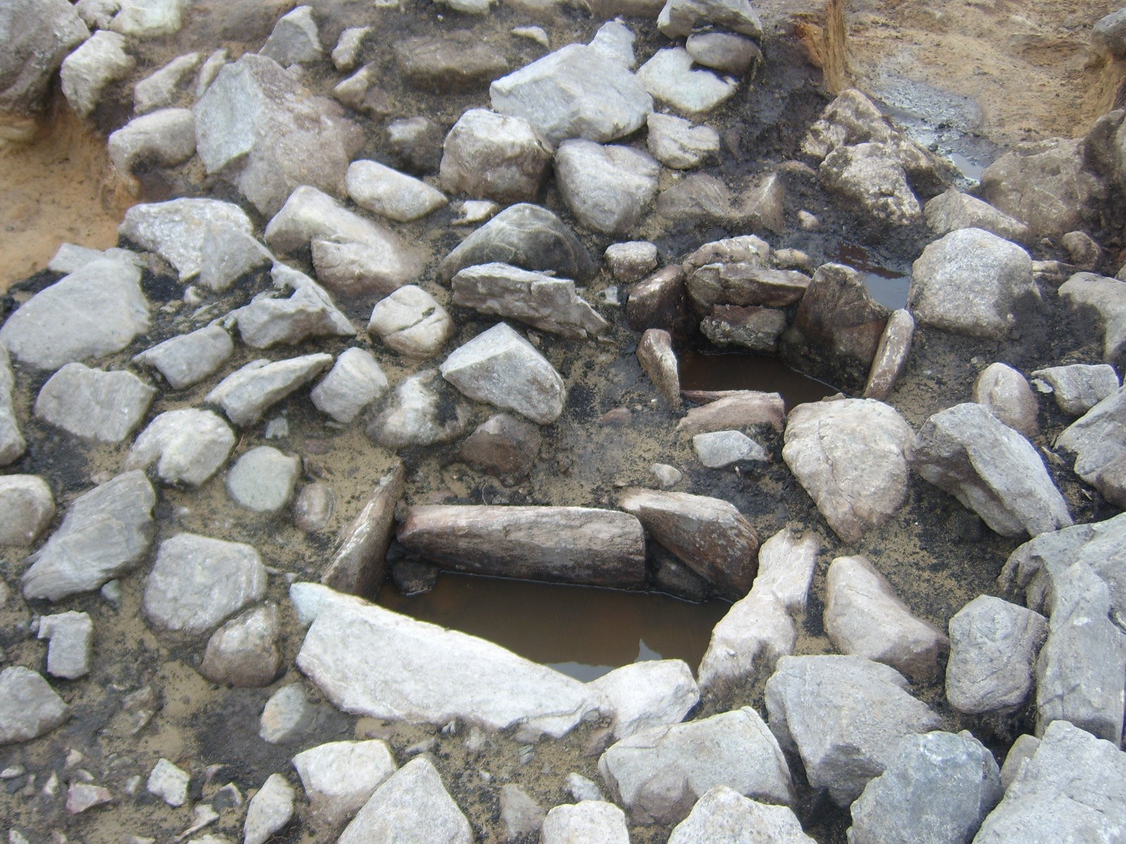
In the largest site were found the cremated bones of two adults, a man and a woman in one cist and the same at least in the other.. There was evidence that the bodies had been fleshed before cremation.
Fragments of sheep/goats were also found in these cists. Samples of burned oats were also taken from the dig which indicates that farming was being carried on here at that era, albeit crude. Also found were fragments of flint tools, pieces of pottery and it is safe to say that a significant settlement existed around this site and is either still buried beneath the peat or have been removed by farmers who were making improvements to their lands.
The archaeologists who worked on this site estimated that is was around 3,600 years old. This excavation, while it is fascinating, is only gives us a small window into the world of these people, a mere page in the unwritten history of the first people who lived in the Sixtowns area thousands of years ago.
More sites.
There are many visible monuments to these people all along the high ground from Owenreagh to Tullybrick to Davagh and these include two sweathouses, several cairns and graves as well as sites where there are traces of settlements. Many more are buried and may never be found.
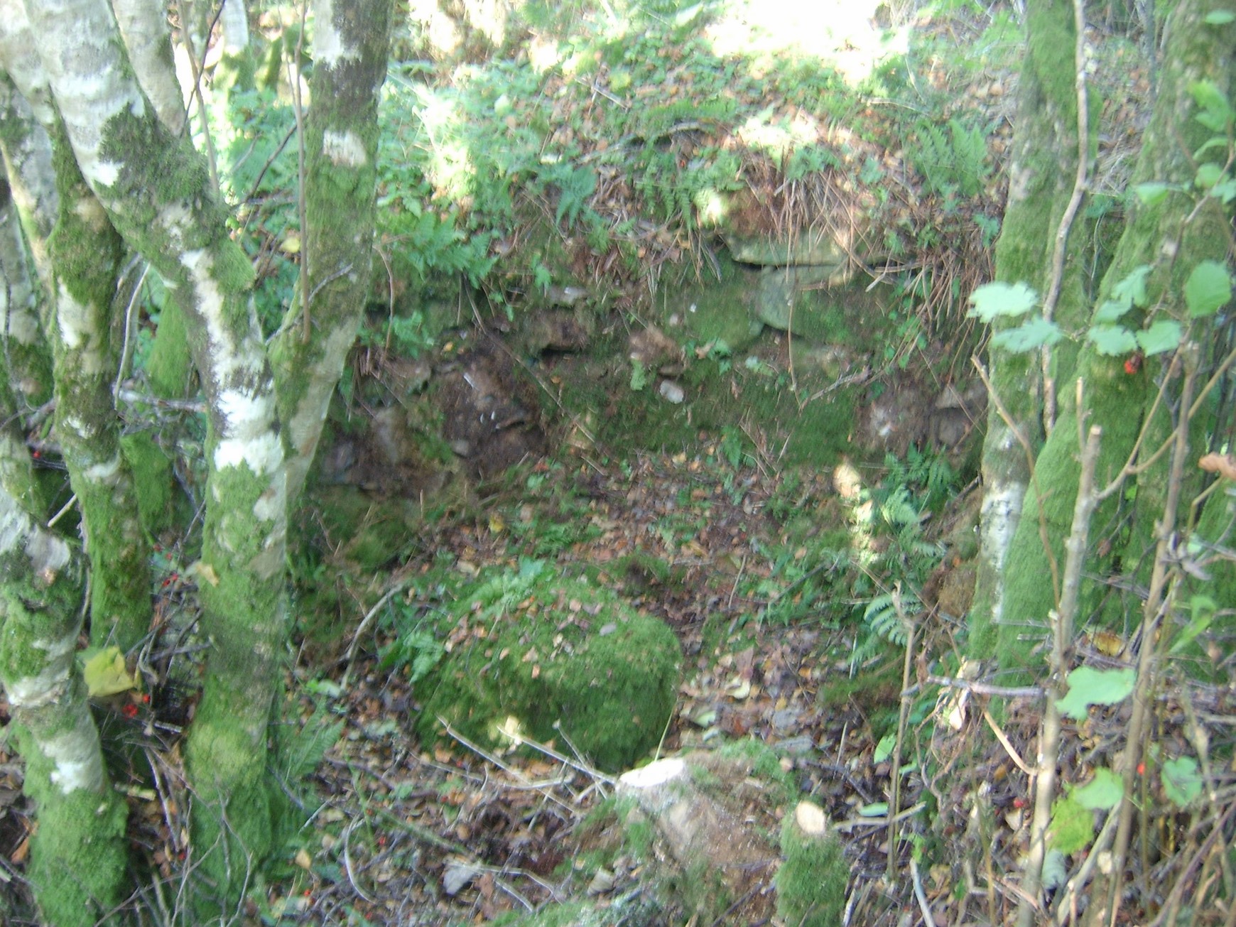
This is the remains of a sweat house in Glenviggan.
There are the remains of a sweathouse in Crockban, Tullybrick close to the edge of Glenviggan. Sweathouses were much like modern day saunas where people sat inside them in order to remedy ailments or indeed to cleanse their souls. A fire would be lit to heat the stones and then the person(s) would enter for a sustained period. It shows us that these people were not as primitive as we might believe and that they knew quite a bit about mending the spirit and body.
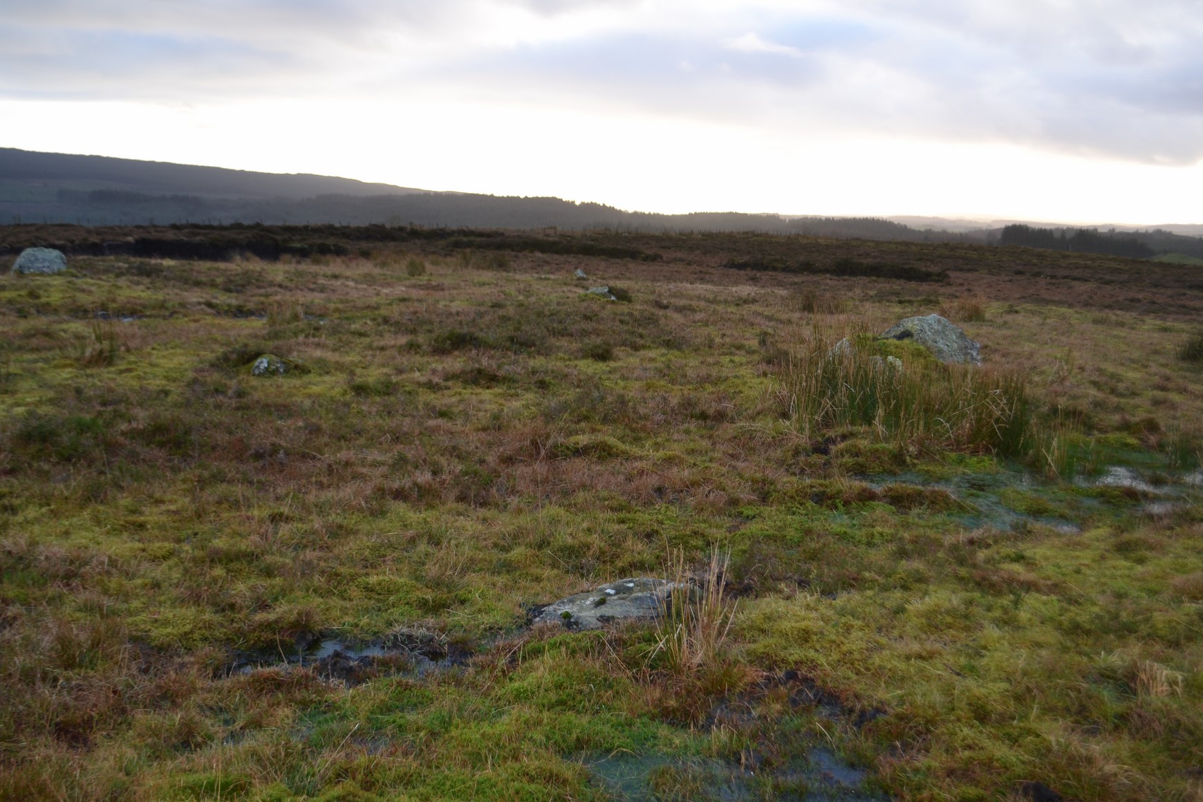
A number of burial mounds have been discovered by turf cutters in Altayeskey. There could be upwards on fifty of these in one area and may form some sort of equivalent of a Stone Age cemetery. This site has not yet been fully explored.
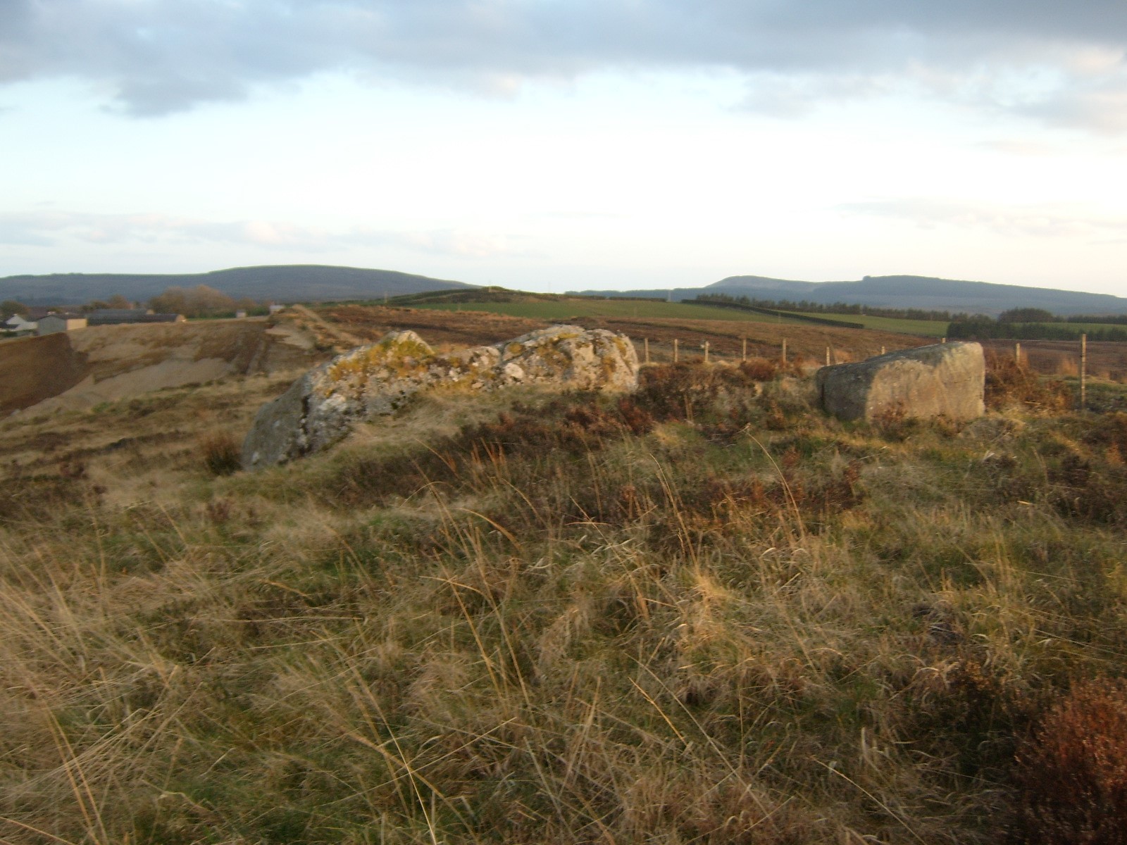
There is a huge stone at the edge of Creagh sand pit in Owenreagh called the Giant`s Grave. It is believed that a giant is buried beneath but it is hardly likely that these people would have been able to shift such a huge stone. There may have been someone buried underneath part of it.
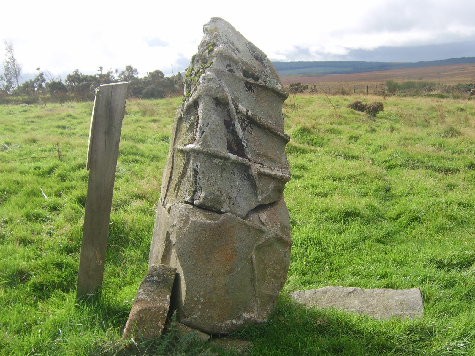
The Tethering Stone.
There is a curious looking stone standing in a field on Stone Hill in Tullybrick and legend tells us that this was the stone to which St. Colm Cille`s heifer was tied. It was even claimed that one can see the rope marks around the top of the stone.
In actual fact this stone could predate St. Colm Cille by a long time indeed as it is most likely to have been some sort of Megalithic ritual stone.
The Ordinance Survey Memoirs in 1835, stated that :
“In that subdivision of Tullybrick locally called Bolie Colmcille, and in the holding of Pat Cassidy, there stands a stone column called Bacan na Glisha. It stands two and a half feet high, two feet broad and one foot thick. It is locally said that St. Colmcille had a cow called Glashgelvin which was kept constantly tethered on this stone, and that the stone was in consequence called Backanglashgelvin or `the grey cows tether stake`. There is some impression around the neck of the stone said to have been caused by the tether by which the cow was confined.”
 .
.
The Bronze age leaves much less traces of its people behind barring the odd ring fort or site of a settlement.
It is not until the end of the first millennium that we have any information about who lived in the Sixtowns.
The old church of Scrine provides us with some sort of timeline of events and where and how the people lived for the period from the start of the 1200`s right up to its demise at the start of the 1600`s .
Folklore tells us that the church was founded by St. Patrick and later converted into a library by St. Colmcille. This is how the church gets its name … the scrine or the shrine/library.
While it is highly unlikely that either of these noble saints ever set foot there, it is most likely that followers of theirs, various religious orders would have occupied the place for many centuries. We do not know how far back the church really dates but there is mention in the Annals of the Four Masters of the erenagh of that church having been murdered in 1182 AD.
There is also an account in the same books, of the church being pillaged by a Dermot McLaughlin from Innishowen, in the year 1202. After sacking the church he was ambushed by an O`Neill chieftain and some local Sixtown lads and a battle took place on a hill just south of the church where Dermot was killed and his men defeated. The hill was called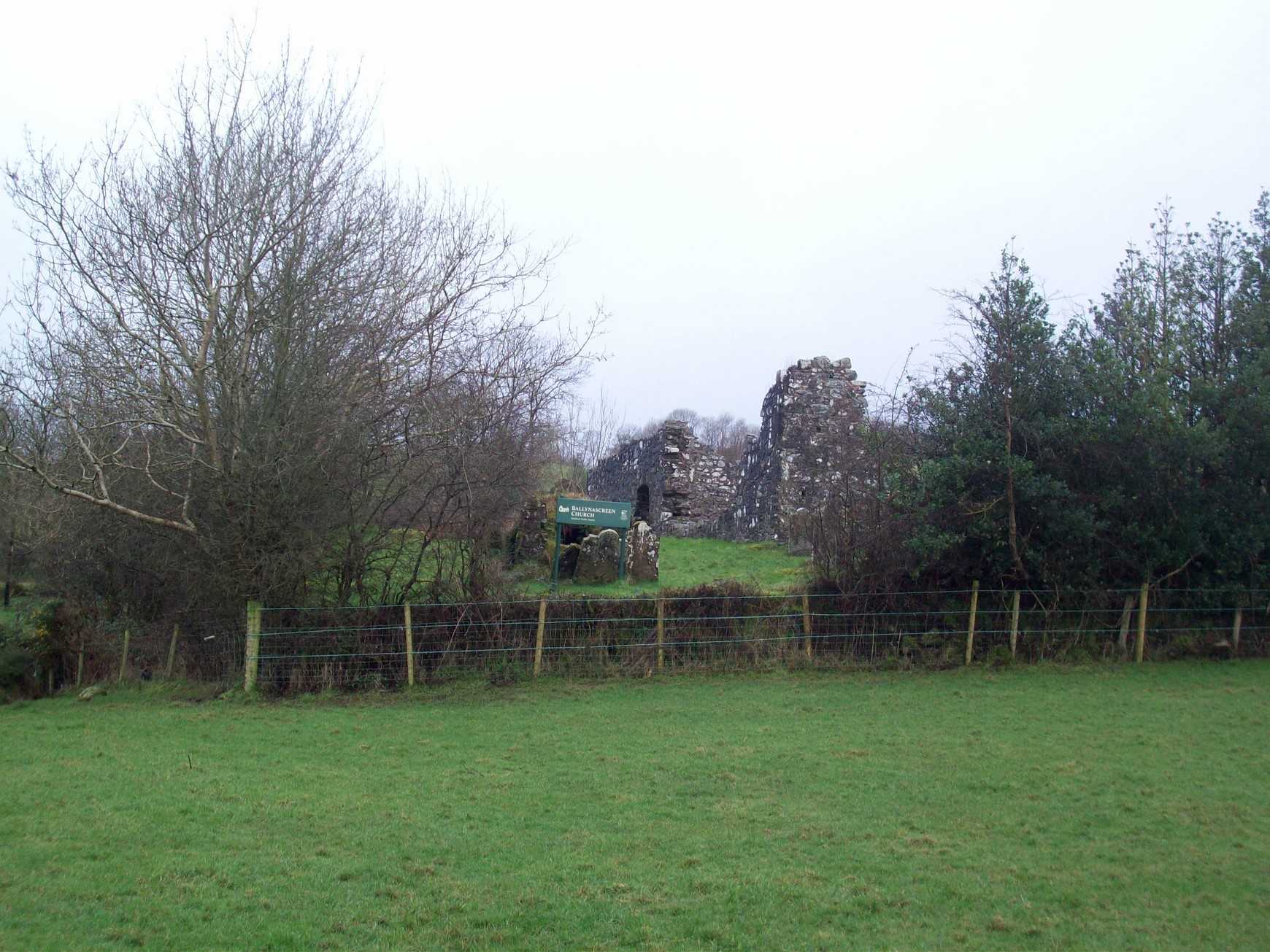
Eiscir Mhic Lochlin which means McLaughlin`s esker from that onwards and it is believed that Dermot was buried there. The subtownland of Altaeskey (glen of the esker) gets its name from this hill.
Here we are provided with evidence that the Sixtowns was populated at that time at least.
The next written reference we have to the church of Screen is of Primate Colton`s Visitation to Derry in 1397. He was sent by the King of England to do a survey on the state of the churches in that diocese. It refers to him staying over at Banagher before making his way through “ye wilds of Glenelly” passing Badony church and following on to Moneyconey and then arriving at Desertcreat. All these churches were connected to the church of Scrine. He was able to say that the country was in a peaceful state and that the churches were in a good state.
200 years later the church of Scrine would lie in ruins after the Flight of Earls. It is believed that Hugh O`Niell`s entourage stayed at Moneyconey as he made his way from Tullyhogue out through Glenelly on the same traditional clerical route which Primate Colton took.In another survey of the state of the churches in 1609 it was reported that there was no erenagh resident there and that the roof was off the church. There was however still a vicar called McGillian there.
A further survey in 1679 reported that the church had now a new roof as well as other repairs done. The rector listed was Andrew Henderson which indicates new tenants, the C.O.I. had taken over the church. This heralded the arrival of the planters in the Sixtowns and an end to the erenagh as a system of settlement.
This also brings me to how the Sixtowns got its identity and name.
During the reign of the O`Neills, for centuries this part of the country had been their territory.
The tradition at that time was that each church would be granted a piece of land to help raise finance for its upkeep. These church lands were called erenaghs and a person would be elected to manage the erenagh. He too had the title of “ the erenagh” and he would rent out the land to tenants. Of the rent which he would pick up, he would take a cut, the bishop would have been given a cut and the rest went towards the upkeep of the church.
The Sixtowns, or six baliboes as they were known as then, were the erenagh lands of the Church of Scrine. The Sixtowns is the only area in the parish which has a collective name. The townlands of Glenviggan, Moyard, Moneyconey, Tullybrick, Cavanreagh and Owenreagh make up the Sixtowns. After the Flight of Earls in 1607, all the lands which had been owned by these lords were confiscated and so with them went the erenaghs which then became the property of the Church of Ireland as it was considered to be the established church.
There are written records that the Church of Scrine was knocked down and built up again several times throughout its history. It can be taken that while there may have been times when it was in ruins it was operating for most of the time from the 1100`s up to some time in the 1700`s when it was finally abandoned. We can also assume that the erenagh would have been occupied right up until the early 1600`s
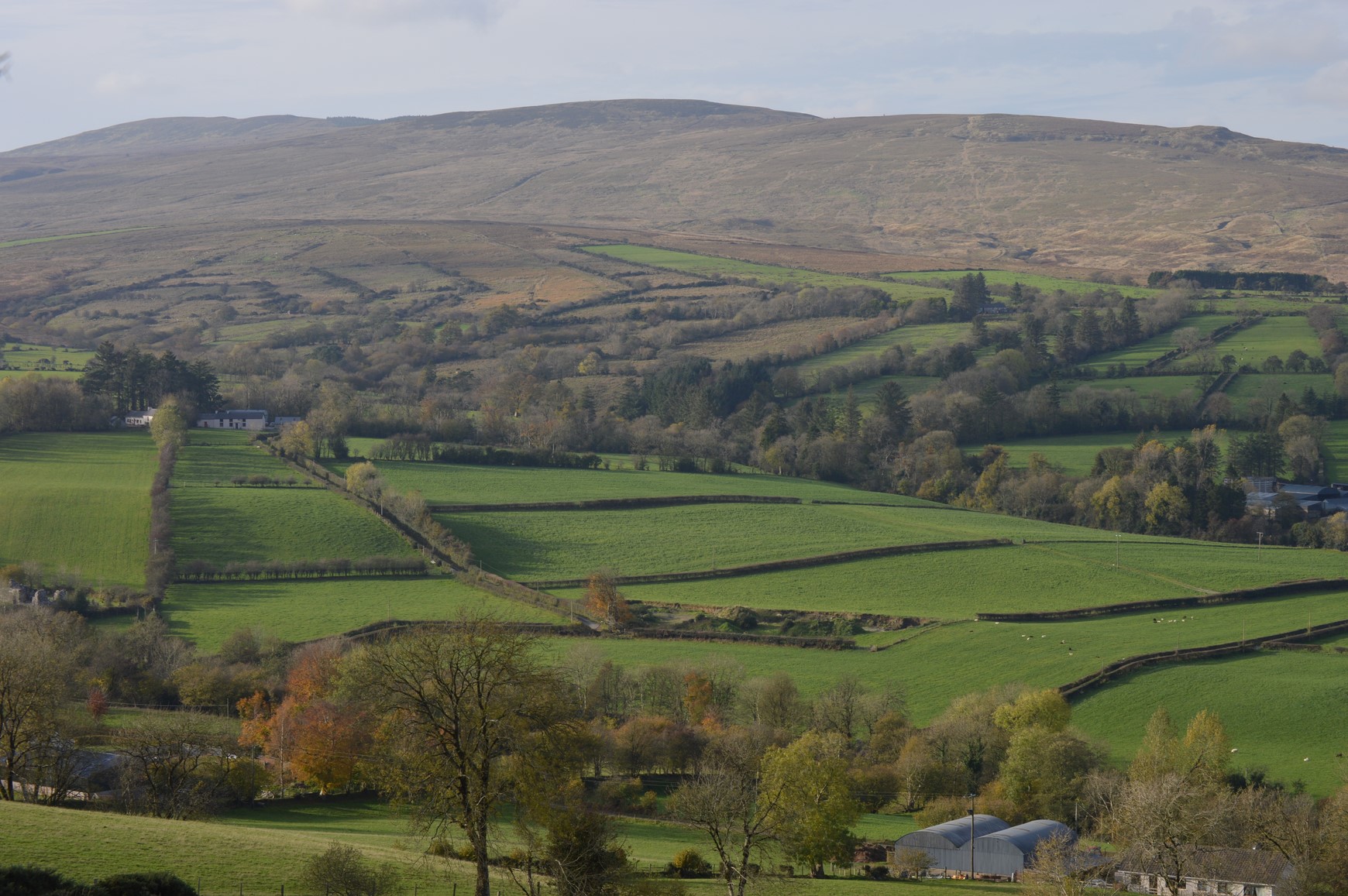
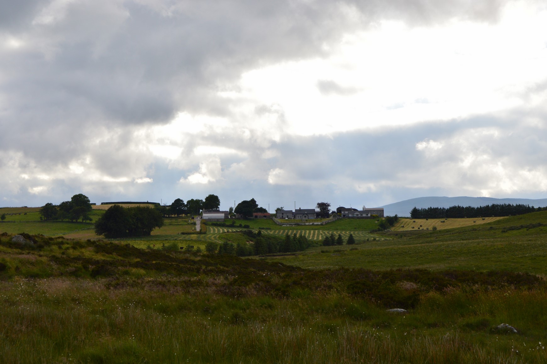
Here we can see some of the erenagh lands of the church of Scrine which is on the left of the picture.
Who were the first recorded residents of the Sixtowns.
The Hearth Monies Rolls of 1664 are the first written records of residents living in the Sixtowns even if it only names the head of the house in each case.
The government of the time sent soldiers out around the country to record the names of any house with a hearth in it which could then be subject to a poll tax.
While these rolls may not be totally reliable, they nevertheless give us a very good flavour of the surnames to be found in the Sixtowns at that time.
There is something intriguing about the surnames listed:
O`Doherty, O`Donnell, M`Laughlin, McColgan, McFadden, McDevitt, O`Gallaghoir, O`Deeny and O`Harkin.
In fact these can all be deemed to be north Donegal surnames. So how did they get to be there in Sixtowns so far away from Innishowen?
There are two possibilities.
1. These people may have been the decendants of Dermot McLaughlin`s defeated army of 1202A.D. who, with their leader having been killed and lost his territories at home , had nowhere else to go and just settled down in the area.
2. The second explanation is more likely to be true and it has to do with the Old Church of Scrine. There was a tradition in the time of the erenaghs, that the religious order which was occupying the church would bring their own people with them as tenants. There for, if an order from Donegal occupied the church, it would follow that they would bring Donegal people with them as tennants. Ther Augustines who had close contacts with St.Colmcilles order were in the Church of Scrine for a long time and would have had strong links with Donegal. It would most likely follow that the tenants of that era were of Donegal names. The only surnames which remain from that census today are Bradley and Moran.
After the Flight of the Earls the Church of Ireland began to rent out the lands of the erenagh and while they brought in Planters to occupy some of the better land they also rented other parts to native people, many of whose descendants are still there today.
Rundale F.arming and its effect on settlement patterns
By the late 1700`s the Planters had brought a new method of farming which they had practised in Scotland. It was called rundale farming.
This system changed the pattern of settlement in the area and from then until well into the 1800`s the people worked a communal type of farming where they lived in clusters of houses called clachans and a leader was elected to divide the arable land out on the basis of need with the mountain land used as common grazing land. It was a very fair system, dividing out land to families on the basis of need and the system could be tweaked over time to keep the divides fair. There averaged about four to five houses to a cluster or clachan, at the start but as the population grew rapidly after the start of the 1800`s there might be up to 8 or 9 houses. The rise in the population created all sorts of problems for the clachans and soon the system began to show the strains and and was no longer functioning properly.
At this time the populated area of the Sixtowns would have been confined to the lower parts of Cavanreagh and Owenreagh or small fertile clearances along the upper Moyola in Altaeskey and Moyard.
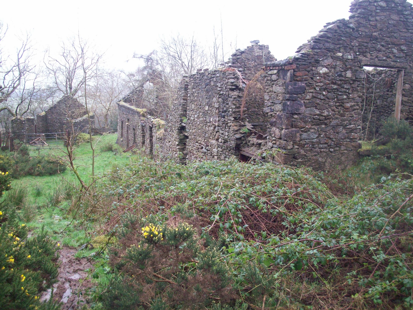
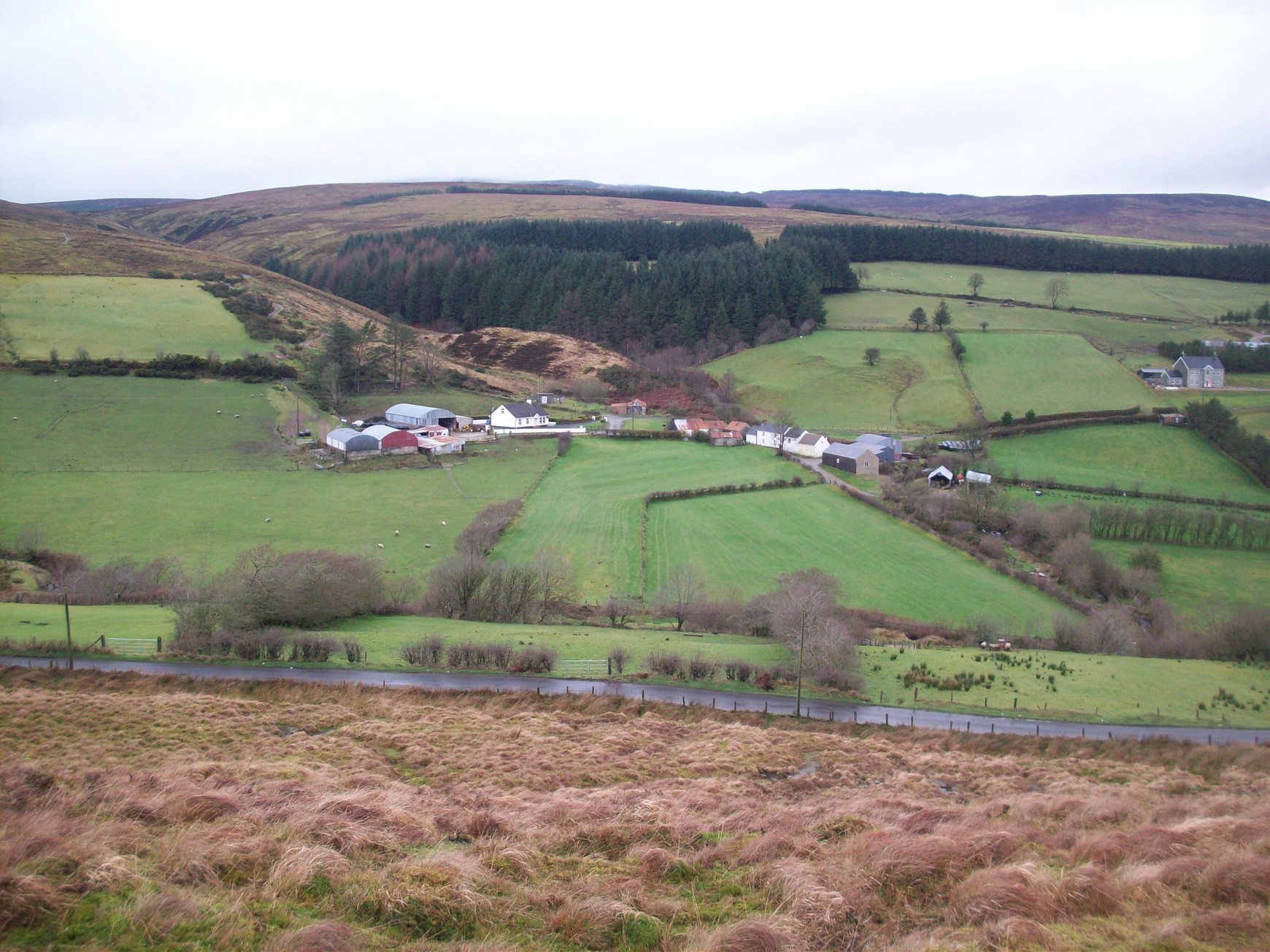
The ruins of a former clachan in Moneyconey.
Each family in the clachan would work plots of arable ground close by and they would grow oats and potatoes. In summer the families would bring their herds up to the mountain pastures above the Moyola valley and they would stay in bothys for the entire summer thereby giving the lowlands a needed rest or the men a chance to harvest the crops free of the threats of rampageing cattle. The women would churn and make butter and they would spin yarn and even took their bees with them to get honey.
This system was known as boleying
The subtownland of Boley in Tullybrick gets its name from having been a boley ground in this era.There are the remains of bothys still to be found in the upper parts of the Sixtowns which had been boulie lands.
Boley which was formerly summer pasture land in the Rundale days.
Settlement patterns change again.
By the early 1830s the rundale system was failing its purpose because of the sudden population explosion which rendered the clachans congested and the land could no longer be divided out fairly and lots of disputes were taking place over ownership and boundaries.
The landlord saw this as the ideal excuse to extend his portfolio of tennents and he decided to break up the clachans and the rundale system, giving each tenant a strip of land which was clearly marked out with fences. Many landlords throughout the Sperrins were doing the same thing. They were referred to as “improving landlords” It also gave him the opportunity to move families from congested areas up to mountain farms in Tullybrick, Moyard and Glenviggan and increase his buisiness portfolio and so a new system of agriculture and settlement was born in the Sixtowns.
LANDSCAPE.
In this new system each tenant would have a strip of land which would run from the lower ground up to the mountain pastures giving him some good, some hill and some mountain ground. These strips can be clearly seen today along the sides of the Moyola valley.
Remains of ladder farms in Owenreagh can still be seen today. The area of land on the left is actually made up of three or four former ladder farms which have been made into one. The farms here ran from the banks of the Moyola river right up to Lough Patrick.
Thus the population of the Sixtowns became more scattered right up into the previously uninhabited and mountainous areas.

New surnames appeared in these areas like Cleary, Campbell and McKenna in Tullybrick and McNamee, Clerkin, Molloy, Kelly and Conway in Glenviggan and Moyard.
Land had to be broken in and fields began to appear on the mountainsides. This was intensely difficult and laborious work and it took generations to bear any fruits.
Among other improvement works initiated by the landlord were the building of bridges, roads and rights of ways. Many of these rights of ways are sadly grown over or incorporated into private ownership leaving very few routes for ramblers to use.
So the settlement patterns in the Sixtowns were by this stage changing completely. The new tenants built their houses mostly above their arable land so as to make it easy to carry manure down to their land rather than upwards. Some of the clachans remained for a while leaving small clusters of houses dotted along the valley sides. The remains of some of these can still be seen here and there, to the present day.
The Hollow in Moyard was a former cluster.
A new system of farming
Most people along the sides of the Moyola valley built their houses above their arable land.
Why?
Then they gradually began to break in the higher land behind them into fields. The soil was either poor rocky and so they had to take measures to improve it.

This system of farming remained up until the present day.
Life was tough, trying to rear a family and pay the rent in a moneyless economy. People were just lucky if they could scrape out a living.
Generally if a tenant could not pay the rent they got evicted by the landlord. However, there are no surviving stories of evictions in the Sixtowns. There are some stories of individual tenants offering to pay an unfortunate family`s rent arrears and later claiming their land. Many were forced to emigrate to America or England.
Eventually the tenants were able to buy out their lands at the start of the 1800`s with the coming of the Land Act. This helped ease some of the strain of rent worries.
Although the landlord system was no more popular in the Sixtowns than it was in elsewhere in Ireland, there were some redeeming factors like the clear designation of farm boundaries and the organisation of roads and townpads to bring better communications and order to the area. Land was granted for a school and three places of worship.
The system ensured that there was always access to and from all farms and it laid out rights of ways and lanes as well where tenants were free to move to and from their homes. Roads were constructed and bridges were built throughout the Sixtowns.
The road from Draperstown up towards Sixtowns was started in 1835 and the bridge at Tullybrick was first built in 1773. The bridge between Tullybrick and Moneyconey was built in 1834 and was washed away by a flood in 1929.
The Moyard road was started in 1928 and by that stage the landlord system was long gone. Local man Barney Conway took the government contract and a boon of volunteers would show up each day to do the labour, their food and drink being their wages. Many were glad to take up the offer in such hard times.