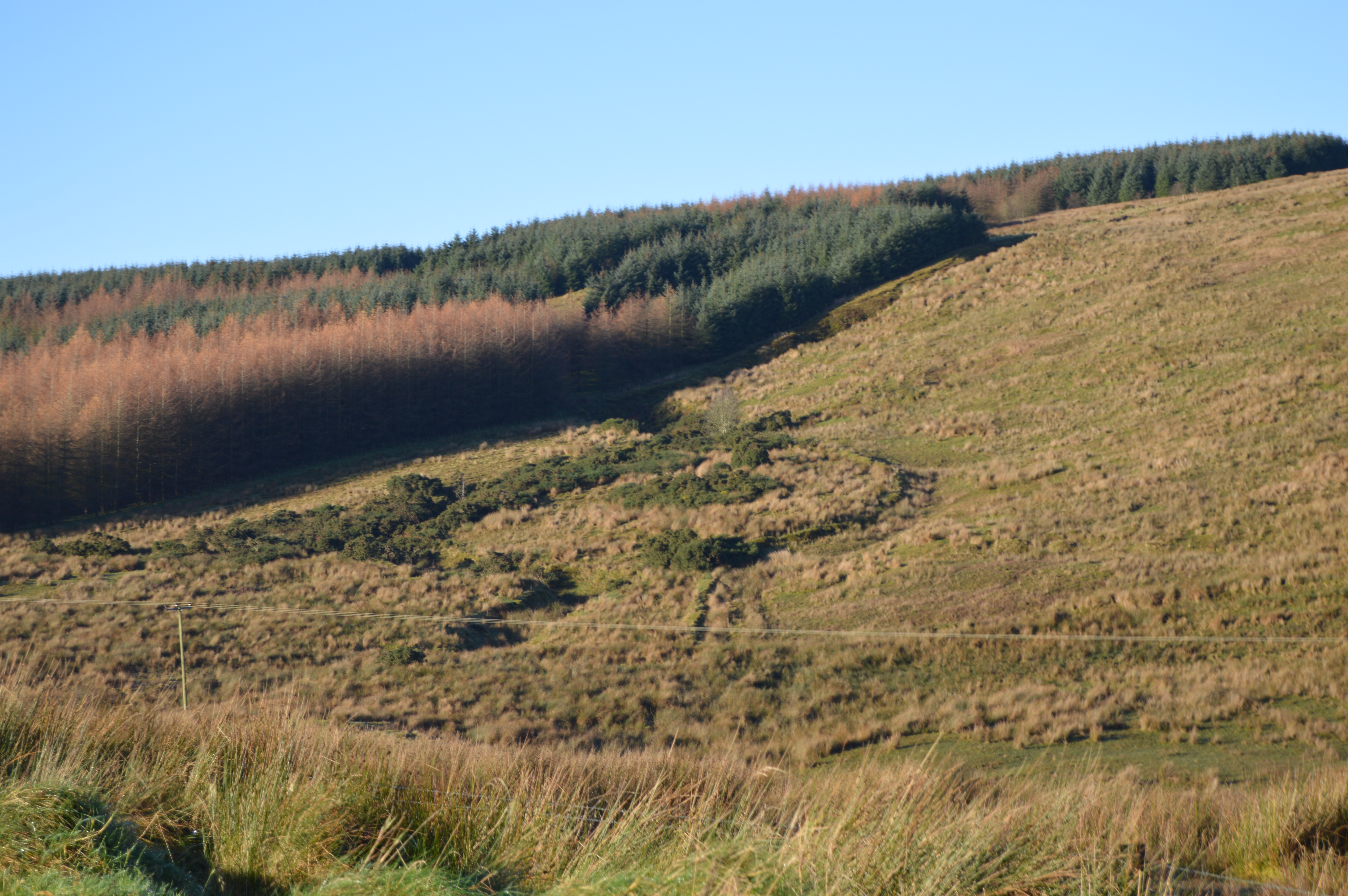
Moyard. (Maigh Aird)
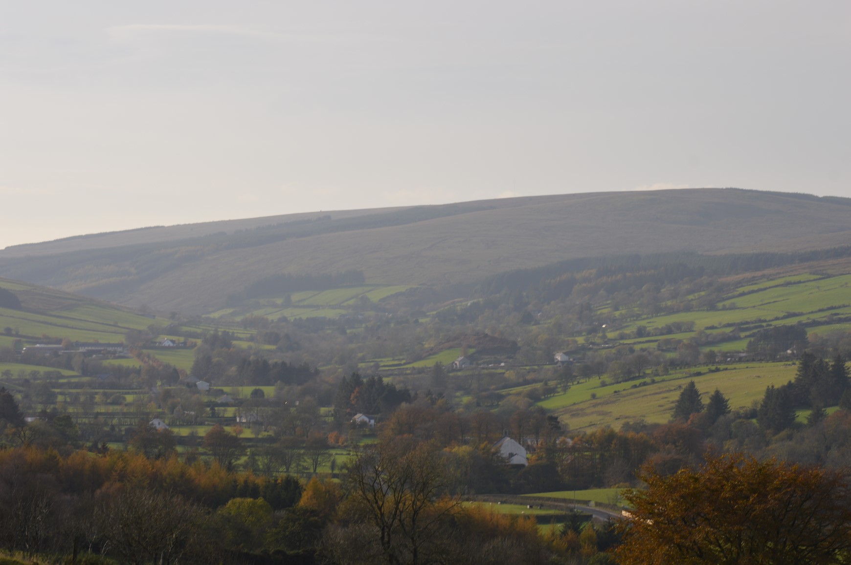
The townland of Moyard is made up of 1580 acres and lies between the townlands of Moneyconey and Glenviggan and straddles the source of the Moyola river.
The name Moyard comes from the Irish words “maigh ard” which mean “the high plain.” This townland used to be called “Maigh ard na ghuail” which means “the high plain of the coals”. This was connected to an activity which was once carried out towards the end of the 18th century when the locals hacked down and burned the forest which once grew on this ridge and used the wood to make charcoal to be sold to the local iron smiths. Some of the logs still turn up half burned as we can see from the photos.
– The ridge which we see just behind the houses is called Ardnagoole and this was once covered in trees, the roots of which are still to be found below the peat surface even today.
The Irish language survived here right up into the 1900`s and as a result we have some beautiful small place names in Moyard.
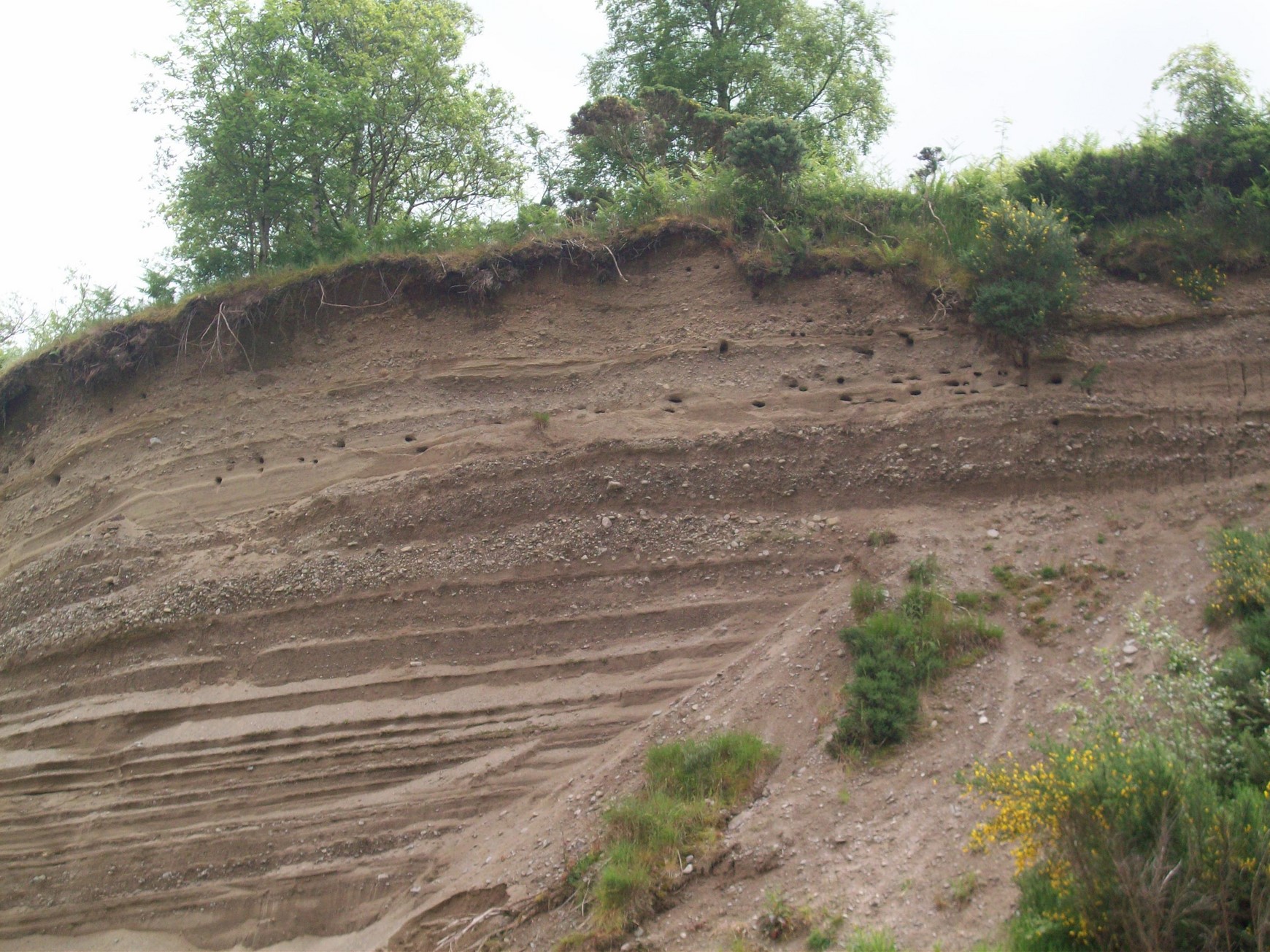
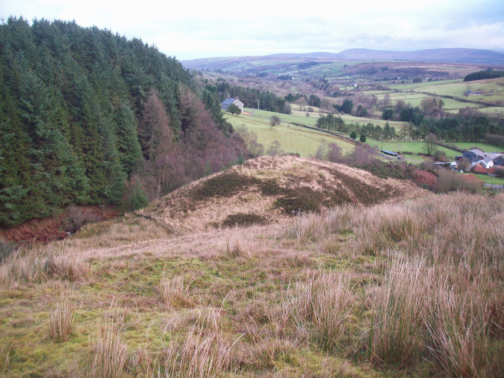
What is now left of Crockahole Hill.
Crockahole (Cnoc an ghuail) meanss hill of the coal. This is all that is left of Crockahole as it has been quarried away over the past 50 years. The sand cliffs provide a haven for sand pipers or sand martins who come back every year to have their young. It is now a protected site, much to the benefit of these rare and beautiful birds.
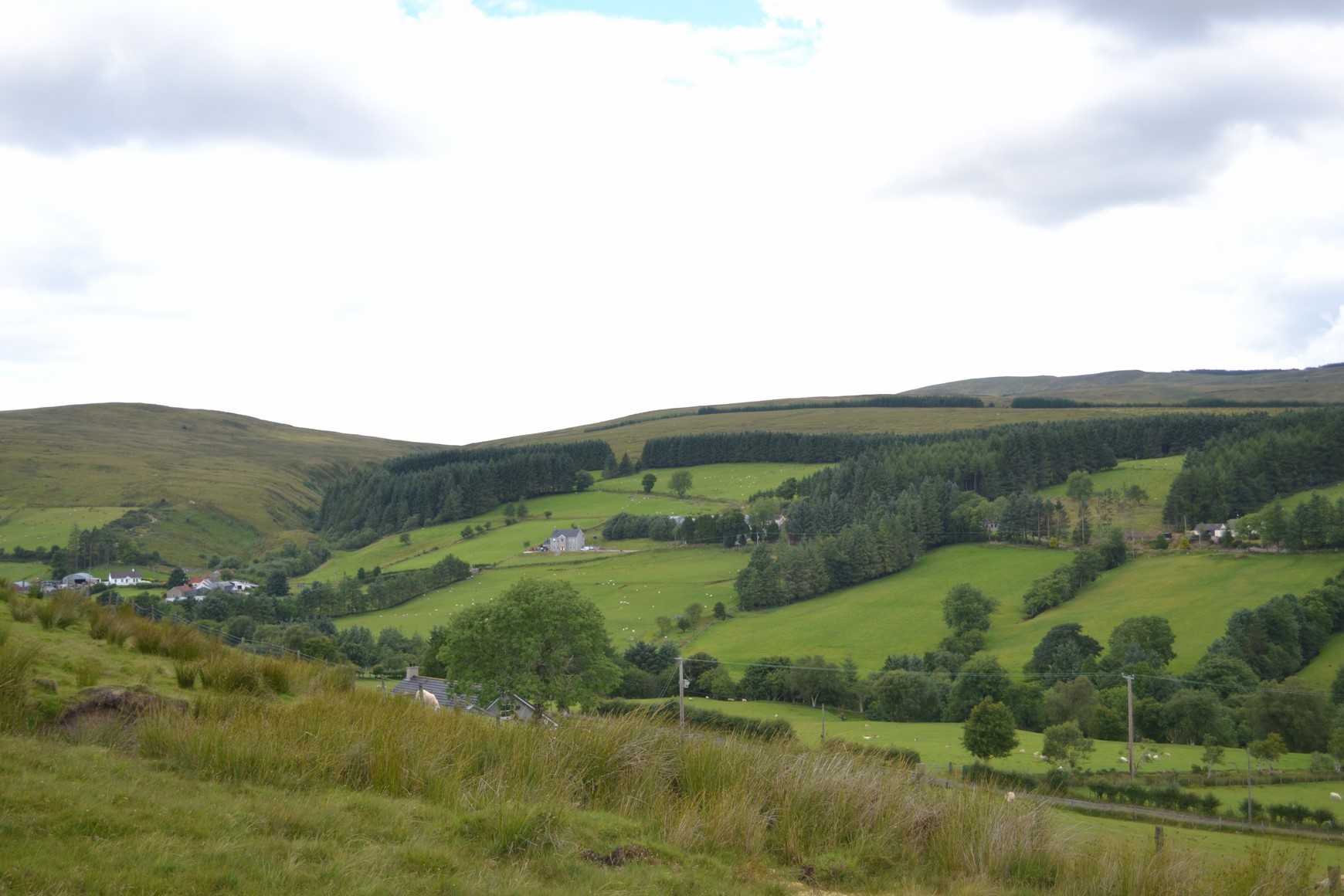
Strannahinch.
Strannahinch (Srath na hinis) holme of the islands (most likely this was a flooded area with several islands on it.)
 Treoltai (centre of picture)
Treoltai — the rough piece. The small tummock in the centre is Treoltai. There are the foundations of a bothy on top of it which may date back to the Rundale days of summer pasturing.
Bealnamala (beal na mallaigh) means “the mouth of the brae.”
 This is Meenastachan which means the “ foot of the grazing “ is the area with fields on the far side of the valley.
Years ago in the townland of Moyard many of the fields had names to distinguish them from one another. The fields were smaller then and there was a greater variety of uses for them, e.g. growing oats, potatoes, grassed, turnips, kale, flax, grazing, meadows and so on.
Here are some of the Irish names on fields in Moyard:
Machaire “ the plain” Talamh bheag “ small ground” cul pairce “ back field” tamnach “ small hill”
Roinn dubh “black piece(sallys)” Pairce Seamas Bhride “Bridie`s Seamus`s field”, Pairce Phadraig “Pat`s field,” Mallaigh bhui “the yellow slope”, Cnoc ban “the white hill”.
There are other names on fields which reflect the increased use of English like:
Turnip field, Black garden, Kiln field, Long dale, Nancy`s holme and Patsy`s brae, Tom`s meadow.
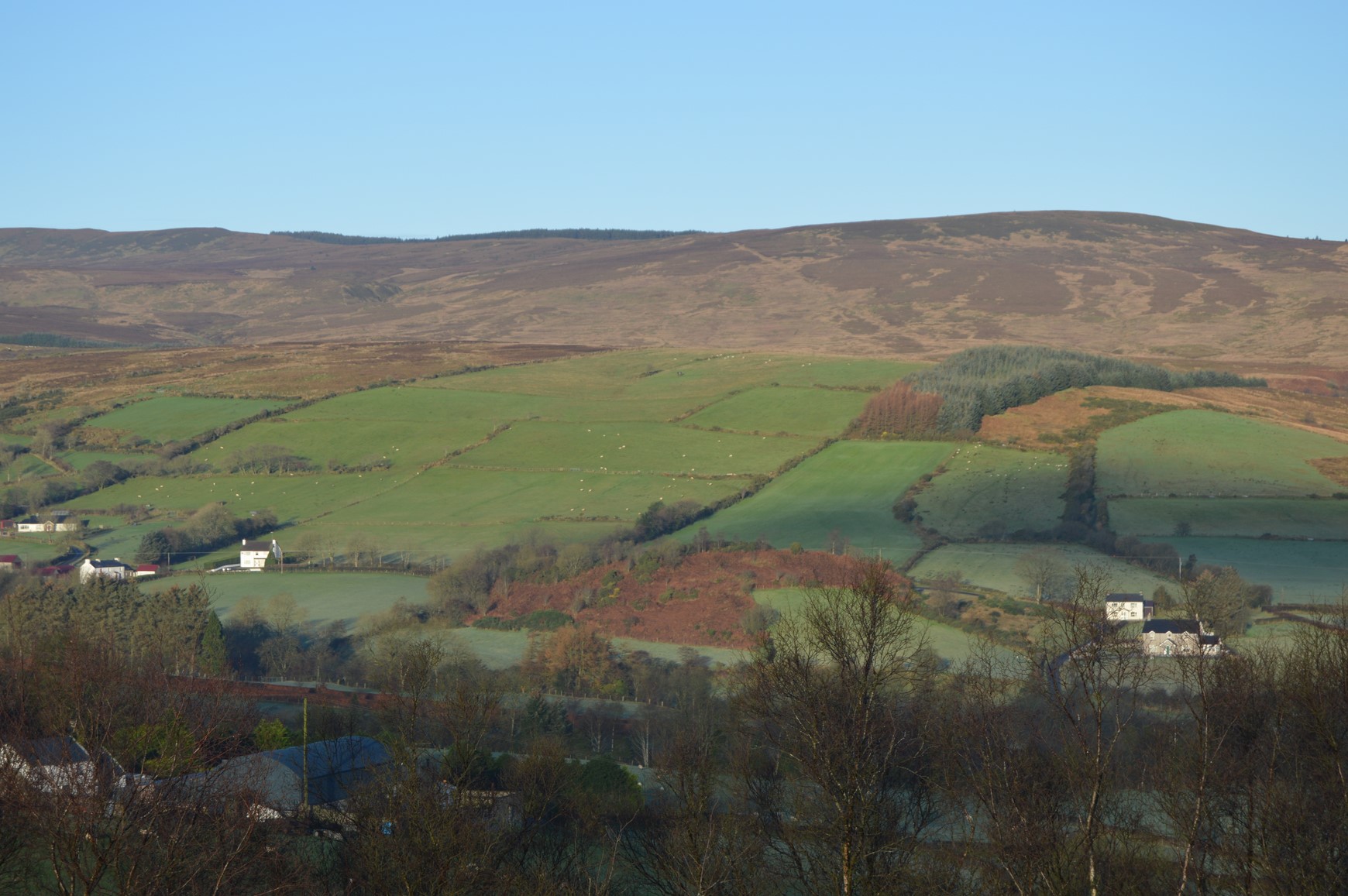
Ladder farms.
Most of the farms on the north side of Moyard were laid out in strips. This was a popular system of laying out farmland in the time of the landlords. It sort of ensured that each tenant got some lowland, some hilly ground and then some heather and bog ground at the top end. In this part of the townland the farmers of earlier years had to break in much of the hilly or sloping ground. This was a laborious but essential task and we can see from the amount of arable ground on the upper slopes, how some tenants did more of this than others. In the 1800`s there was a tendency for a father to divide his farm equally among two sons. Then in the latter half of the 1900`s some farmers bought the land next to their farm and the situation was reversed again. Evidence of both these situations can be seen from the main Sixtowns road.
The farms on the right hand side of the photo are typical of the ladder farms of Moyard. The portion of grazing in the centre is what was originally three ladder farms, once divided up among three sons and now made into a single farm.
Quern stones.
We do not really know for how long Moyard has been inhabited but here is a relic which could be anything from four to fifteen hundred years old. This quern stone was once used to grind oats. It would have had a similar looking bottom piece and the axle would have protruded up the centre so that the top piece could rotate on the bottom one to grind the oats. There was a time when there was a tax on the owners of these tools which might explain why they have turned up in the most remote locations in the Sixtowns. This quern stone was found in a stream at the upper end of Moyard There is another one in the Royal Academy in Dublin which was found in the Moyola at the lower end of Moyard near the Shepherd`s Rest. This one had peculiar carvings on it.
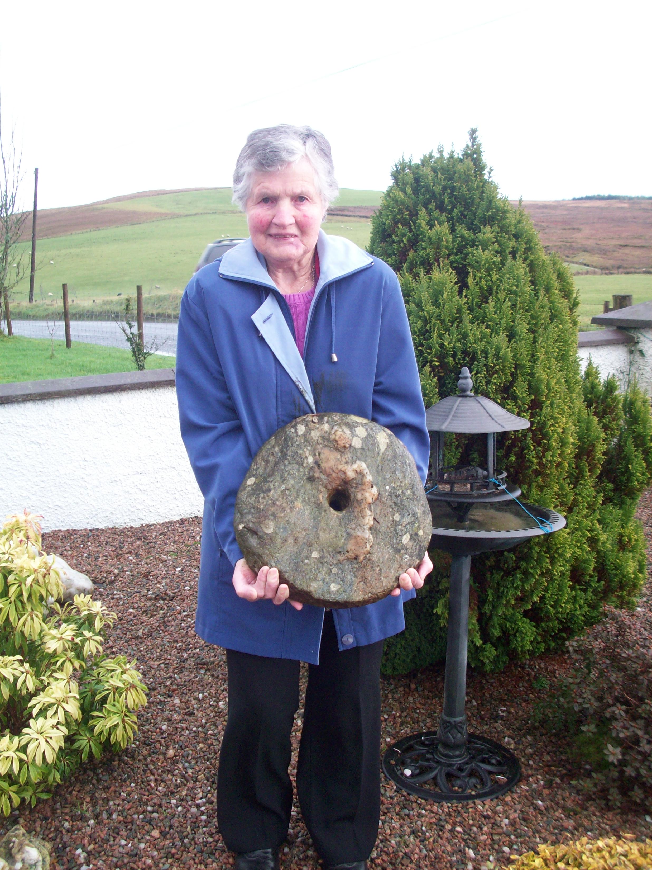
Dora Bradley views a quern stone which was found in Moyard.
Ring Fort.
Another possible link with ancient peoples who lived in Moyard could be the ring fort at the top end of the townland. This can be seen to the left side of the above photo and is close to Bealnamala Bridge. It is possibly a former Bronze Age fort which would have commanded the south western approaches of the Sixtowns area and places further afield. The remains of former potato lazybeds ( or wrigs as they were known locally) can be seen in the centre of this ring.
Emigration.
Emigration during the 1800`s and early 1900`s had a profound affect of the families of the Sixtowns area. Moyard was no different and there was hardly a house that was not affected by it. Some went to England or Scotland while most went to America. Most families never saw their loved ones again once they set out for America. One young man called Hugh Bradley set off for America in 1850 at the age of 17. This young man would most likely have never been further from home than Draperstown before this. How and ever he took a ship to New Orleans and after a couple of years moving from place to place he finally settled down in Johnstown Pa. where he worked in a steel mill for the next 50 years. He joined the Union Army when the Civil War broke out and he rose to the rank of Captain.

Captain Hugh Bradley 1832-1908.
Unlike many of his countrymen he survived the war and returned to his job. He had a son who was a devil for adventure from a young age and who left the steel mill and headed out west to seek his fortune. He started into the gambling business and became very wealthy owning casinos and clubs in various states of America. He bought a stud farm in Lexington Kentucky and became a well known name in horse breeding and racing all over America. He appeared on the front page of time magazine in 1934 under the heading “I`ll bet on anything”.
He became known as Col. Edward Reilly Bradley and the title of Colonel was bestowed on him by the state of Florida for his charitable works. His life story is worth reading. He died in 1946 on his Idle Hour ranch.
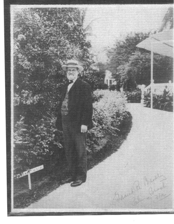
Hugh Bradley when he came back to visit in Moyard.
Hugh Bradley was one of the lucky emigrants from Moyard who managed to make one trip to his beloved home, no doubt paid for by his wealthy son. He returned to Moyard in 1904 by which time his father and mother had passed on and his neighbours although they gave him a great welcome , were now nearly strangers to him. Hugh is buried in the beautiful little town of Hollidaysburg Pa. not far from where he spent most of his life toiling in the Cambria Ironworks.
People of Moyard.
The earliest written records of people who lived in Moyard was the Hearth monies Survey in 1659. Listed in Moyard was: Shane O`Doherty, Edmund O`Doherty,Turlough O`Doherty, Donnacha O`Donnell, Donal O`Kennedy and Conor O`Brolchain (Bradley).
The only surname of these which has survived is O`Brolchain or Bradley. In fact it is claimed that the townland of Moyard was once offered to two Bradley brothers if they would switch religion to the Church of Ireland. Apparently they promised to do so but later reneged. There actually was a time at the start of the 1800`s when all residents of Moyard were Bradley.
The next census was in 1832 and it shows new surnames. By that time the landlord was moving tenants up the valley to new holdings so new names began to appear like Cleary, Kielt, McNamee, Connolly and Molloy. These were all in the upper and previously uninhabited area of Moyard. The Bradleys occupied the lower half of the townland.
The Griffiths Evaluation of 1856 shows a similar pattern of surnames with little change.
Here is the 1901 census list for Moyard.
Residents of house number 1 in Moyard
Surnames of the townland today are: Bradley, McNamee, Quinn, Doyle, Hegarty, Murray, Rafferty, Connolly, McAllister and McSorley.
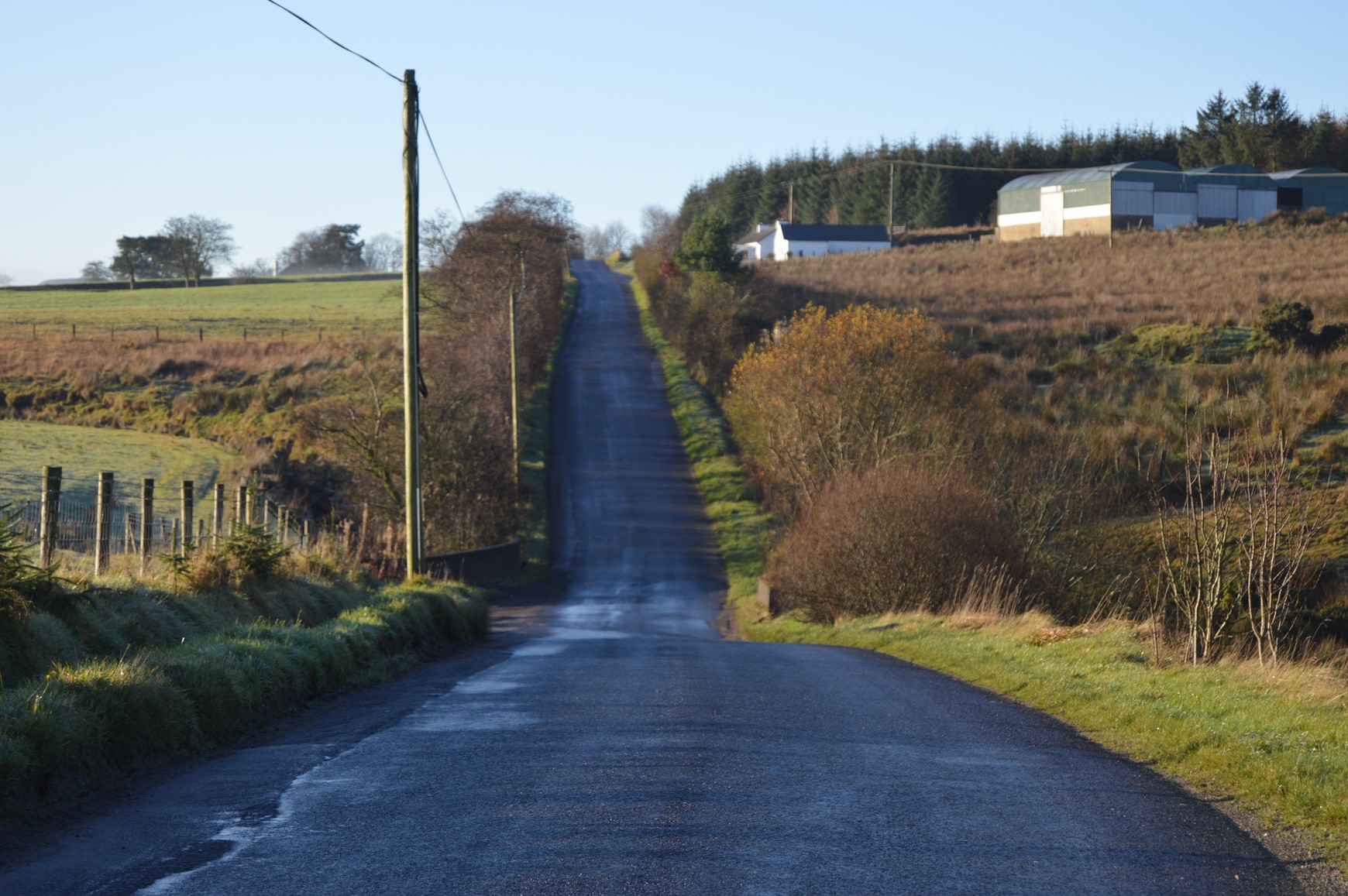
Up until the early part of the 1900`s that part of Moyard which lies on the north side of the Moyola river had no road through it like it is today. Up until then each farm had a “pass“ or pathway from the farmstead out to the main road. This meant travelling down the slopes and across a ford or “karry” (Irish word cora meaning a weir) as they were locally known. If there was a flood in the river they could not cross over so it was not a very convenient means of travel. The people then had an ingenious method of creating a cutting down the spink (slope). They would turn the direction of the water flow of a stream which had torn a canyon from the high ground down to the holme, rendering it dry. Then they would make a pass down to the river for themselves out of this dry canyon. In the picture is one such pass. You can see the winding shape that a rough stream would carve out of the land.
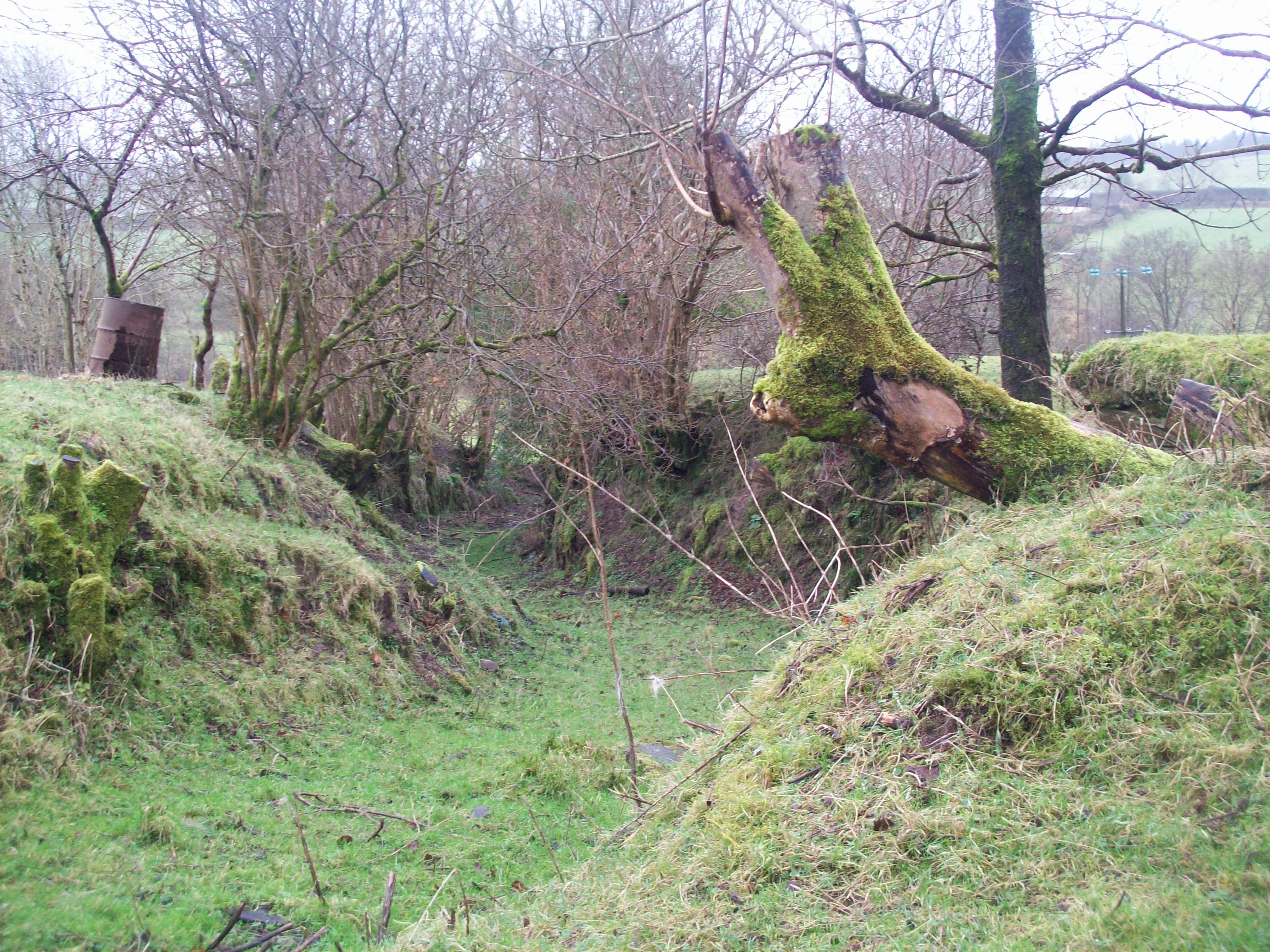

PHOTO – There are still a few traces of these town passes to be seen on both sides of the Moyola in the townland of Moyard. In the top photo you can see from its meandering shape that this was once a small river canyon which was rendered dry by turning the course of the stream elsewhere and the track then made into a bye road with minimum digging needed. In the bottom photo the bye road goes from the main road past the sheep and down across to the north side of the valley.
Eventually in 1928 the people of that part of the townland got together and pushed for a new road with a proper bridge across the Moyola. A boon of volunteers began to track out the route of the new road. Then in 1929 local contractor Barney Conway took the contract of piping the glens along the route and finishing the road which was supposed to reach the main road at both the upper and lower ends of the townland in order to get the full grant. The route out at the top was marked out but never finished and can still be seen from Bealnamala bridge where it was supposed to join the main road. Men with horses and carts filled the glens for the road and boons of volunteers worked just for their days food and drink. This was at the start of the Hungry 30`s so men were coming from all over the parish to help. The bridge was made at the very lower end of the townland and is still there today even though it was built by amateurs.
Before the road was built people moved up or down the townland by what was called a town pad which went from the top down to the bottom and then over to Moneyconey. This pad was really a bridle pad which could not take a cart but people were able to walk or lead a horse along it.
Moyard is bounded at the lower end by a deep glen of rushing “spa” water which is called The Coiner`s Glen.
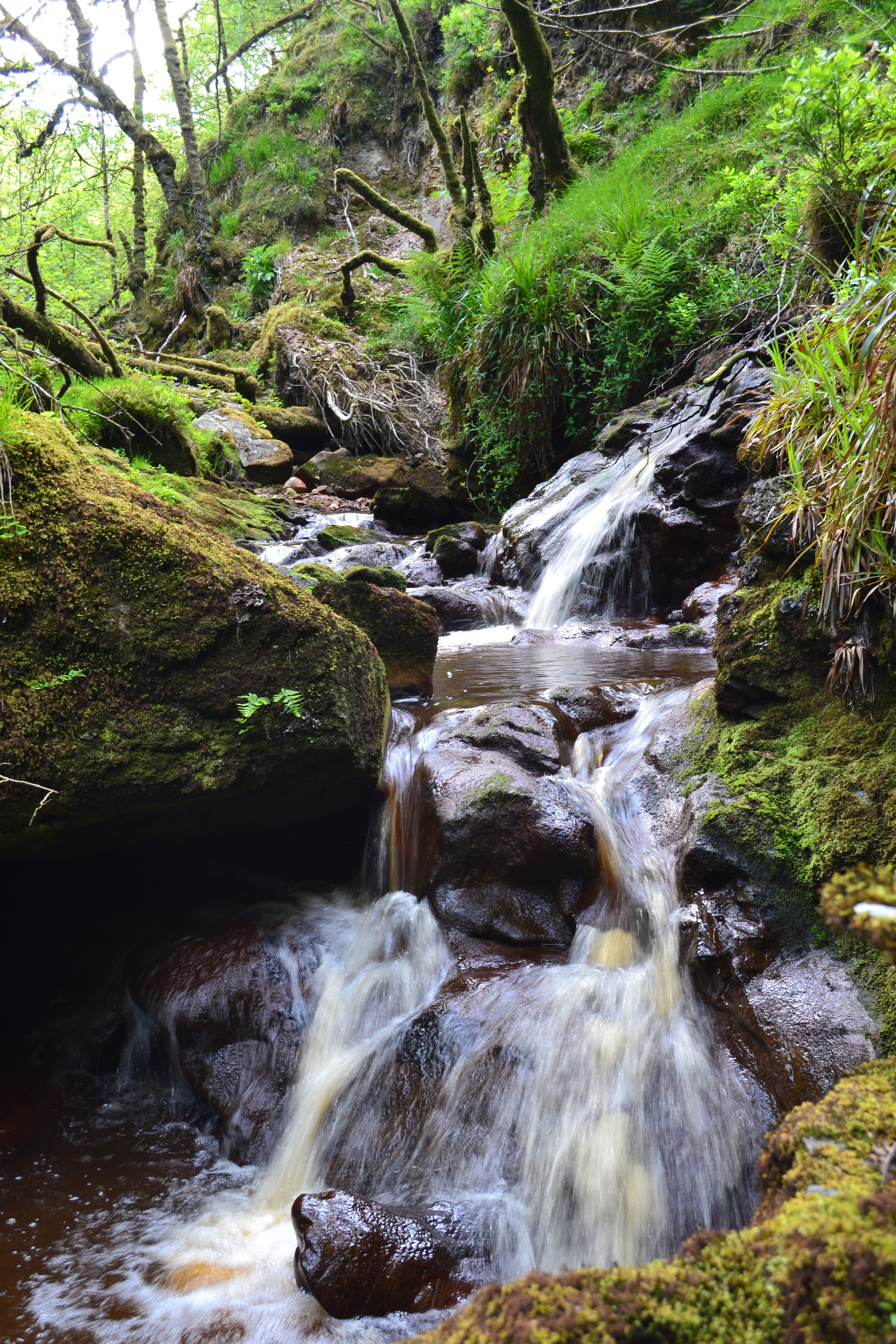
The waterfall in the Coiner`s Glen.
This glen contains the last of the wild and natural vegetation which once covered the ancient Sixtowns landscape. A particular species of dwarf oak tree grows there as well as various rare fauna and the glen is now a protected area. The Coiner`s glen is so called because about 150 years ago, there was a man living beside it who used to prospect for gold there. According to local folklore, he used to, when a flood was imminent, tie hay ropes across the stream. When the flood passed he would gather the ropes and wash the small grains out from them for himself. He must have had some degree of success because the landlord took a court injunction against him to force him to stop this activity. There are a couple of locations in this glen where it is known that poteen was distilled and indeed it is said that there is still a couple of barrels of the stuff which have been buried there. Would be good stuff by now. There was another site in Strannahinch which was said to have run quite a sophisticated still close to a small glen on Connolly’s farm. The people were McNamee, better known as the “Honours” after their mother.
The local.
Moyard has had its own public house for the past 100 years. Sometime around the start of the 1900`s a man called Hugh Bradley bought the licence of a public house which was situated beside St. Patrick`s Chapel and he set up a pub on the site where the Shepherd`s Rest bar now stands. He later sold the premises to another Bradley from across the river in Moyard. This family ran the place for about 15 years before selling it to a man from Brackaghdysart called Michael Doyle who had just
returned from having worked in Philidelphia for a time. In the 1960`s his son Michael and wife Bernie began to develop the prosperous business which it is today.
Houses in Moyard.
The traditional house in the townland of Moyard would have been the single storey cottage with a thatched roof. The only examples of these cottages which remain are the ones which had a steel roof put on them. Unfortunately after being left unoccupied for a few years, the thatched roof would eventually collapse and after that the walls would also fall in, leaving only a ruin.
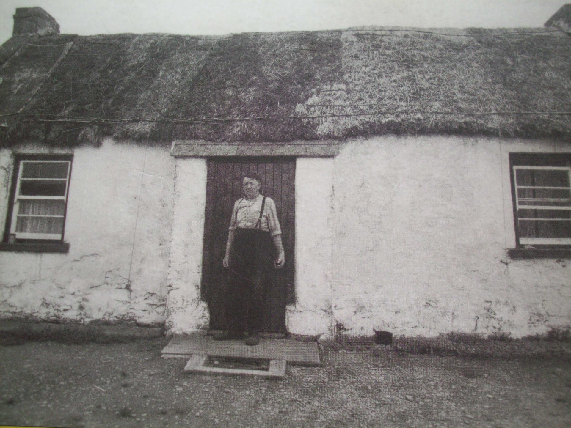
A typical Moyard cottage.
Sometimes a byre with a barn above it would be built onto the cottage. There would be a door at the front and back of the barn to create a draft so that the farmer could sift the chaff from the oats after he had used a flail to thrash them. There would also be a trap door in the floor of the barn so that fodder could be dropped down to the cattle in the byre below. There would also be a hole in the side wall of the byre so that the manure could be thrown out into the “doughill” which was just outside. There might also be a stable for the horse and in later times hen or pig houses.
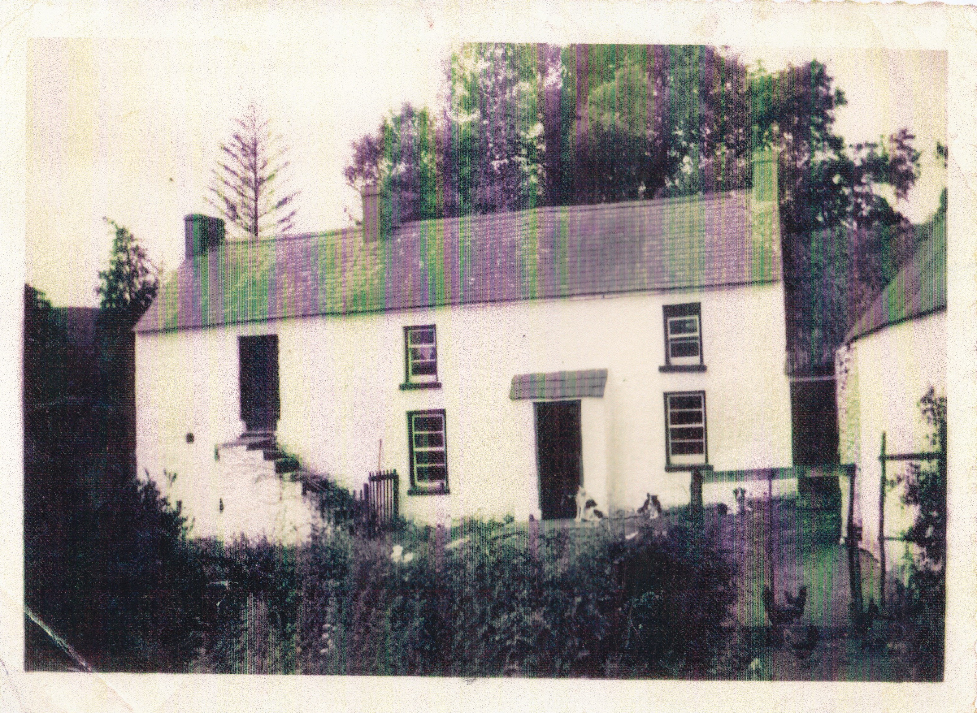
A farmstead from the 19/20 century with its barn, stable and out houses.
About two hundred years ago people in the townland of Moyard, just as in other parts, lived in clusters of houses called “ clachans”, a type of communal settlement which existed during the Rundale farming era. This place is called the “Hollow” and would have been a clachan at a time. There would have been more houses then. There would have been several of these clachans throughout the townland of Moyard.