Moneyconey.
The town land of Moneyconey lies between Cavanreagh, Altaeskey and Moyard and borders Glenelly along the top of Slieveavaddy at its northern end. It comprises 1121 acres of arable and mountain pasture. John O`Donovan, who visited this area in 1835, was told by local people that Moneyconey comes from the Gaelic words “muine comhnuidhe“ (modern muine conai) which means “the hill of rest.“ However , Gregory Toner, in his book “Place names of Northern Ireland“ vol. 5. suggests that the name originates from the words “moin congna“ which mean “bog of the antler.“ Apparently, the antler of a giant deer was dug up in the bogs of this townland in the medieval times after this breed of deer having been extinct for thousands of years. Everyone is entitled to their opinion in the difficult translation of place names but the area around the old church of Moneyconey certainly would have been used as a place of rest for a very long time indeed.
HOTO – Moneyconey with Slieveavaddy and Carnanelly in background.
There are no known relics or evidence of Neolithic people having lived in Moneyconey so we must assume that settlement here only dates back to the Bronze Age possibly. There have been discoveries of pointed sticks in the bogs of Moneyconey which are more likely to date from the Bronze Age but other than that we know very little about settlement in this era.
The O.S. Survey tells us of an ancient grave having been found in Cavanreagh close to the site of the old church which would be in Moneyconey.
William Phillips of Cavanreagh, in labouring a sandy hill in the above town land in 1815, got, about three feet below the ground, a grave , 5 feet long and 2 ½ feet broad and 2 feet deep. It was enclosed by a stone building and contained a quantity of rich black earth.
This would suggest that this area was used as a burial place long before the present site of the church had been founded. So who knows, the name Muine Comhnuidhe may be a very old one indeed.
The oldest written piece of information which we have on settlement in the Moneyconey area is to be found in the Annals of the Four Masters, which was a history of Ulster written by four monks in Donegal. There is a reference to the erenagh of the church of Scrine having been murdered in 1183 AD. This would prove that there was an erenagh attached to the church at Moneyconey with its tenants living within it. It is likely that that was the main reason why people were living in that place. We know that from that point onwards at least, there were tenants of the church living in that part of Moneyconey, albeit a small part of it.
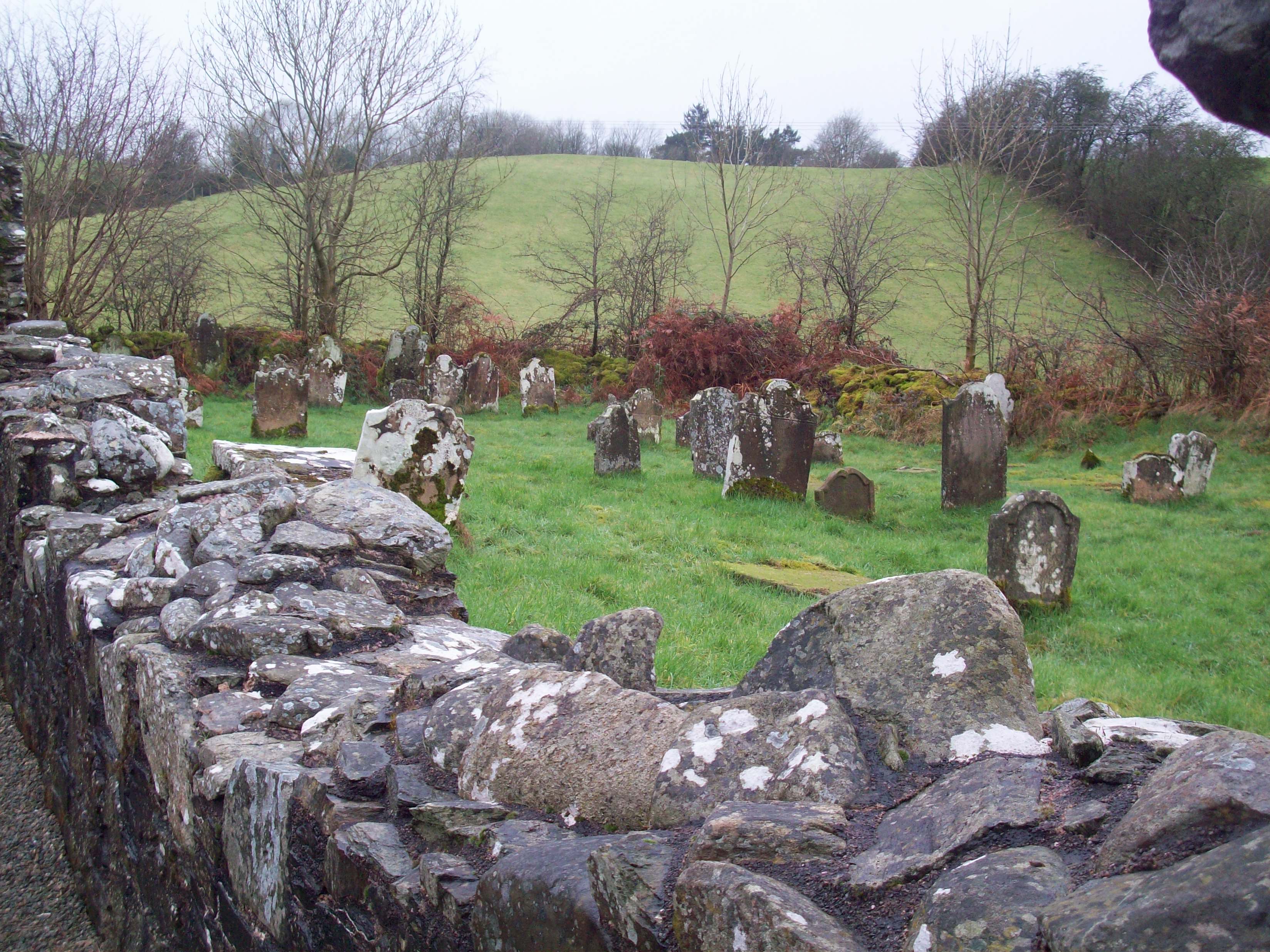
Without doubt the focal point of the townland has been for long, the Old Church of Ballinascreen. Exactly when the church was first built, we do not know but legend has it that it was built by St. Patrick as a church.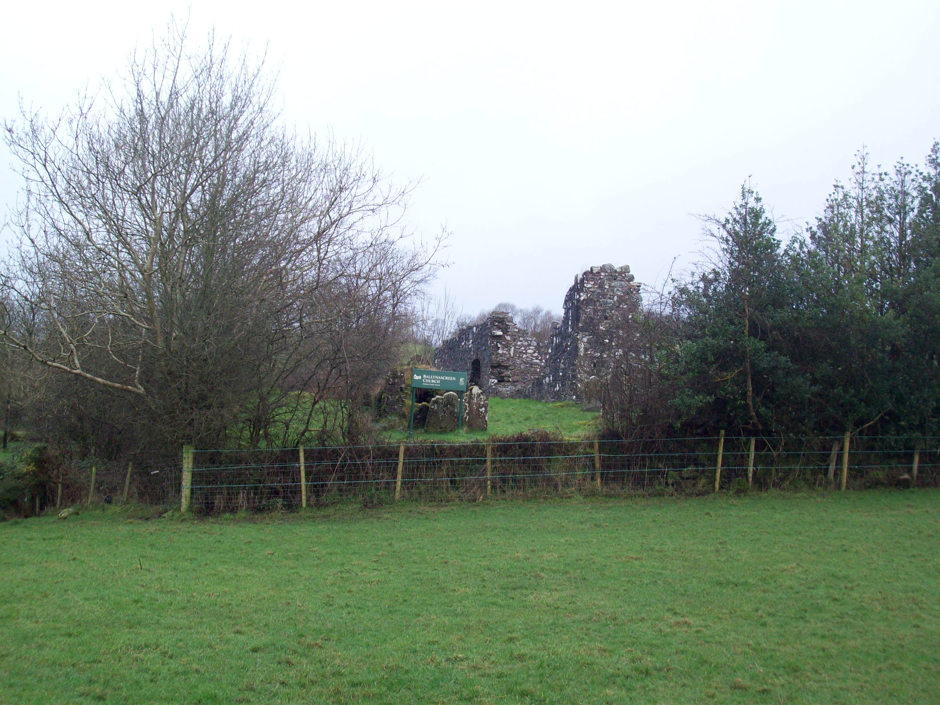 ,
,
. It was then believed that it was turned into a library/monastery by St. Colmcille, giving the parish the name Baile na Scrine or the town of the shrine. There might be more in the latter assertion, in that St. Colmcille would have founded religious sects to set up monasteries and churches like Ballinascreen around the country, hence the association with the saint in the local folklore. The folklore attached to the origins and history of the old church at Moneyconey may at times seem far fetched and unreal but in many of the stories, is a symbolic reference to something which actually happened.
We are told that this ancient church was commenced to be built on different sites within the parish. The building which was done by day on each one of these sites was mysteriously torn down by night by a monster or invisible agent. This continued for some time as each new site was tried and eventually a site was settled on, just across the Moyola from where the ruins now lie. This site was believed to have been on the land formerly owned by the Gillespie family in Tullybrick. Old foundations found there about 200 years ago including the ruins of an old lime kiln fueled local beliefs that this was indeed the intended site of the Church of Ballinascreen. However , this site too came under the same attacks as the previous sites and it was decided that all the people should be summoned together to pray for God to send some kind of message or sign as to where they could build their church. It is at this point that I must draw attention to one of the symbolisms in the story so far. It is most likely that since the Christian church tended to build its churches on pagan religious sites, it came into conflict with the druids and their supporters. This might explain the reason why so many of the sites were attacked by night. It would be an understandable reaction from the druids since, in their eyes their sites were being desecrated by a foreign religion. It is interesting that when the present site, as we know it was picked, it was sited just outside that area of the Sixtowns which was heavily populated Neolithic and Bronze the age periods. If that site was across the Moyola river boundary then that could be why the church survived the wrath of the “monster” from then onwards. That piece of folklore would then seem to be telling us more than is immediately obvious when we first hear it.
The story goes on that at the end of a period of prayer, St Colmcille announced to all there present the joyous tidings that the Lord had accepted their humble but fervent petitions and that he himself had heard the sweet tolling of the bell, as if descending from the heavens which he believed was the message from the Almighty to point out the spot on which the church was to be built. He also ordered all present to spread their cloaks or garments on the ground so that the bell would come to no harm on landing. Each person present complied and eagerly awaited for some time to see if their garment would be the chosen one for the bell to land on. Eventually the bell was heard by everyone hurtling down from the heavens towards the assembled crowd. Lo and behold it landed on the cloak of McGillian but then came to rest on the cloak of McGurk and folklore tells us that from that point onwards the McGurks and the McGillians were continually at odds with each other. This entertaining legend merely symbolizes the historic rivalry which existed between these two clans for which should be the erenagh for this church. The McGurks were the dominant erenagh clan within the O`Neill dynasty and the McGillians were also an erenagh clan.
We do know that these two families vied for the role of keeper of the bell and it is interesting to know that after the church fell into ruins, the bell eventually ended up in Termon McGuirc (Carrickmore). On the other hand, in the Survey of the Parishes and the Chapels in Derry Diocese in 1607, we can see that the vicar of Ballinascreen church was a Sean McGillian so the McGillians must still have had some role in this erenagh. So, which of these families attained most influence in the Church of Ballinascreen, we simply do not know but what we can see was that a lot of the old folklore told a real story which carried a symbolism about a live issue of that era.
It would be reasonable to question why a church which was to service a large area would have been sited at the most south westerly end of the thickly forested Glenconkyne, a most inaccessible place in those days. When John O`Donovan visited the place in 1836, this is what he had to say about it;
“I spent some hours in the old churchyard yesterday; it is a lonely spot, now even deserted by the dead.”
It does not seem likely that he would have recommended the site as one for a parish church.
However, accessibility had little to do with it. The significance of this site may go further than its convenience to its parishioners. In fact this church is the centre piece of nine other churches each of a nine mile distance from each other. (Irish miles)For this reason these churches were called “Teampall na naoi nocht mile” or the nine mile churches.
The reason for the central location of the church at Moneyconey was that it being a place to store valuable books, (baile na scrine —place of the library) it was a convenient and equal distance from each of the other churches around it. It was also situated in a very safe place at the top of the thickly forested valley of Glenconkyne which was not an easy place for a foreign raider to reach.
It was most likely to have been at times a place where priests would have studied for the priesthood. Inside the church there are holes higher up in the walls which suggest that there was once a loft in the church which would have been used as a place to sleep.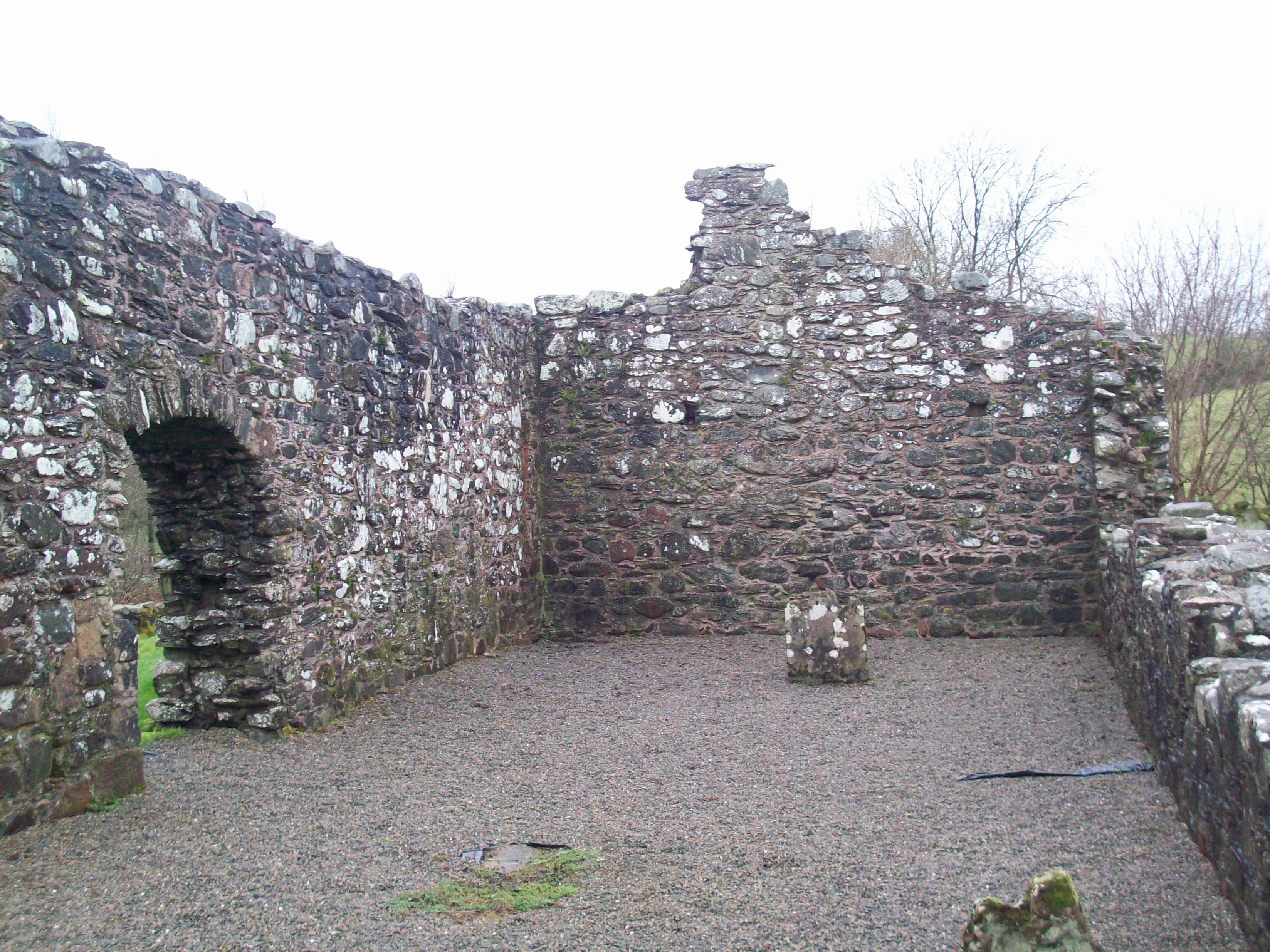
We can see the holes in the gable wall which held the loft beams in place which would suggest that there was in fact sleeping quarters within.
In early times travel from one place to another was laborious and often done on foot. People on church buisiness were always on the move in those times and if we were to assume that a distance of nine Irish miles was a fair days travelling we can see that these churches would not only have provided the pilgrims with directional milestones but also a place of rest on their journey.
The Culdees (followers of god) would have been associated with these churches as they travelled around organising seminars and retreats. It seems that these churches were in a position to accommodate these kinds of people on their missions.
The O`Neills would have had control of the Ballinascreen area up until the flight of the Earls in 1607 and would have used this system as or when they needed it. Some people are of the belief that the Great O`Neill, along with a sizeable number of his extended family, while making his way from Tyrone to Rathmullan stayed over for a night at Moneyconey. Certainly he would have received a welcome and there would have been room for that number of people. He would have been able to leave there next day and make his way out through the gap at Glengamna without any trouble and down Glenelly to stop over at Badoney which would have been the next of these churches on his journey and a reasonable journey in those days.
Aside from those people attached to the church of Scrine, we do not have any written references to people living in the townland as such until the Hearth Monies Survey in 1664. The names of the householders which are listed are: Edmund O`Doherty, Owen McDevitt, Owen McColgan, Daniel O`Conaghan and Hugh O`Deeney. We do not know if these people lived throughout the rest of the townland or whether they lived in that part of Moneyconey which is close to the church. Certainly these are full blooded Innishowen surnames and it could be assumed that they came to the area because of their association with some religious order which originated in Donegal. That would suggest that they lived near the church and were tenants of the erenagh.
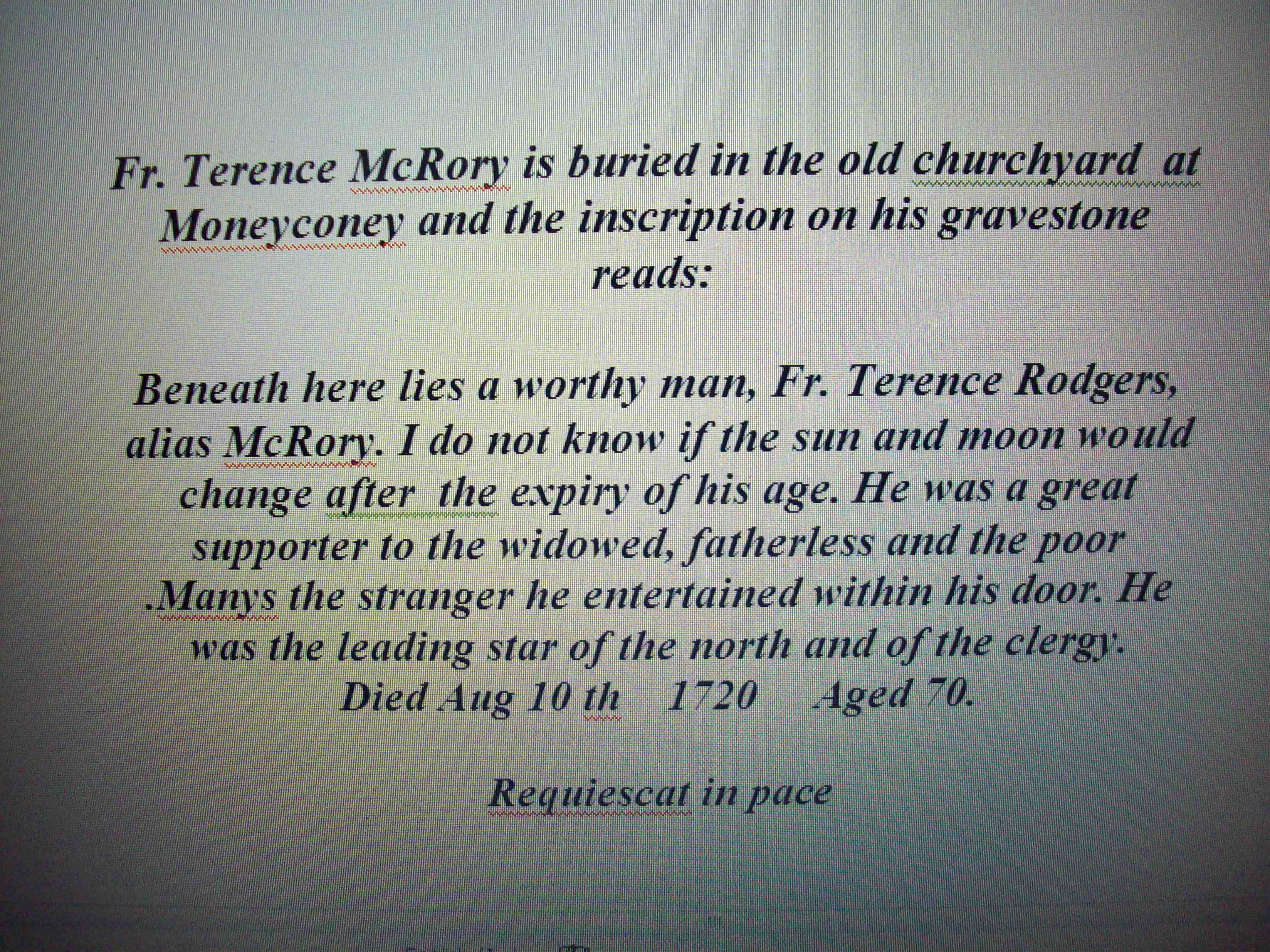
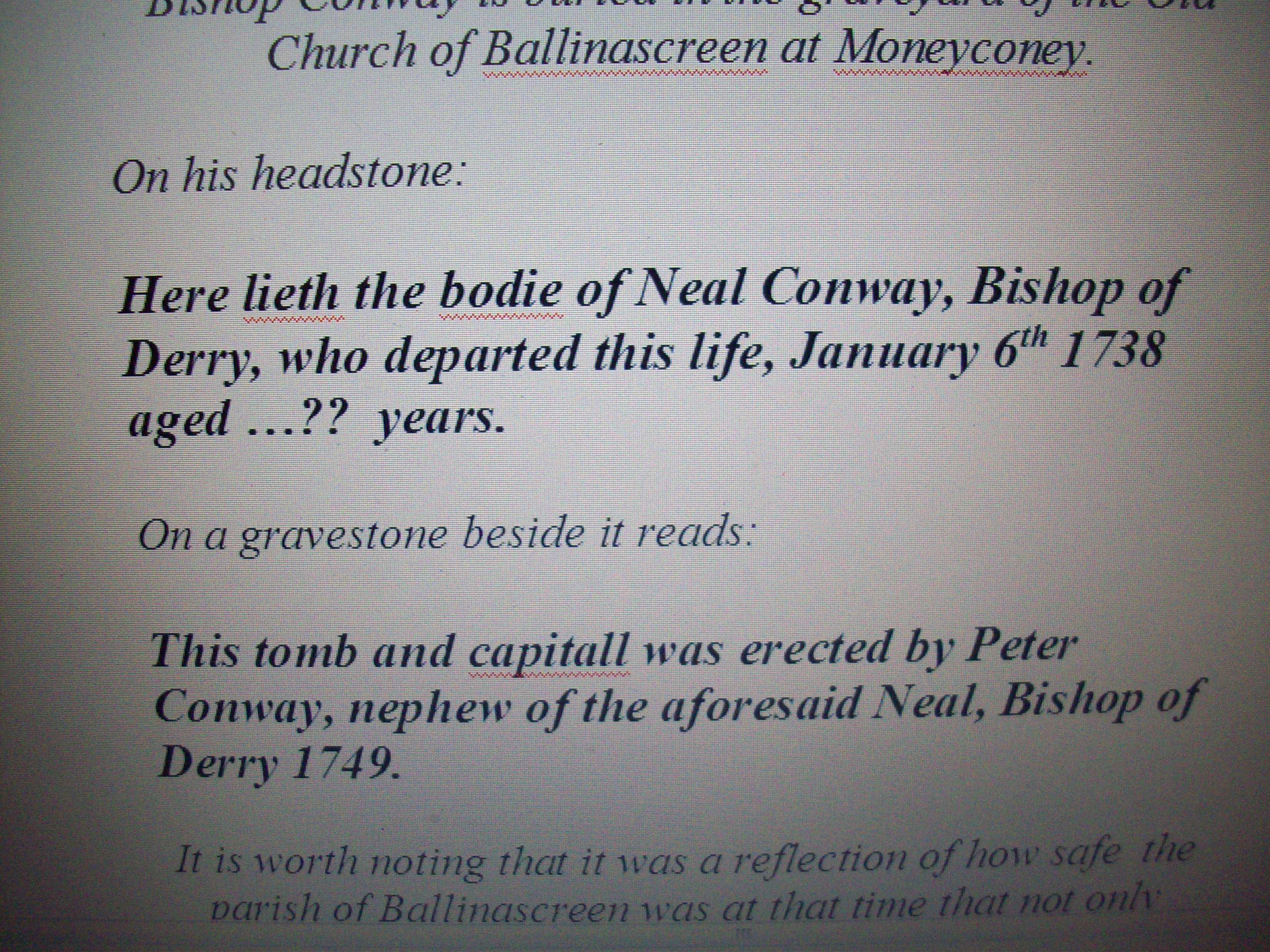
These grave inscriptions belong to the graveyard of the Old Church of Screen at Moneyconey.
There is no information available to us as to how many people or who lived in Moneyconey in the 1700`s because no census were taken during that period. We must wait until 1825 to get any new information on who lived where at that time. What we do know is that the system of agriculture used during the 1700`s was the Rundale system which seems to have come from Scotland originally. Without going into too much detail on how this system worked, it was based on a cluster of houses which were home to a community of anything from 5 to ten families and an open field system of farming. The cluster or clachan as it was also called was usually to be found in the middle of an area of arable land.
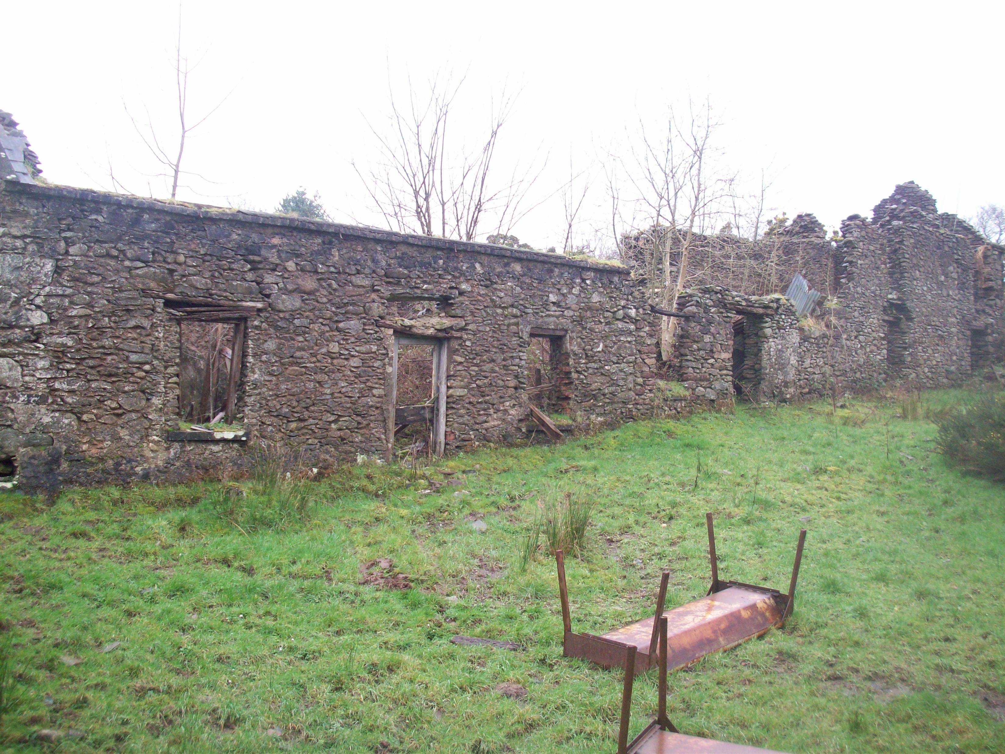
PHOTO – This is the ruins of the Barnett clachan in Moneyconey.
The tenants would elect a leader who would divide out the land available, to each family on the basis of need. The outlying grazing land would be used as summer pasture. Therefor we are able to hazard a guess at where these clusters might have been situated. Looking at the land quality, we can assume that two areas would have been obvious and they would be the lower end of the townland, with a smaller area at the upper end looking most like ones that could support clachans. The middle section of the townland would probably have been uninhabited then.
By the end of the 1700`s the townlands of the Sixtowns were going through a period of unprecedented change as they came under the control and ownership of landlord James Stevenson who had bought the entire Sixtowns from the previous owners, the Church of Ireland.. Stevenson had bought this area as an investment so he set about breaking up the old Rundale system and setting out all of the land in each townland into farms with straight and clearly designated marches. This meant that the people of the clusters in Moneyconey found themselves being moved out of their clusters and further up the townland to farmsteads which were peppered all over the land. Although each tenant was given their separate farm many still did not move too far away from their kinsfolk. We find that the Barnetts stayed pretty close to each other as did the McBrides at the lower end and the same with the Bradleys at the top end of the townland.
The survey of 1825 lists families in Moneyconey.
There were 12 households in the townland in that year.
There were two Barnett families, five Bradleys, two Duffys, two McBrides and one McCloskey family.
By the time that the next census came out in 1832, the population had been rising rapidly as it headed towards its peak at the time of the Famine. In this survey we see 29 householders which represents well over double that of seven years previous. We can see new names coming into the townland like, Holly, Campbell, (Mc)Gillion and Murray as well as an increase in the number of families of those listed in 1825.
The next census we have for Moneyconey is the Griffith`s Evaluation of 1856. This is the most accurate and detailed census to date and it comes with a map which shows each tenant`s farm by number. The quality of the land on each farm is shown along with the rent payable on it. The downside of this survey is that it only names or lists the head of the house for each farm and so we cannot get any details of family members as in the 1832 or 1901 listings.
After the Griffith`s Evaluation we have to rely on old rent books to find out who lived where in Moneyconey since it would be the last survey until the 1901 census which gives us a huge amount of information on the people who lived in this townland.
The names on the rent book for 1880/90 were:
Bridget Connolly,Henry Bradley, Pat Connolly, Cormac Bradley, Hugh Bradley, John Kelly, James Murray,Pat Bradley, Michael Bradley, Hugh Murray, Rose McBride, James Bradley(Roddy) Peter Molloy, Frank Bradley, Bernard Bradley, Brigid Duffy, John Duffy, William Barnett, Ephram Barnett and James Barnett.
After that the next source of information we have on those who lived in Moneyconey comes in the 1901 census list. On this census there are 18 households listed for the townland. The surnames listed are :
4 Bradleys, 2 Murrays, McGuigan, 2 Duffys, 3Barnetts, McBride and McFarland.
This census gives us lots of detail on the residents of each house making it an excellent source of geneology for those who wish to trace family roots.
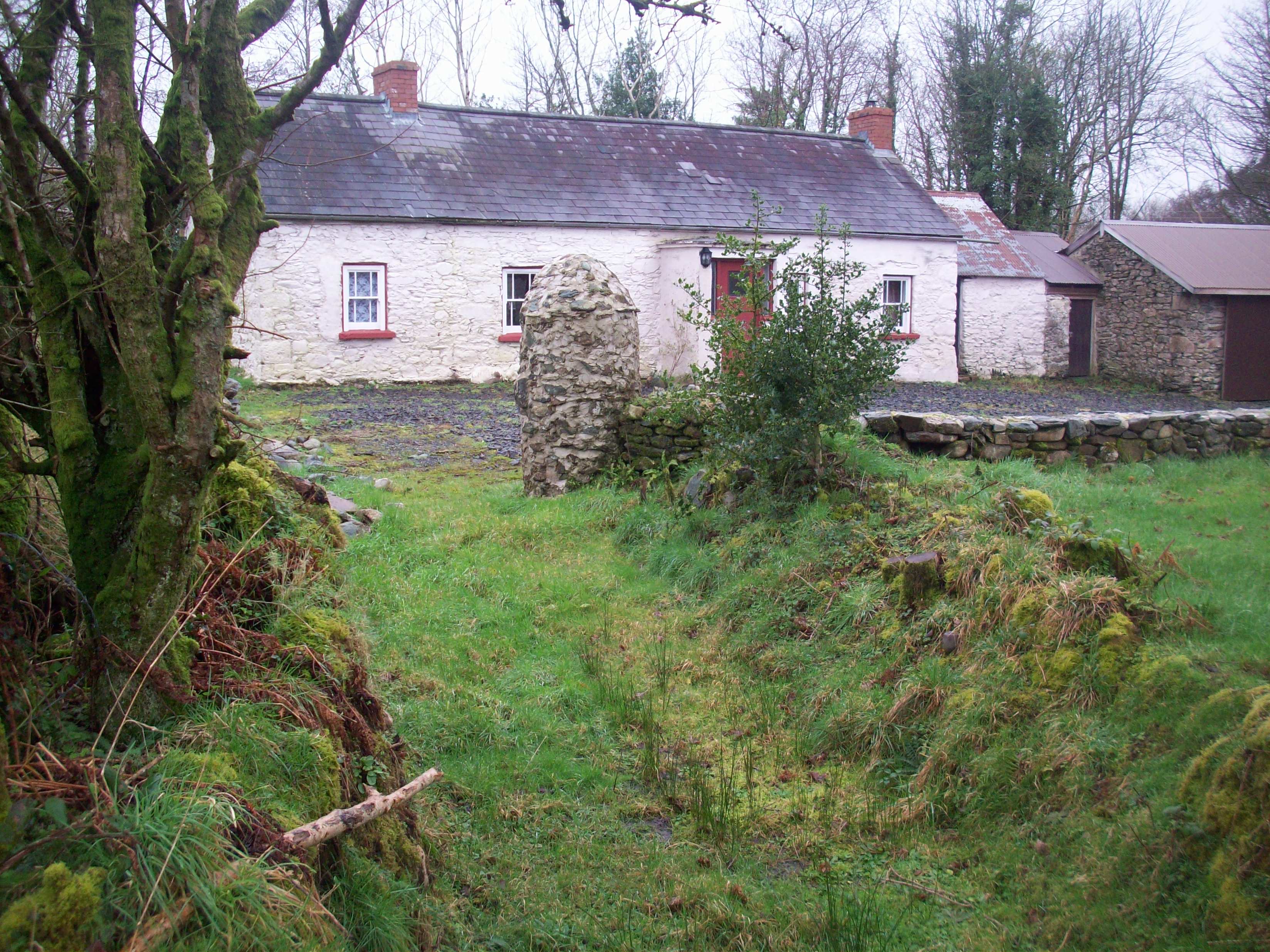
Roddy`s (Bradley) Moneyconey
PHOTO – This little cottage in Moneyconey is typical of the kind of house in which people of the townland lived from the early 1800`s. The pathway from the house was the only way out to the main road.
Roddy’s would have been a ‘ceildhi house’ (kaley) like many others in the townland in the days. before modern technology.
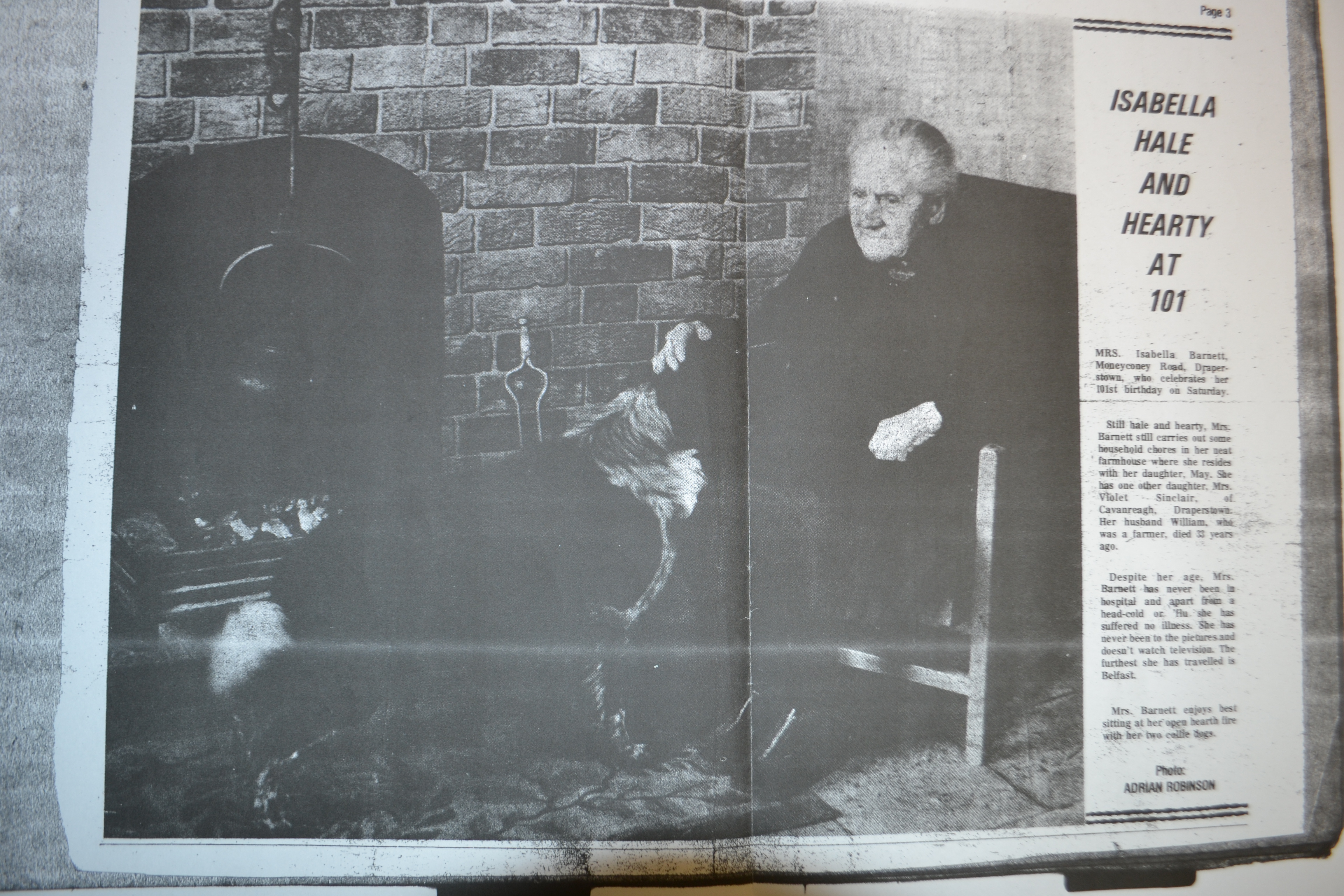
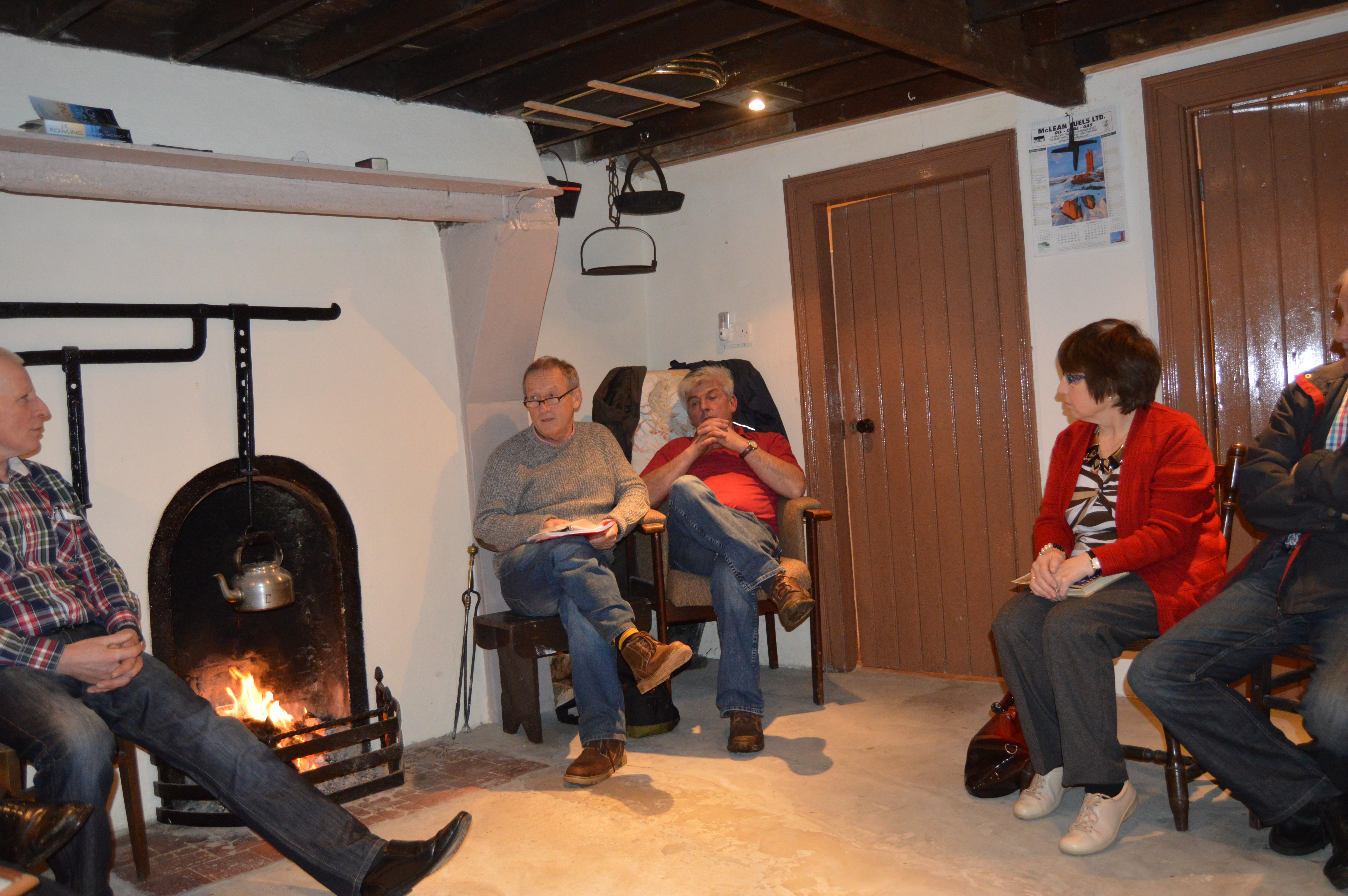
The people of Moneyconey would have been a hardy breed. Here is Bella Barnett at 101 and still in her own house and with all her attributes. The longevity of these people has to do with fresh air and hard work.
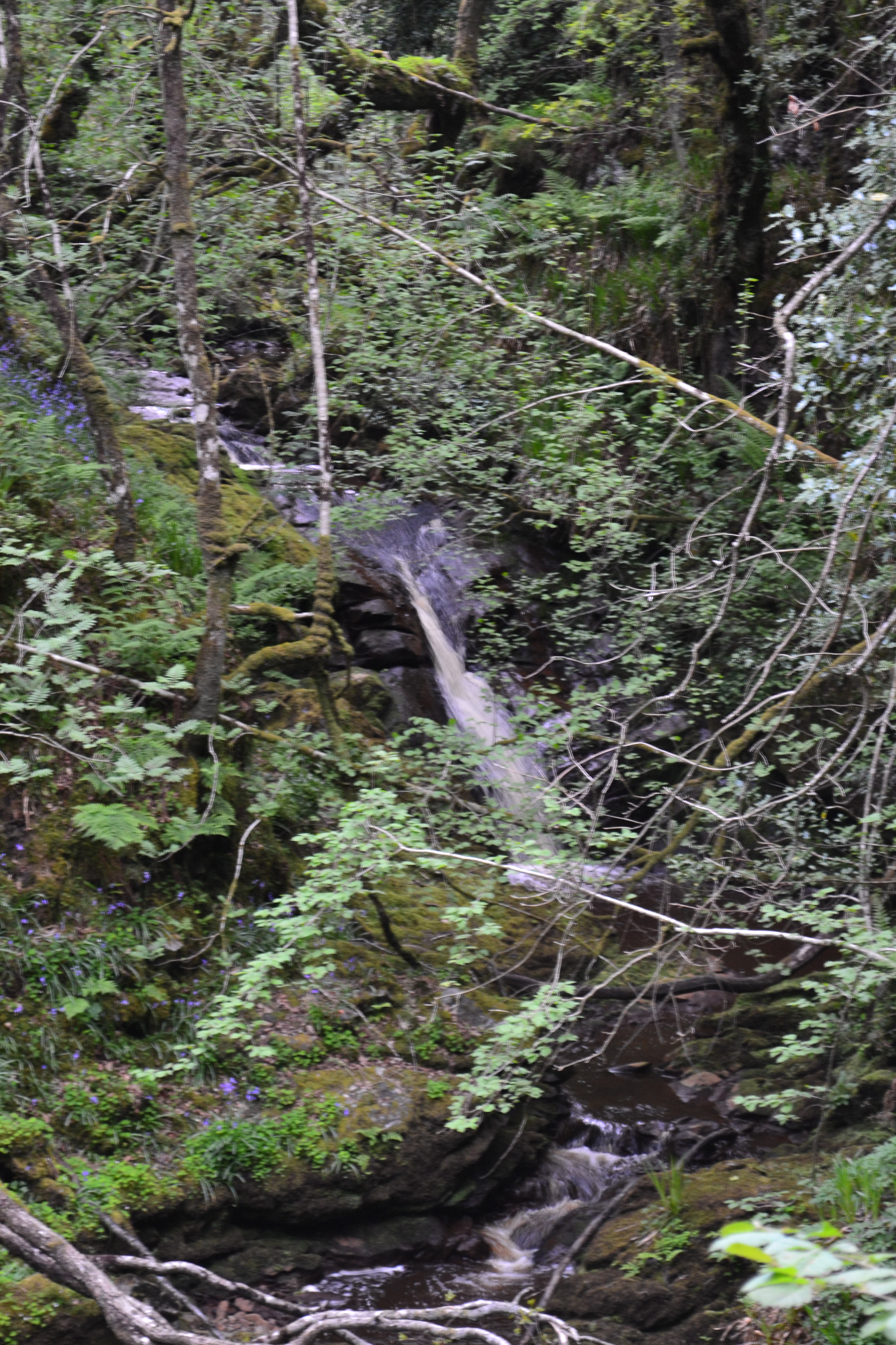
The Coiner`s Glen.
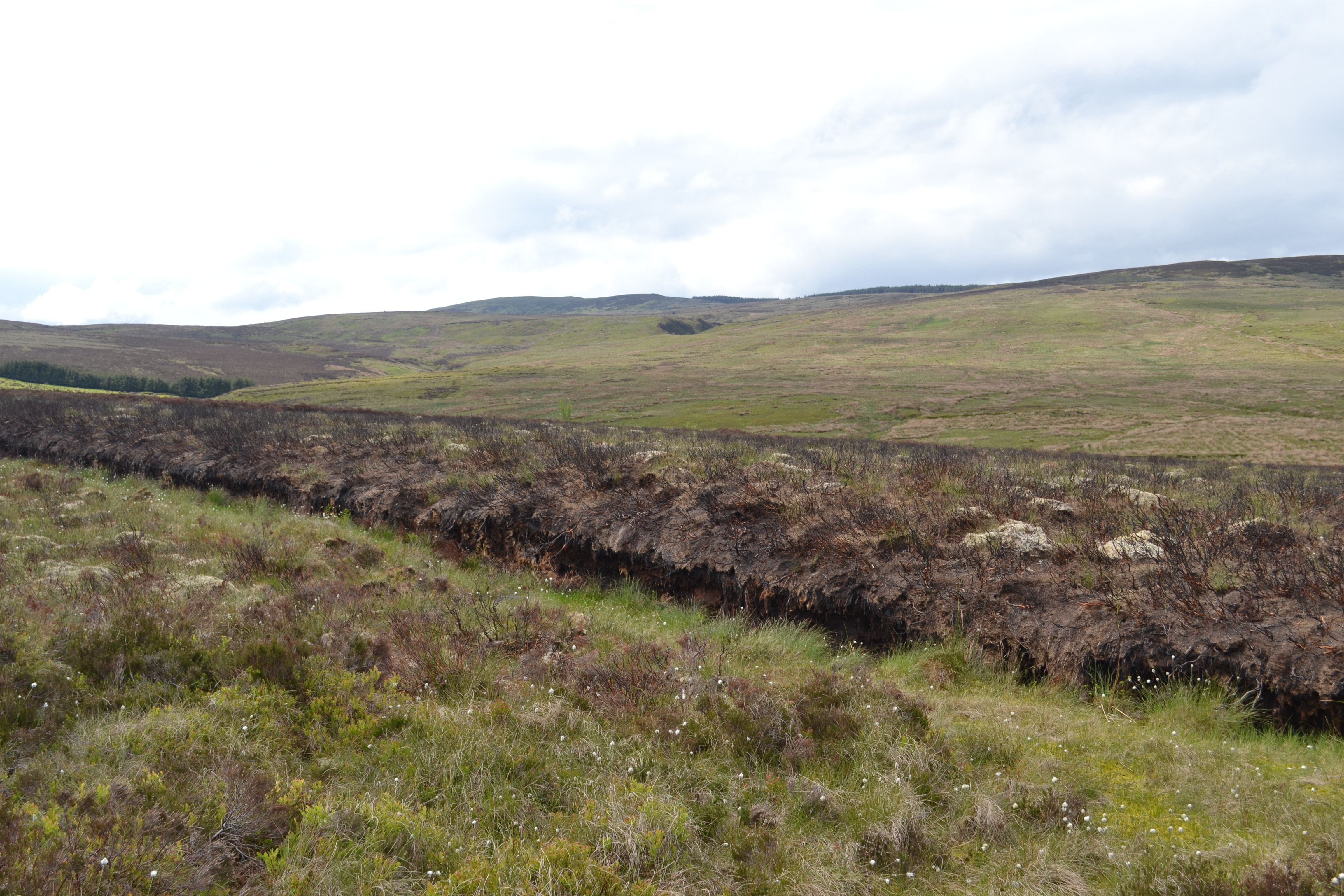
Moneyconey is separated from Moyard by the Coiner`s glen, a beautiful glen which is full of the original vegetation which once filled the ancient valley of Glenconkyne.
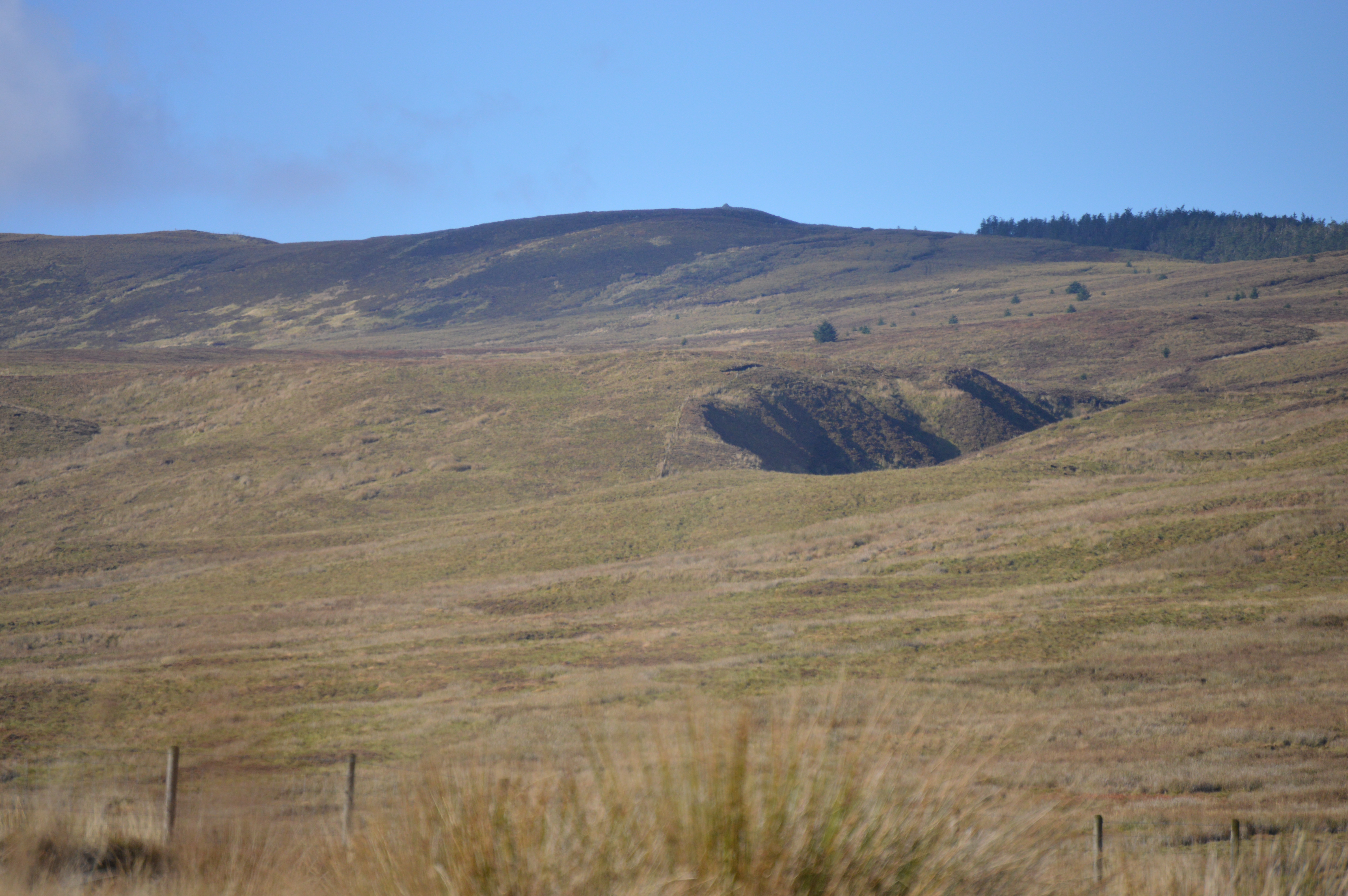
PHOTO – The is the north west corner of the townland of Moneyconey with the Binn Bhui making a huge gauge in the landscape. Behind it we can see the top of Carnanelly with Glenelly on its back and Doraville estate to its right.
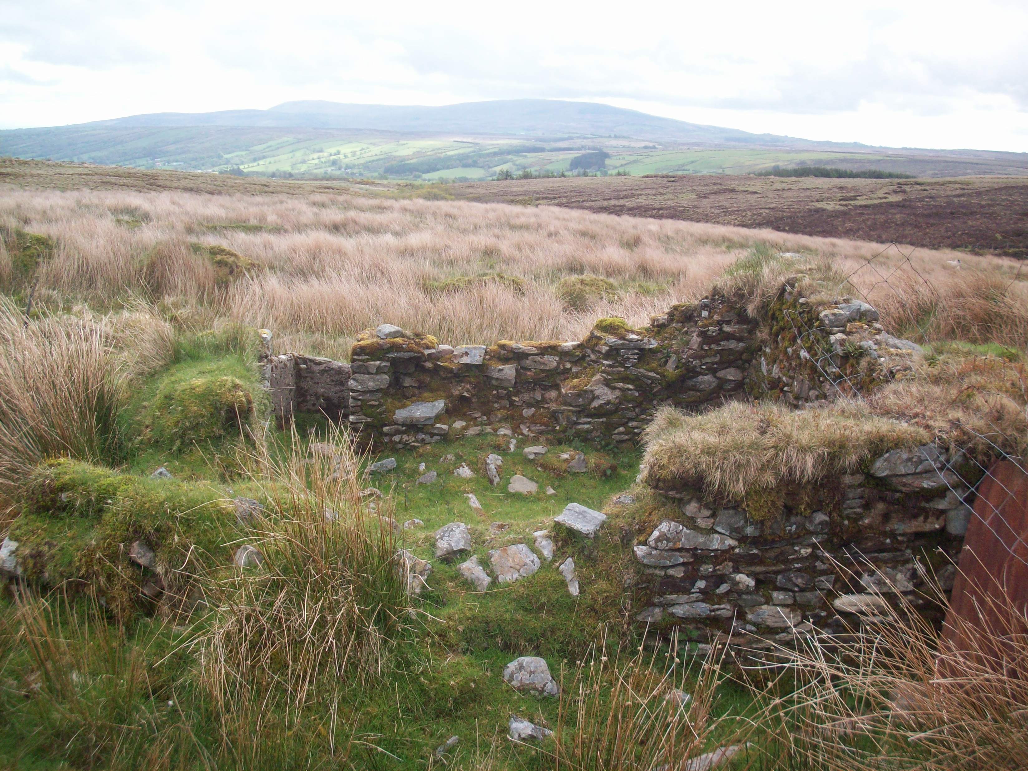
PHOTO – This was once the home of the Cleary family who used to herd geese on this mountain. We can also see the traces of the lazy beds which were once used to grow potatoes.

Photo: This little hole in the rock in Mumawannish glen is known as the wart well and it renowned in the townland and beyond for its power to rid people of warts. It is a well known landmark in Moneyconey.