Cavanreagh.

What does Cavanreagh mean?
There are a couple of versions of the meaning of Cavanreagh. The most popular one is “cabhan riabhach” which means “the grey hollow/hill”. The other one is “cabhan reidh” which is closer to the local pronunciation of it and means “ the hollow/hill on the open plain.” This one would seem to make more sense as it suits the terrain in which it lies as well. The townland of Owenreagh also has the same word in its name and it would mean “ open plain of the river”, rather than the meaningless “grey river” version of it.

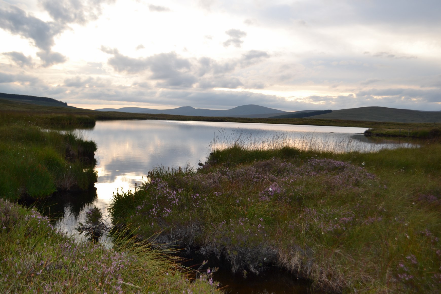
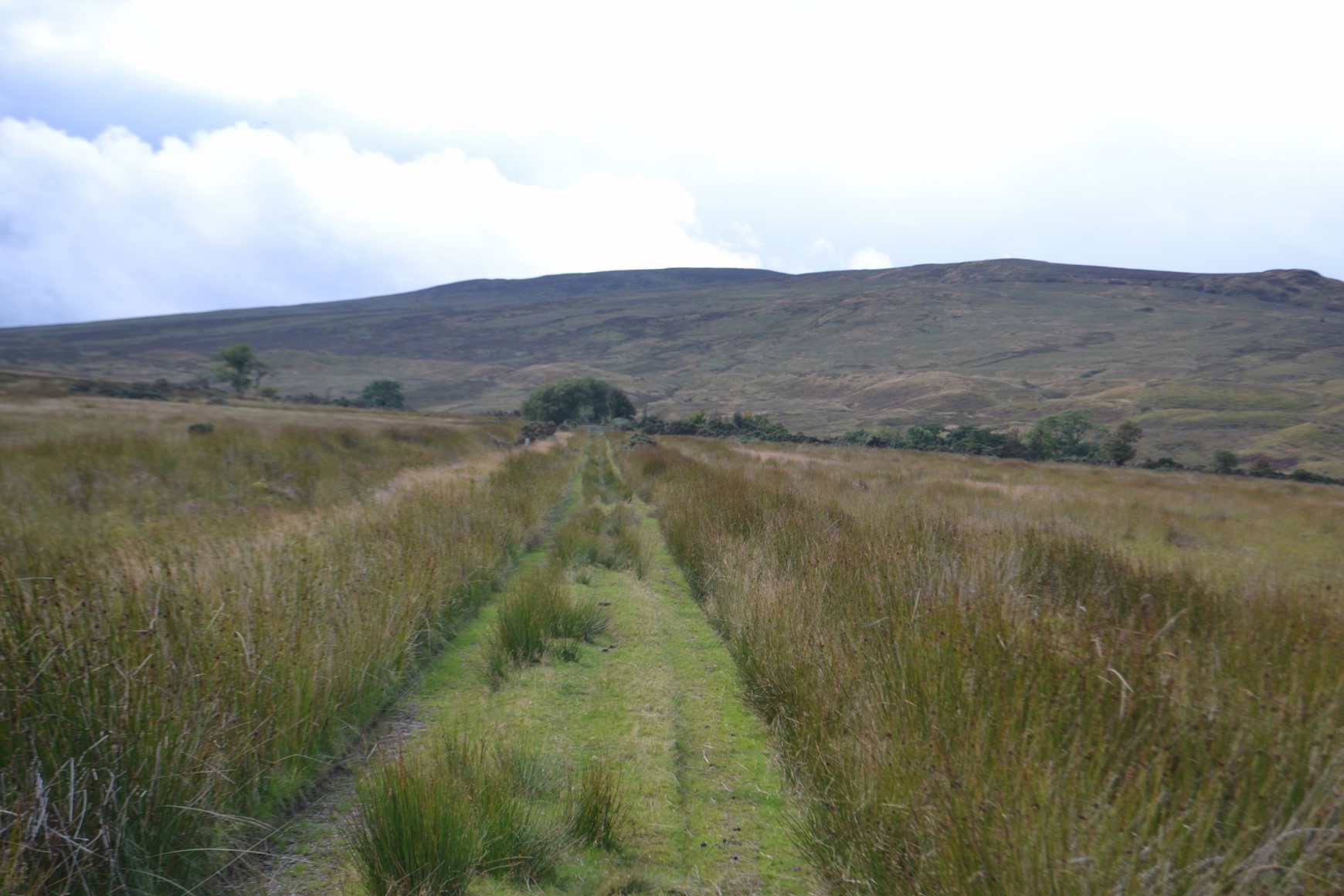
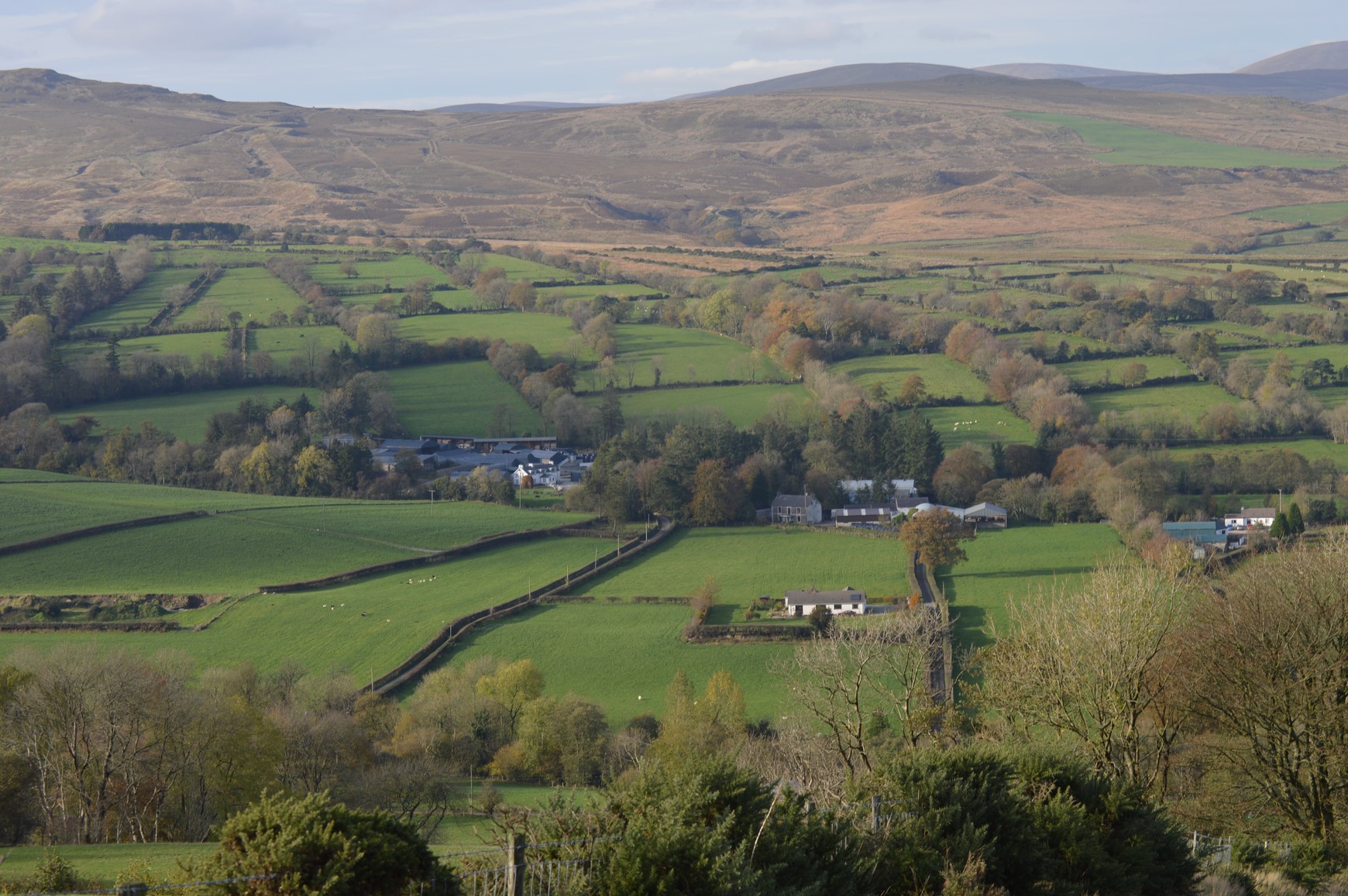
– We can see a series of sand eskers in the centre of this photo which might contribute to the meaning “the hill plain” for Cavanreagh. Mile mountain is at the top with Carricknashinnagh (the rock of the foxes) to its right.
Cavanreagh consists of 1731 acres of mixed arable and mountain pasture and runs from the banks of the Moyola river up to the top of Mile mountain and Lough Uisce. It is bounded on one side by Moneyconey and on the other side by Glengamna. The river Glashagh flows down through part of Cavanreagh before it joins the Moyola river. This tributary flows down through a beautiful wooded glen similar to others in the Sixtowns where you will find most of the native species of trees and plants growing there, like oak, ash, holly, sally, rowentree, thorn and elder as well as bluebell, bracken, blueberry, heather and other vegetation.
Glashagh glen.
The slopes of Cavanreagh are sandy and there are many sand eskers dotted across the hillside which were left behind by melting glaciers at the end of the ice age. On a sunny winter day you can see these sand eskers from the main Sixtowns road strewn all along the foot of Mile Mountain. The flat holmes close to the Moyola river banks are also gravely and make good arable farmland. Perhaps this is the reason why the townland has always been so well populated. In fact the lower ground of Cavanreagh would have made up the main part of the original erenagh lands of the Old Church of Scrine and this area would have been the first part of the Sixtowns to have been settled in after the Iron Age.
Cavanreagh had the greatest variation of surnames of any in the six townlands during the 19th century as the Griffiths Evaluation shows. It is possible that one of the reasons why this was so was that there was a mill and a bleach green in the townland at that time and its workers would have moved there at some time to be close to their work. Another reason would have been that the plantation saw many families with a wide range of surnames settle into the area which previously had many families who had the same surname. The bleach green was situated along the Moyola at the lower end of Cavanreagh, a place which is still called “the green”. Several people must have been employed there. because we are told that a man called O`Cathan who claimed to be the last in the lineage for the chieftainship of the O`Cathans of Brackfield, was a foreman on a bleach green in Cavanreagh.
The area at the bottom of this photo was always known as “the Green” and this may have been the site of the bleach green in Cavanreagh.
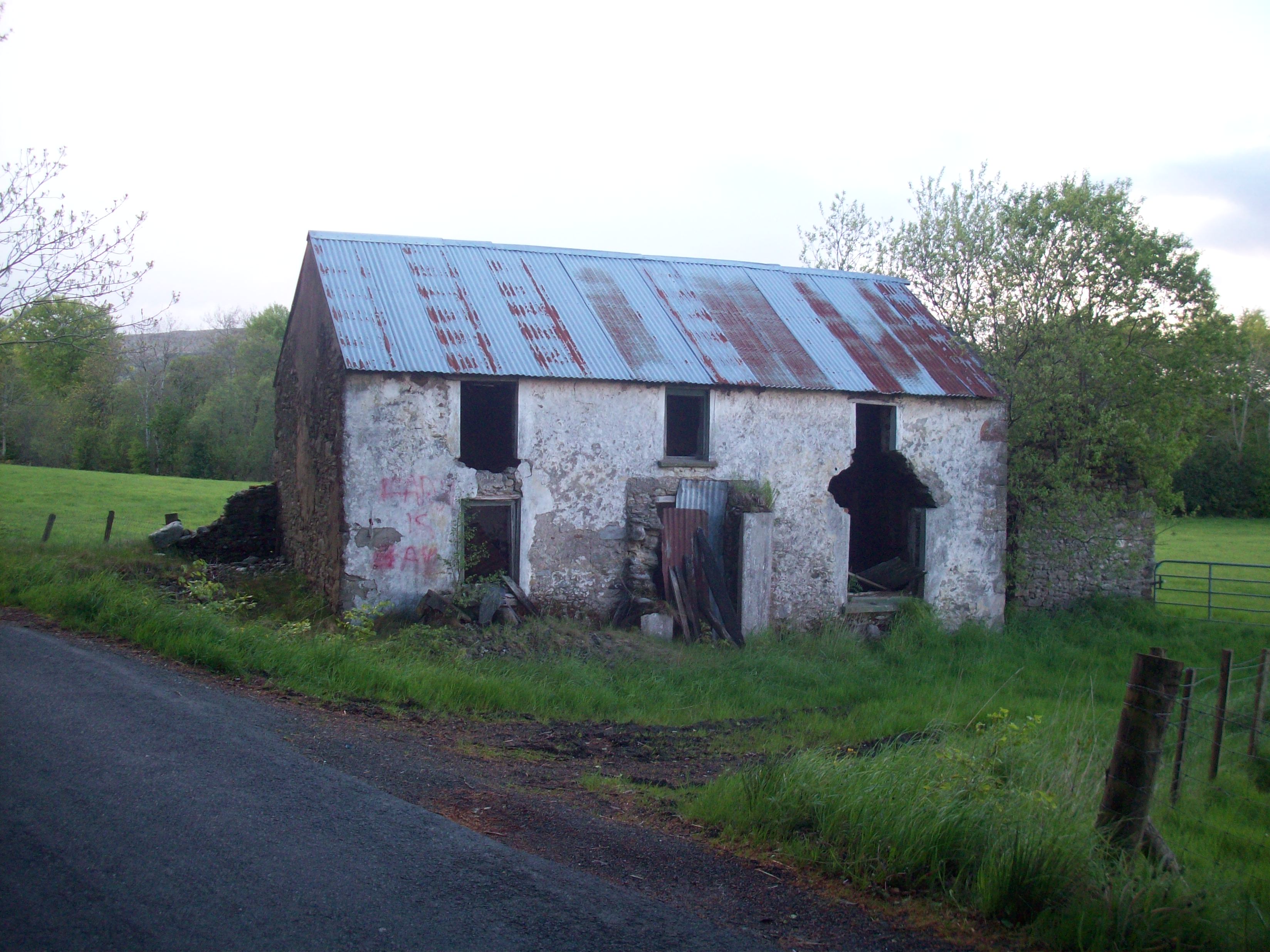
Later on there was a cornmill in Cavanreagh which would have employed some people. It is still standing today and is owned by Gerard Donnelly, although the waterwheel is gone from it. The name of a previous owner, James McKelvey is still to be seen above the door of the building. This mill was a cornmill and it served the surrounding area, milling the corn of farmers throughout the winter.
The O.S.Memoirs describe the mill thus;
The machinery of the corn mill in Cavanreagh tenanted by Neill McKelvey is contained in a good slated house and worked by a breast wheel 13 feet 6 inches in diameter and two feet across the paddles. The supply of water is not constant, being but a small mountain stream (Glashagh Burn).There are two kilns adjacent, one slated and the other thatched. O.S.Survey
The Cavanreagh mill.
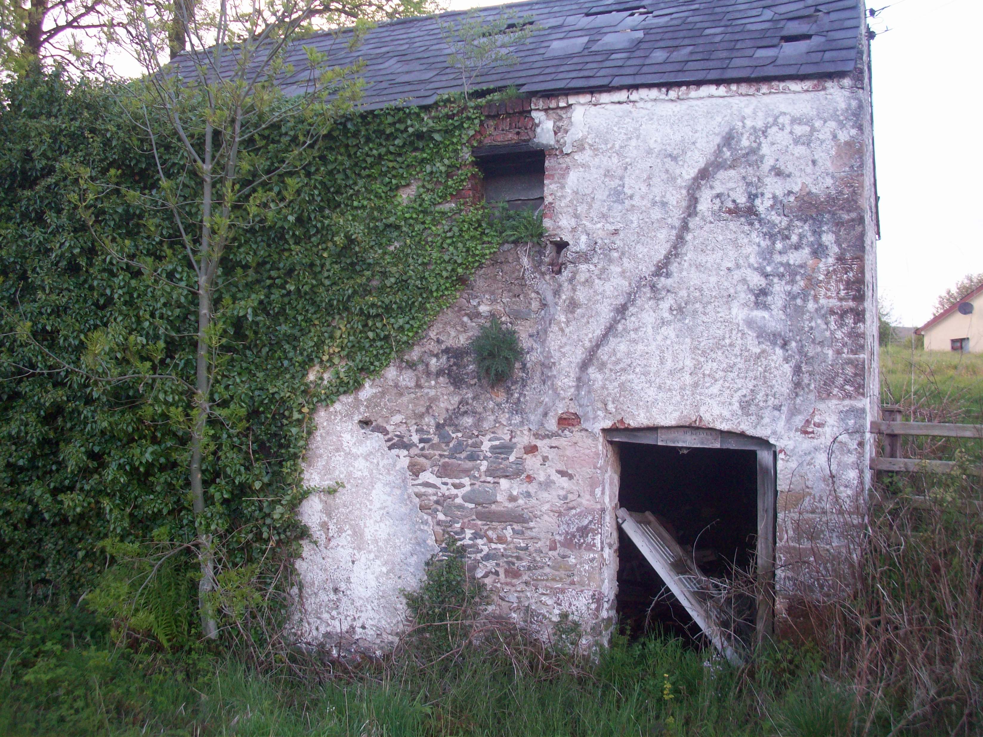
The farmers brought their corn to the mill and helped with the work of milling their grain. There was also a grain drying process in operation. The floor of this building was made of perforated sheet metal while down below in the basement there was a fire which heated the grain on the metal floor. This fire would be started off by turf but when it got going the chaff of the grain was used as its fuel. It burned slow and hot and the grain was spread over the metal floor above and then turned over and over by the workers until it was dried. At first the hulls were removed and then the shilling was ground. The children coming from school were always sneaking in to got some of the freshly ground and roasted shilling. According to the old people nothing tasted as good. No money passed hands between the miller and the farmer. He was paid with “muddar” which was a share of the grain. The farmer had also to give his service for free.
There was a grain drier in operation as well and it was fuelled by the chaff of the corn after it had been milled. This chaff burned slowly and very hot and it was based down below the floor of the drying house, the floor of which was made of sheet metal. Once the fire below got going, the metal floor became very hot and the men kept turning the corn over and over until it was dried.
The arrival of the thrasher spelt the end for the mill as farmers had their corn thrashed without having to leave their own farm. Regrettably the wheel has gone from the old mill but the building still stands as a monument to the ways of the past and as a glimmer of hope that one day soon some organisation will take on the task of restoring it.
Roads and pads.
Nearly 300 years ago the only road into the Sixtowns passed through Cavanreagh and went as far as the Old Church. Its main purpose was to serve the church but also the considerable population of the townland at the time. The O.S. Map of 1832 shows the road branching off at the little bridge on the present road about ¼ of a mile east of St Anne`s Church, and heading in a straight line for the foot of Curragh Brae. This bypasses the mill and seems to have been the main road on to Glenelly at the time. The present road past the mill was constructed at a much later date. This older road seemed to pass close to several clachans and when it reached Curragh Brae it went in a straight line over the crown of the mountain, a considerable distance to the left of the present road. If you stand at the mill today and look up the road you will see the track of the old road going over Cavanreagh mountain straight as the crow flies. The other road at the “top of the planting” as it is referred to locally, was probably constructed to serve the mill. There were quite a few families who lived on the higher ground of Cavanreagh heading up towards the mountain and these people would have used several shared lanes and pads to get out to the main road to Draperstown. Those who lived close to St.Anne`s Church and as far as Barnetts in Moneyconey, would have made their way down to the Cavanreagh road and then across past the Wee School, across the footstick and up the pad to the main road.
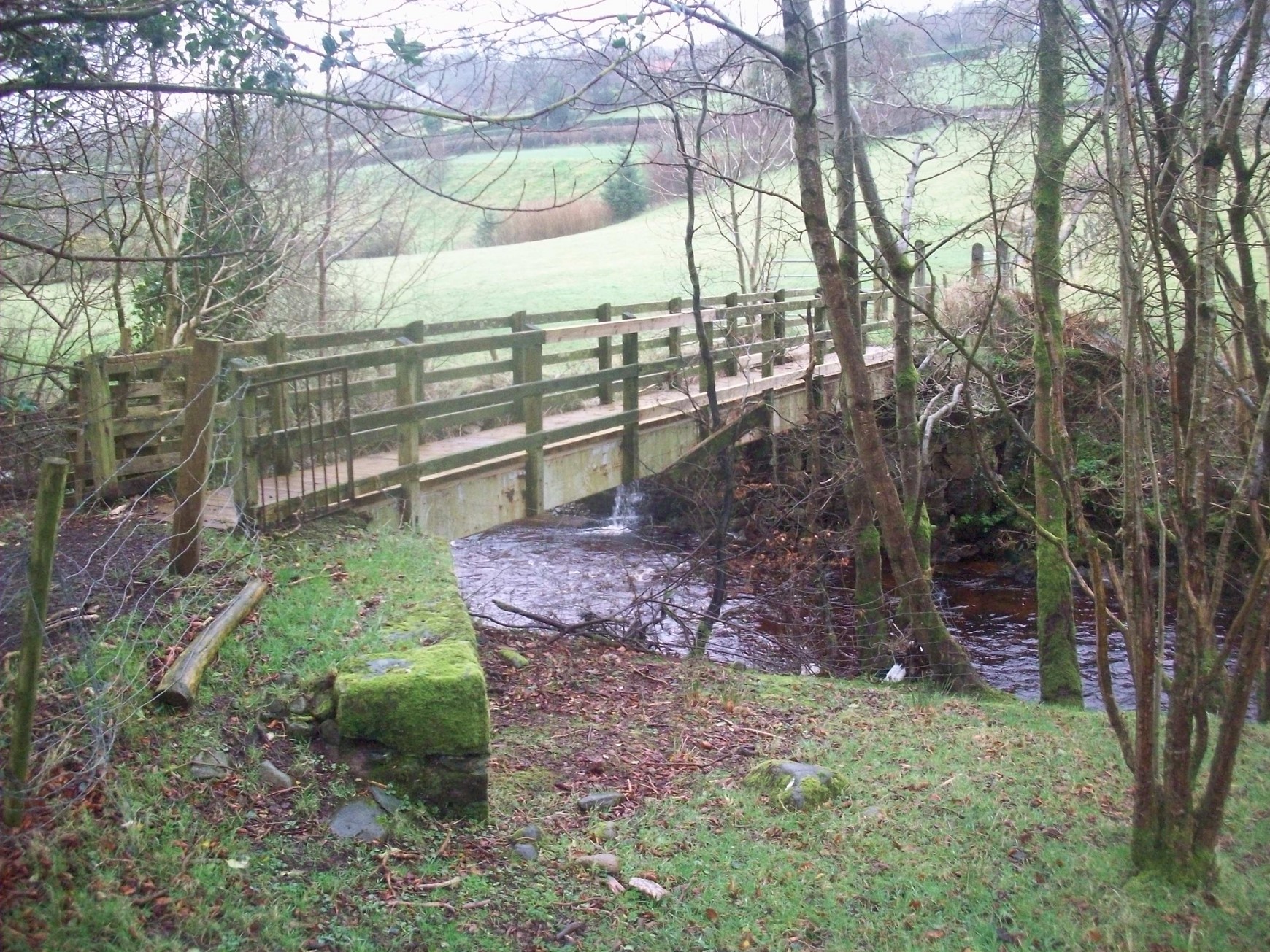
Local people on foot would have used this path and “footstick” to get out to the main Sixtowns road.
These lanes and right of ways are rarely trodden today, as those houses are empty and the mode of travel has changed beyond recognition over recent years. The last regular user was Mary (Ned) Bradley who thought nothing of the walk from her house at the top of the mountain down to the post office in Owenreagh for her pension and back up again. Perhaps some day in the not too distant future these right of ways will be opened up again to walkers who will be able to discover the treasures to be seen on a stroll through this most interesting townland.
A mountain pass in Cavanreagh.
The Meeting house.
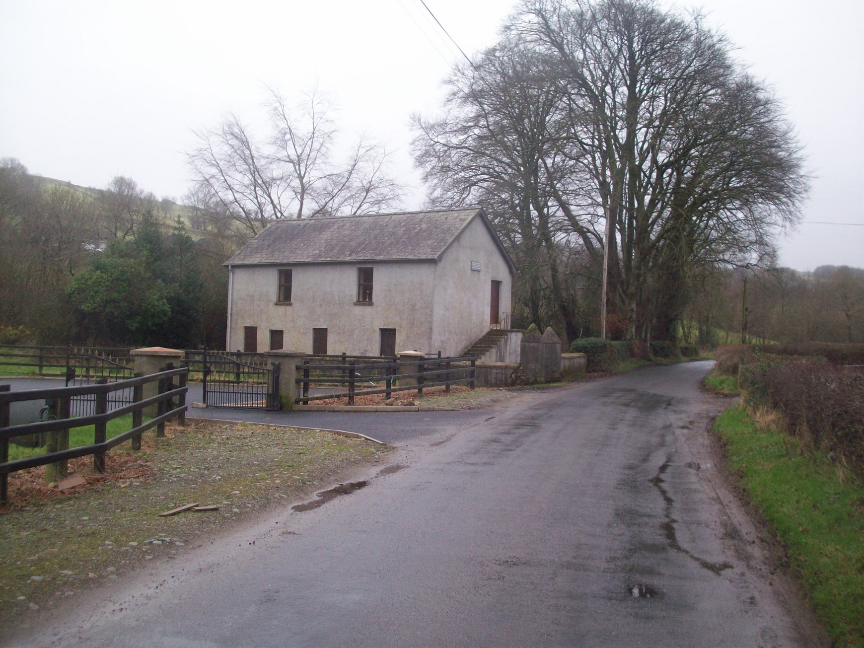
Not far from the site of the Old Church stands the two story building which is locally known as the Meeting house. This building was used for Sunday school and other assemblies. It is not used much nowadays but is still maintained and has recently had some repair work done on it. The pastor lived in the downstairs part of the building while the upstairs was used for services. It was once the place of worship of the Presbyterian congregation from the Sixtowns.
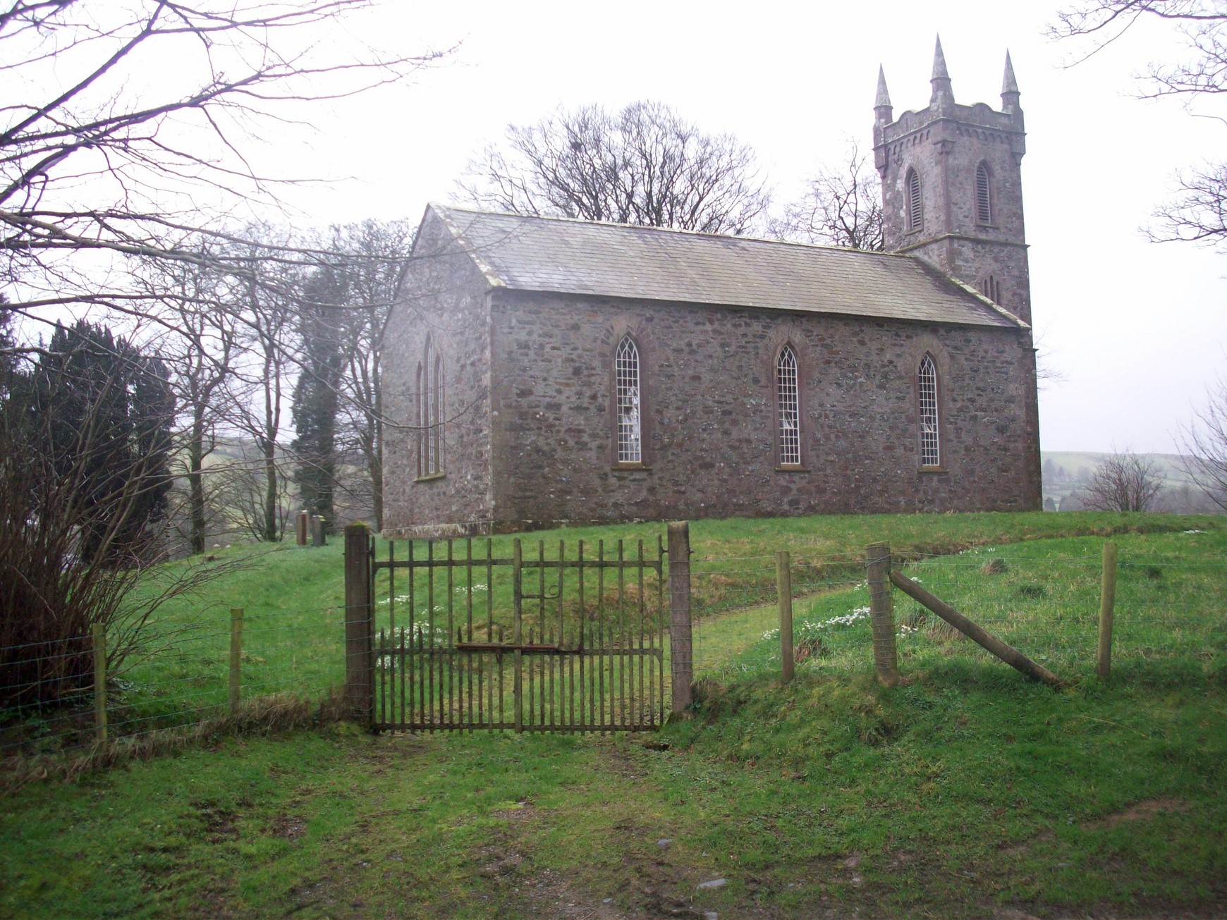
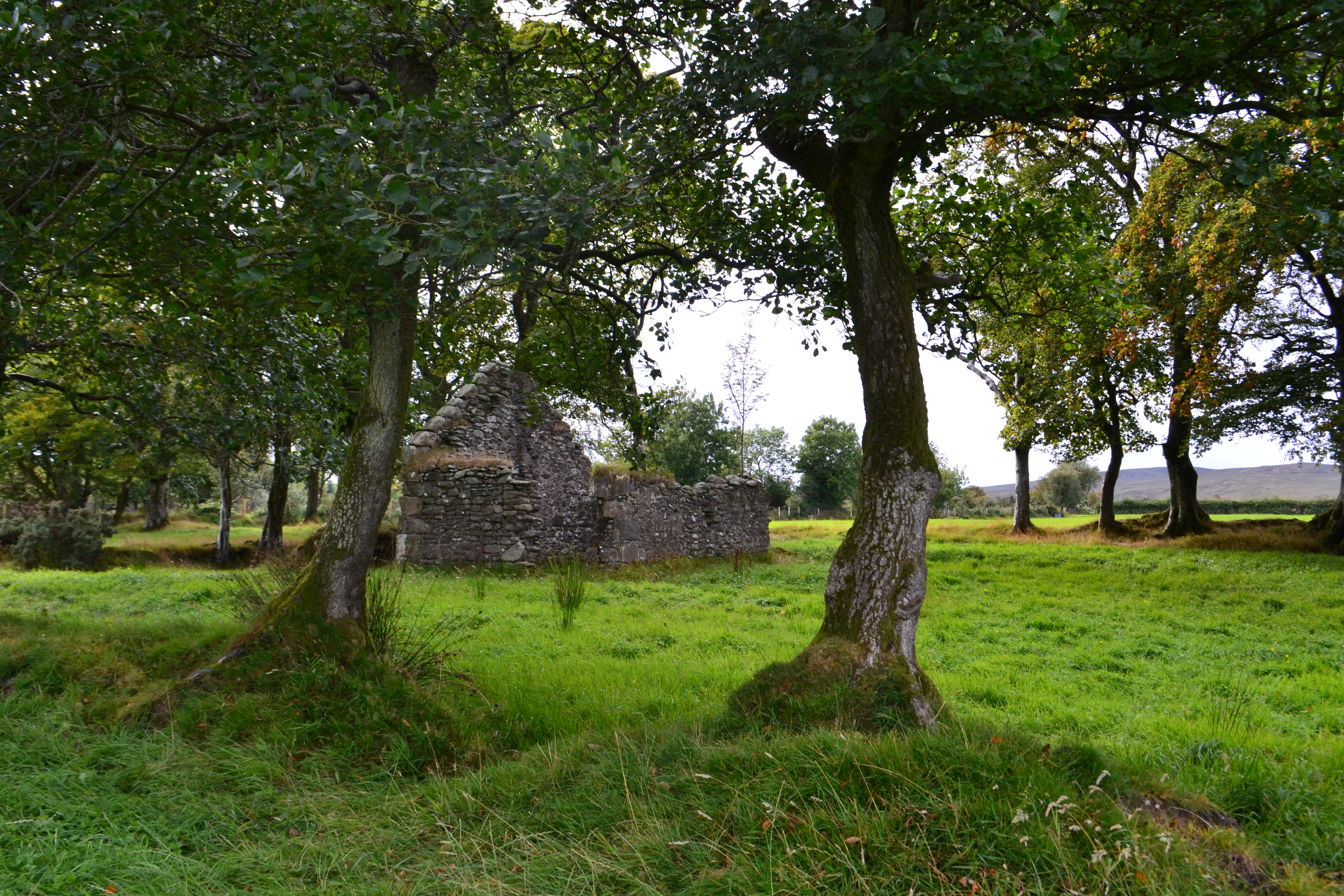
– St. Anne`s Church of Ireland.
St. Anne`s church was opened in 1845 to serve a considerable congregation from the area and the first resident curate was the well known scholar Rev. Thomas De Vere Coneys and he was then replaced by another famous scholar Rev. Robert King. Both these men were very into the Irish language and indeed when the church was first opened part of the celebrations were carried out in Irish. Indeed also attending the opening ceremony that day were 80 students of Irish. The Rev. King was well known for his “ceildhing” visiting houses of all persuasions debating religious issues of the time.
In 1851 Rev. King moved on and Rev. Mathew T Moriarty who was born in Co. Kerry. It stands in a most beautiful setting in the centre of the townland and has a small adjoining graveyard. The graveyard holds the souls of many Sixtowns people including the surnames Laughlin, Hassan, Dornan, Reid, Deane, Taylor, Sinclair, Elder, McKeown, Leacock, Barnett and Bradley.
There is nobody of the Church of Ireland faith left in the Sixtowns so the church is only opened for special occasions.
Beside the church is the beautifully restored former parsonage where the pastor would have lived when he had a considerable congregation. It later became used as a hunting lodge which gives it its nickname “the lodge”. Later on again it became the property of the Deane family and after the last of that family emigrated to Canada, it was bought by the Bradley family who still live there today.
Cavanreagh and its people.
It is most likely that there was little or no settlement in Neolithic times in this townland as there are no known relics of these people to be found but from the Bronze Age onwards this would seem to have changed. The main reason for this was that the Neolithic people did not have the metal tools to cut down the forests or till the stiff soil and they just went elsewhere. With the arrival of the Bronze Age and Iron Age that would have changed.
There is a reference in the O. S Memoirs of a find from, probably the Bronze Age in the townland.
In Cavanreagh in the year 1815 a grave 5 feet long and 2.5 feet broad and 2 feet deep was found enclosed by a stone wall. It contained a quantity of rich black earth.
/ O.S. Memoirs.
This is the only remnants of the Neolithic Age which we have in Cavanreagh. In fact this grave may be from the Bronze Age. One way or another, it is fairly clear that the first settlers in this townland were from the latter age. On the top of Cavanreagh mountain there is an area which has been designated as a Bronze Age settlement of some sort.
The next evidence of settlement recorded in Cavanreagh would be closely conected with the Church of Scrine. In days when Ulster was ruled by the Gaelic clans this area would have come under the jurisdiction of the O`Neills and it was their custom to grant to churches pieces of land which were called erenaghs or church lands. The tenants on the erenaghs would pay rents and the revenue from this would go towards the upkeep of that church.
It seems that whichever religious order was occupying a particular church, they would bring their own tenants with them which meant that these groups of tenants would have been a closeknit community who all originated from the same place. This might go some way to explain in the Hearth Monies Rolls in 1664, the presence of such surnames as McDevitt, O`Doherty, McColgan, O`Conaughan, O`Deeney, McFadden and O`Harkin which are all strictly Innishowen surnames. These tenants must have followed their order from Donegal to Cavanreagh. Of course these names were gone by the end of the 1700`s and this would show that there had been quite a turnover in surnames over the centuries in Cavanreagh, especially when you look at the census lists from 1825 onwards.
After the Hearth Rolls, the next and first proper attempt to record a census of the population was done in 1825. The Plantation had brought more change and a wide range of new surnames as the landlord and new owner of the Sixtowns set out the land to his tenants. Some of the tenants in Cavanreagh were occupying fairly substantial parcels of land but many others had small holdings or even just a house. As the population of Ireland was growing rapidly at that time so did the population of Cavanreagh eventually peaking around the middle of the 19th century. In 1832 there were 15 different surnames in Cavanreagh compared to 4 in Moyard. There were 29 houses in the townland at that time.
The surnames listed were :
McKelvey, McGlynn, Grey, McNickle, Sinclair, Phillips, Burns, Hamilton, Moran, McCool, Divin, Cleary, McNamee, Orr, Smith,
The Griffith`s Evaluation in 1856 shows a total of 33 different surnames in Cavanreagh with 45 houses in all but this was where it peaked. Moyard still had only got 6 different surnames at that time. By 1901 the number of surnames in Cavanreagh had dropped down to 24. Emigration and lack of opportunity had begun to take its toll. The surnames of the townland at that time were:
Moran, Bradley, Major, McCrea , Hamilton, Cleary, Heron, Orr, Smyth, Laughlin, Donnelly, McNamee, Douglas, Craig, Hanna, Sinclair, Cassidy, McKeady, Fleming, Gillespie, Phillips, Mullin, McCreanor and McGeagh. There were 33 households in all in 1901.
Most farm households had servants and sometimes relations lodging with them which seems to have been a common tradition in those days. Again there is still no sign of a moving away from agriculture as the main occupation at this point in time. In fact it would be well into the century before this would change. By the year 2014 the number of surnames in Cavanreagh had decreased to 13. New surnames were : McCullagh, Conway and Flanagan.
Here is the 1901 Census list for Cavanreagh.
Census list of Householders for Cavanreagh
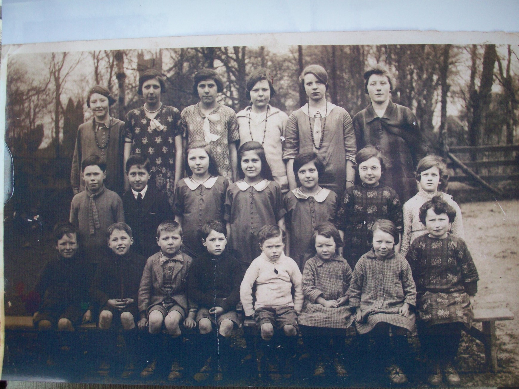
The Wee School.
The Wee School as it was fondly known was opened in 1896 and the newly enrolled pupils moved down from Altayeskey P S. After that it was attended by the pupils of the local Protestant community mostly but had Catholic pupils on its rolls at various times in its history. It was situated close to St. Anne`s church and it finally closed down due to lack of pupils in 1965. The former building is now a private dwelling.
 –
–
Pupils of the Wee School in the late 1920`s.

Over time farms changed hands as families died out in the townland. Many former farmsteads have now been subsumed into larger farms and all we have left are the old ruins of houses to remind us of a once flourishing farming community which is but a distant memory.
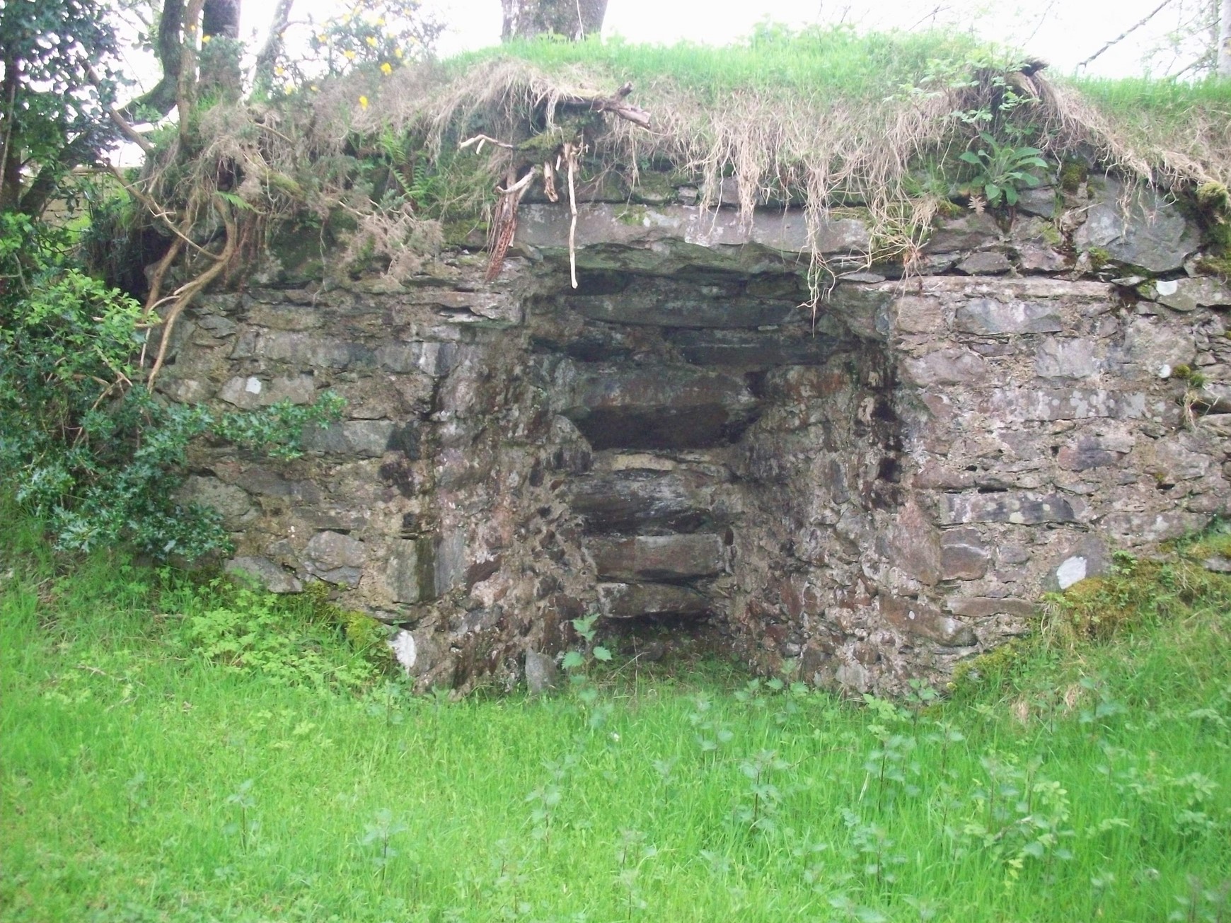
These houses would have been built from lime mortar and stone and the walls would have been finished in lime whitewash. In order to do this work limestone had to be drawn by horse and cart from Desertmartin and burned in lime kil
Lime kilns like the one below which is still in good shape and is on land owned by Harold Sinclair.
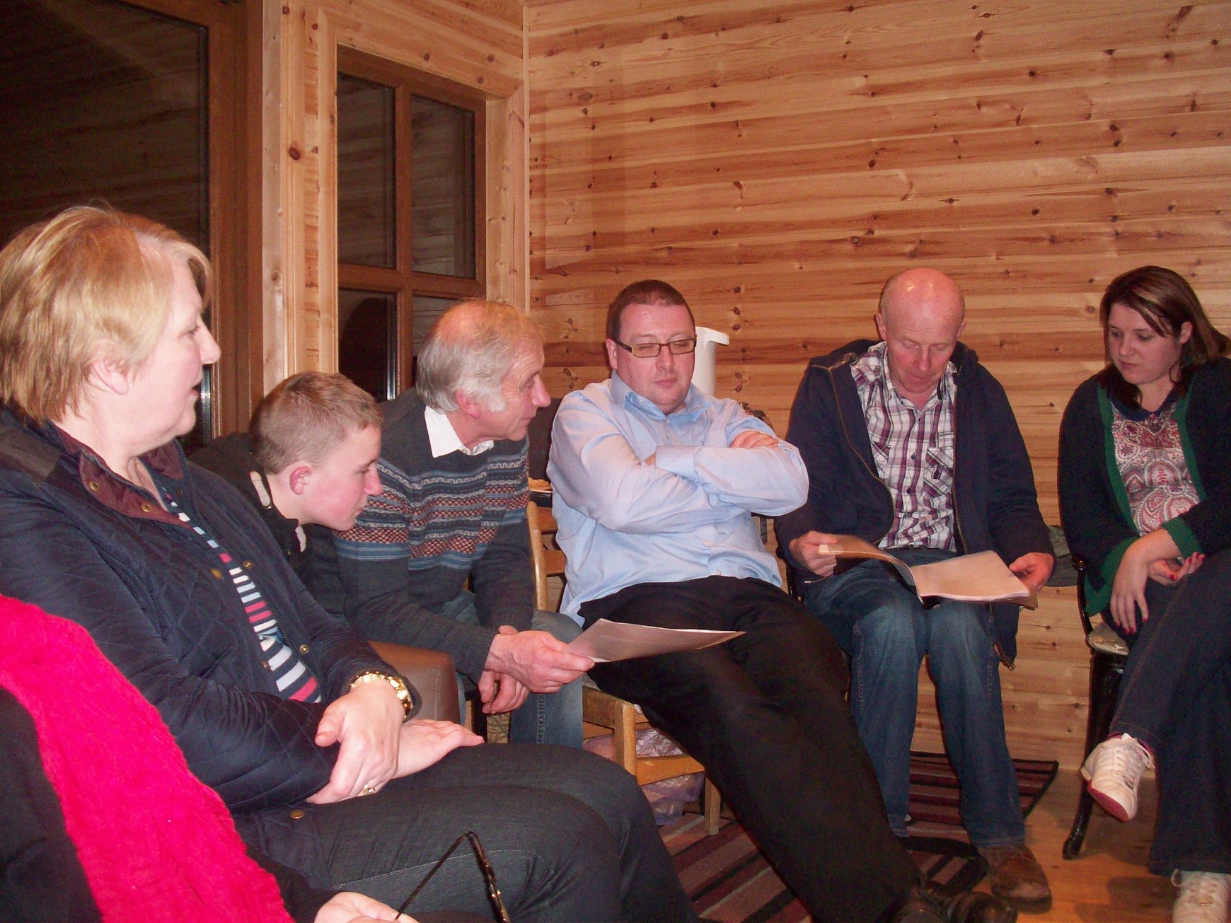
The people of Cavanreagh would have “ceildhied” in each other`s houses in the days when there was no television or other pastimes. They told stories and swapped news and had “a drop of tay” as well. Here the old tradition is being enacted by a group of local residents.
Wee Cavanreagh.
Cavanreagh townland was once divided into two parts, Big Cavanreagh and Wee Cavanreagh. The area shown in the photo is Wee Cavanreagh. It is not known why these two parts are so named.

Wee Cavanreagh
A view of Big Cavanreagh.