The relationship between farming and settlement from the 18th and 19th centuries until today.
Rundale farming.
Up until the early years of the 1800`s settlement patterns in the Sixtowns area were shaped by the system of farming which existed prior to this period, known as the “rundale system”.
This was a system in which small communities or groups of families owned and worked the land in partnership. The people lived in cluster housing or clachans with each household owning its own portion of arable land while grazing land was held in common. The rundale system was the social and economic system of the townland in that not only was it a system of agriculture but it was also a system of communal habitation.
“Arable land in rundale was held jointly, although individual shares were intermingled and their plots widely scattered to include land of different qualities, some on the constantly tilled infield, some on the shifting patches reclaimed periodically from the more remote outfield”.
The decline of the Rundale, 1750- 1850. D.McCourt.
A feature of the rundale was its social elasticity; the arable and meadow lots were re-allotted at regular intervals to equalise shares, both in terms of quality and quantity, in relation to population changes. There were also less regular re-divisions to provide land for all the heirs of deceased holders although traditional checks prevented any fragmentation from being excessive. This was done by restricting inheritance in some agreed manner. This would seem to have been a very fair and equitable system with built in guarantees of equity and indeed it seemed to work for quite a while. However, as time went on and the population grew bigger, these guarantees and safeguards gradually fell by the wayside and there developed an increasing disparity in the size of holdings.
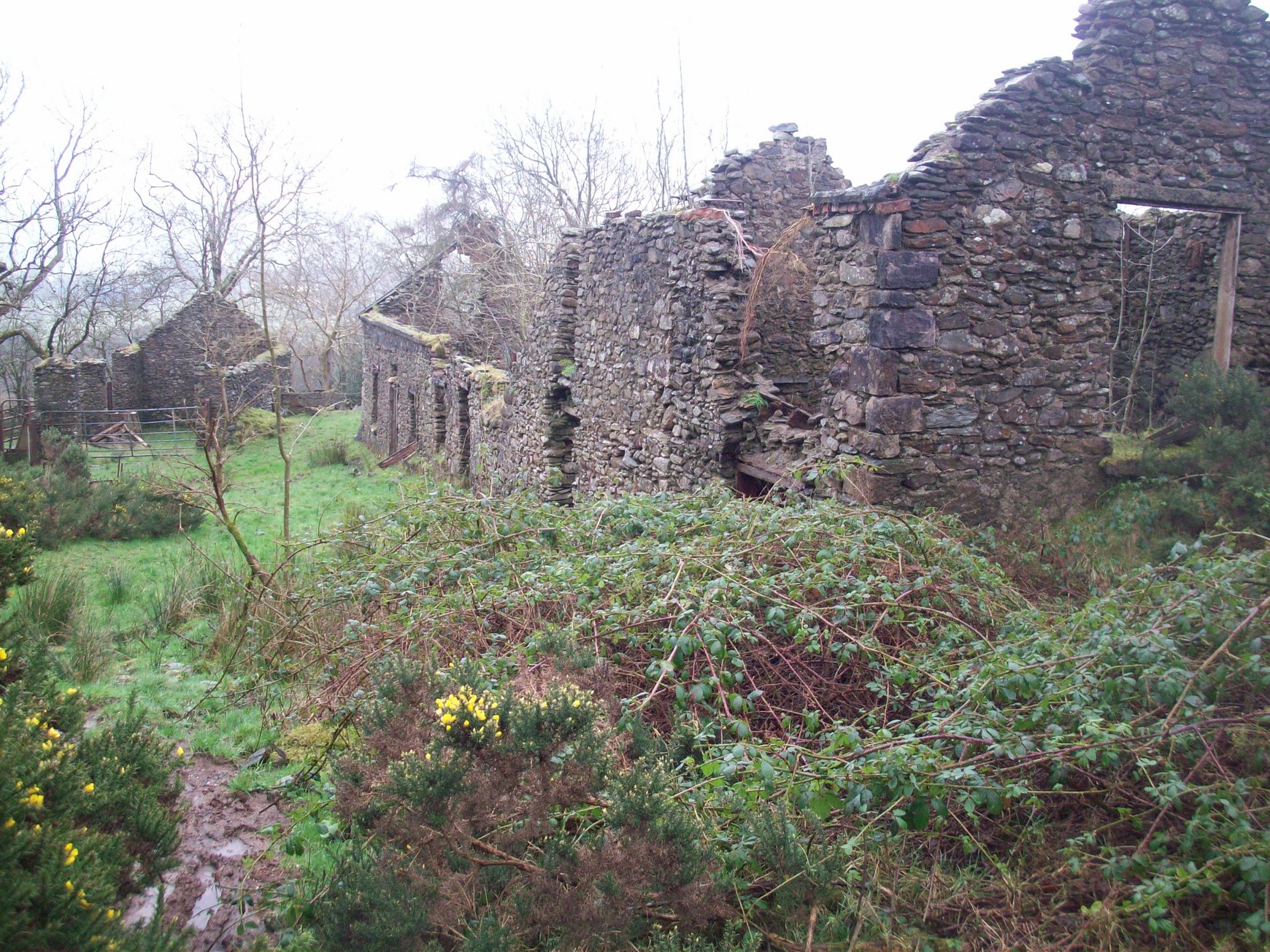
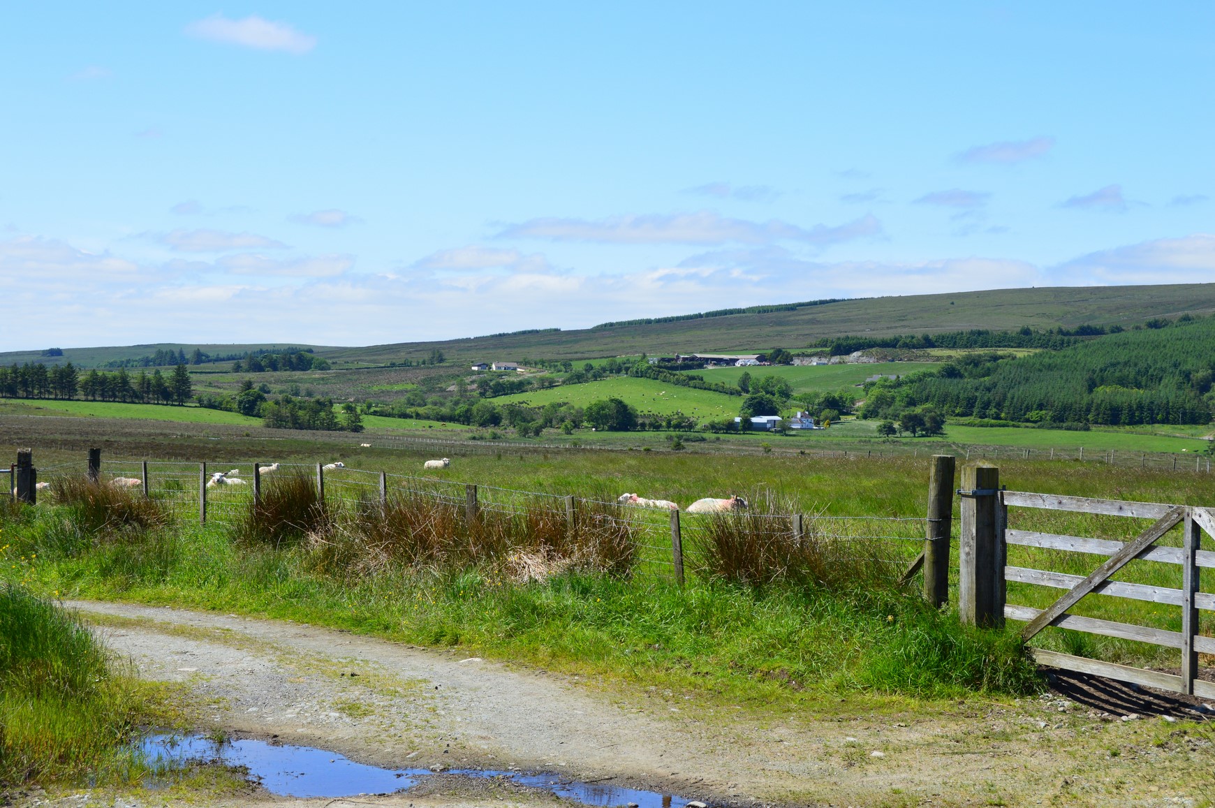
The ruins of a typical Clustre/clachan of houses in Moneyconey.
Difficulties were further compounded around the start of the 1800`s as members of the cluster began to squabble about rights of way, overgrazing of common land by other members, difficulties over the allotment of shares and so on. So intricately mixed were the plots of arable land there were rows over seemingly petty issues such as sheaf’s of corn blowing onto another member`s plot. Change was not only inevitable but very necessary.
Since the occupants of each joint farm lived in a loosely clustered settlement or clachan, the size of each cluster depended on how many joint tenants and the size of the subdivision. Up to about 1750 the average number of families in a clachan was limited (about four to six families). However, as the population reached its peak that number could have been as high as eighteen to twenty in each clachan.
We can get a fair image of the layout of settlement in the Sixtowns around that time. The people would have lived in clusters in the lower parts of the Sixtowns and there would have been extensive areas of rough pasture on the surrounding high ground. Population would initially have been low but as the end of the 1700`s approached it grew considerably. The inhabitation of the wider and higher parts only began after the demise of the rundale system and the introduction of the straight marches by the landlord of the time.
O`Donovan in his letters, refers to these upland areas and what they were used for in the time of the rundale.
“In May every family removed with its flocks and herds to the woody glens and upland heights, then rich with the most luxuriant herbage, (nowadays tamed by the plough). There they lived during the summer on a scanty supply of oatmeal but an abundance of butter ,curds, cream; in short a milk diet in all its preparations.”
This system of summer transhumance was known as boalying and gives its name to the present sub division of Tullybrick, known as Boley. This area was obviously a boalying area at one time. The movement of stock up to the mountain pastures served two purposes. Firstly, the grazing was rich and secondly it meant that the men folk could get on with tilling the land and harvesting the crops, free from the interference of straying animals, since there were no fences between plots of land.
The sub townland of Boley gets its name from the custom of summer pasturing there before it was permanently settled.
The people would even bring hives of bees and their spinning wheels. Milk would be churned to make butter which would be buried in the bog to preserve it. There was also the custom of bleeding the cattle where several pints of blood might be bled from the animals, boiled and stored until it was in a congealed state when it would be mixed with oatmeal. This substance was counted to be a great delicacy in those times and would have been a supplement for meat in the diet of the people. These people would live in `boulie huts` for the duration.
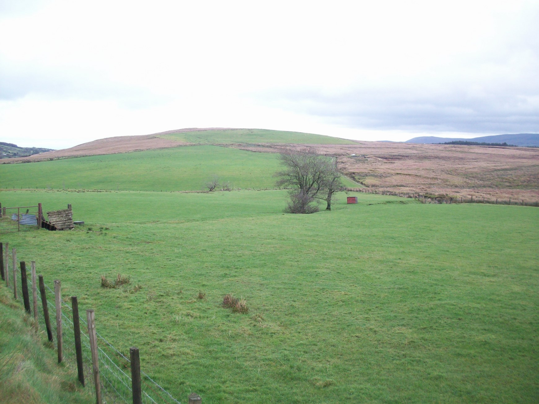
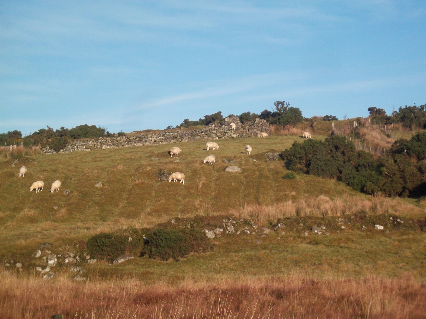
This area in upper Glenviggan was an area of summer pasturing during the Rundale days.
Rosie Church, (of Glenviggan) told me about a place where she and her sisters used to play around, close to her present house and they called it the boulie house. This would suggest that the area around the top of Glenviggan would have been boulie land. My father remembers the old people talking about the superb qualities of the mountain grazing in that area. The same would apply to the area still known as Boulie in Tullybrick. The old people knew what kind of pasture their stock thrived best on, as they had been grazing those lands for centuries. It is not surprising that farmers nowadays, who have land down in the lowlands, are now realising the benefits of mountain grazing in summer in particular areas and are taking land for that purpose.
Dr. Desmond McCourt of Magee University wrote an article entitled “Traditions of the Rundale in and around the Sperrin Mountains” after carrying out an extensive study in that area. He refers to the decline of the rundale in the Sixtowns and the effect it had on settlement in that area. He talks to several local people in an effort to see what was remembered about this era in the Sixtowns. Here are some samples of what he had to report;
“In Cavanreagh townland, Mr. J. Cleary (Tam) of `Wee Cavanreagh`, said that his grandfather came from an old cluster (clachan) before settling in the present house, which lay near the old site. He estimated that he was born sometime before 1815, which would take us back to a date prior to the first Ordinance Survey of 1832.He remembered his grandfather saying that, in addition to seven or eight families, there was a schoolhouse.
Robert Sinclair, aged 76 years, of Big Cavanreagh, heard from his grandfather of another cluster of even greater age. It lay near to where the present Mr Philips farm is now situated. Mr. Phillips aged 84 years, also heard of this cluster and informed me that when making a ¬kesh¬ across his burn some years ago, he came across many old foundations in the vicinity. This, he thought, may have been the cluster originally inhabited by the families of Knox and Leslie, who were at one time the joint occupiers of this part of the townland, according to a 1745 partnership lease preserved by his neighbour, Mr. Sinclair. He also heard it said that once Tullybrick was a cluster of fifteen families; but at the time of the `straight marches` the clachan was broken up, some of the occupiers having been moved up the hill to Boulie to make room for those remaining”
This would indeed provide evidence that prior to this point that there were large tracts of land ready to be occupied by new tenants, in places like Boulie, Glenviggan and other parts of the areas of higher ground in the Sixtowns. In fact the Sampsons map of 1813 shows no previous sign of habitation in any of those areas.
McCourt goes on to talk about a similar situation in Moneyconey.
“Mr. J. Cleary of Cavanreagh said that his grandmother came from `Coneytown` to their present farm. She died in 1903 at the age of 90, which takes us back to 1813. She used to tell stories of the old rundale days that she had heard from her mother.
Mr. George Barnett, aged 67 years, of Owenreagh, said that the lands of Moneyconey cluster were first broken in by his grandfather Ephraim Barnett, the Quaker, who had set out from the former cluster in Dunarnon in Owenreagh. His uncle George Barnett, aged 90, said his father just about remembered rundale and he died forty four years ago at the age of 90”.
Referring to the change in the settlement structure brought about by the landlord he goes on to say;
“There was no doubt then that some sort ‘replanning’ process was sweeping away the clachans and stripping the rundale farms, which persisted on the mountain and peneplain in the Sixtowns region, until the early years of the 19th century.
In the Ballinascreen parish, which coincides with the lowland embayment and peneplain west of Draperstown, clachans were so prevalent in the 1830`s that in the words of one contemporary source “there is neither town or village. The inhabitants live in houses situated in clusters of from six to twelve in number. There is generally one and sometimes two of these clusters in each townland.
But already the rundale system of which they were a part was well on the way to obliteration at that date”.

“Big Cavanreagh”
“Wee Cavanreagh”.
The decline of the Rundale system of farming and settlement in the Sixtowns.
As a result of this rise in population, conditions deteriorated in the clachans, with people living in overcrowded hovels and the system slowly began to fail. Change was inevitable, and it came around the start of the 1800`s when John Stevenson from Fort William in Tobermore bought the Sixtowns from the Church of Ireland and followed in the footsteps of many other “improvement landlords” by reorganising the land into designated farms, laid out in stripes with straight marches. Most of the farms consisted of a long stripe, running from the river right up to the mountain grazing. The idea behind this design was to give each farmer an equal amount of good land and grazing land. These farms were called “ladder farms” because they looked like ladders running up the sides of the valley.
The time was ripe for this innovative move at the time since the old Rundale system was failing fast. This new system would change the settlement patterns in the Sixtowns completely. The whole structure of the community would change beyond recognition, the clachans would be broken up and its members scattered all over the area. The focus would change from one that was communal and based on partnership to one of individual enterprise. Nothing would be the same as an age old way of life would come to an end.
Another factor which also helped speed up changes in agriculture at this time was the boom in demand for farm produce in Britain as a result of the Napoleonic wars. Farmers were no longer merely producing for their own needs but were now entering a marketing economy. Things had to change in farming methods if they were to compete.
The end result of the new system was the breakup of the clachans and the movement of people upwards to land previously only used for summer grazing. It is known that some members of a sizeable clachan in Tullybrick were moved up to Boulie to make way for the newly designated strip farms. It would seem that the landlords were intent on creating as little disruption as possible in their innovations and therefore we could assume that most of the tenants of the new farms were from the clachans closest to where their farms now lay .Popular surnames like Gillespie in Tullybrick and Cleary in Cavanreagh came from clachans close to their new farms.
O`Donovan tells us that at the time he was doing his survey in 1835 that
“Stevenson too has been paying great attention to the improvement of his estate in the Sixtowns and has by rearranging his farms, been effectively destroying the rundale system. He is also laying out his wastelands in lots and settling good tenants on them”.
“A number of these mountain farms are already occupied by many of those of his tenants who formerly held limited parcels of ground on the lowlands, and are now building farmhouses, office houses and making gardens, small plantings etc. on these new tenements. They are receiving some assistance of building materials from the proprietor”.
This would suggest that people were moving up out of the clachans lower down to take possession of farm leases on ground which would previously have been used as boulie grazing. It would also indicate that a huge change in the pattern of settlement in the Sixtowns was taking place which would alter the face of the landscape for a long time to come.
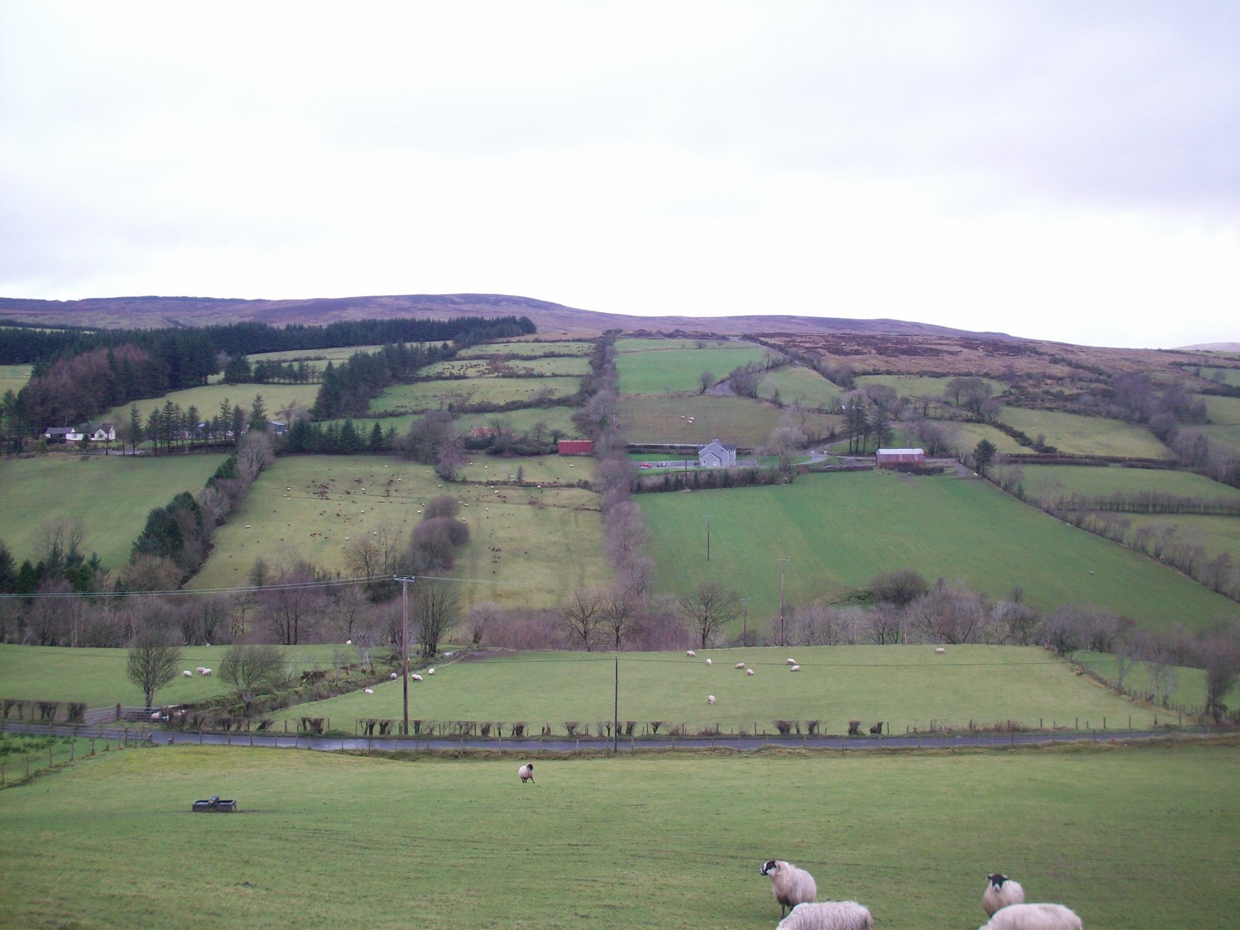
This area would have been mountain pasture land before the breakup of the clachans. Tenants were moved up here during the 1830`s from the more congested areas further down the Sixtowns.
New tenants come to the higher ground in the Sixtowns.
We can, to some extent, follow this pattern of movement of families by viewing the census lists of 1825, 1832 and 1854 which lists families and where they were living at those times.
Looking at the pattern of surnames in some parts of the Sixtowns it is obvious that some of these are not names with long association with these areas. The surveys of 1825 and 1832 do not list these surnames in these parts either which leads me to believe that these were the families which were moved up later on to those particular areas as new tenants. Names new to Glenviggan were Clerkin, Kelly and Campbell. In Moyard there was Connolly, Cleary, Molloy and Clerkin. In Moneyconey it was Connolly which appeared later and in Crockban (Tullybrick) there were Campbells and Morans new to that part. Boulie in Tullybrick which was not listed as being inhabited in 1832, later had Clearys, Mallons and Cassidys who had obviously moved up from the clachans of Cavanreagh and Owenreagh as the landlord proceeded with his reorganising of the farms. It is interesting to note that another set of families which moved up to Boley, namely the McGillions would have been strongly associated with the old church (Moneyconey) and would most likely have moved from the area around it.
The last recorded rector of the old church at Moneyconey was a McGillion.
A survey carried out on the parishes and chapels in the Derry Diocese in 1607 states;
Parish ——– Ballinascreen
Patron —– St. Colmcille
Rector —– none
Vicar ——- Sean McGillion
Erenagh ——- none.
This would suggest that the position of ‘erenagh’ would have been held by the McGillians at some time previous to this. (Remember the folk tale about the McGillions, the McGurks and the bell.). They would have lived close to the church and as they lost control of it would probably have ended up living in a clachan nearby. Some of the McGillians moved to Moneyconey and are known to have emigrated to Quebec in 1834. There was also another family of them who lived up in Glengamna until the latter part of the last century. There are others living in other parts of the parish but the former groups are more significant to the break up of the clachans in the Sixtowns area.
The Sixtowns comes into the ownership of John Stevenson of Fortwilliam, Tobermore.
After the Flight of the Earls and the start of the Plantation of Ulster, all the lands of the Irish chieftains were confiscated and brought under the ownership of the English. Likewise all the church lands came into the ownership of the Church of Ireland. In the case of the Sixtowns erenagh, it became the property of the bishop of Raphoe. Leases were drawn up for tenants and rents were collected for the bishop at regular intervals. However, this was not exactly a very straight forward business venture and it was beset with problems.
One of the most difficult issues which persisted was the varying and often lengthy leases which were issued. The increasing difficulties experienced by the church in the running of its tenancies eventually led to it selling off its lands to various entrepreneurs. The Sixtowns was sold to John Stevenson, who lived at Fortwilliam in Tobermore. He obviously sorted out the lease problem which made the administration of his lands more straightforward and needless to say more profitable.
He, and later on his son, became what was known at the time as “improvement Landlords”. For these landlords `improvement` meant improvement to their property and profits. At first Stevenson carved up the available land in long “ladder strips” running from the Moyola to the mountain. The idea behind these ladder strips was to give each tenant an equal amount of arable and rough grazing land. If you look across at Owenreagh from Cavanreagh, you will see what this system looked like.
This new layout had massive implications for the structure of settlement in the Sixtowns. People became more spread out over the countryside. Then in the early 1830`s, James Stevenson, son of John, decided that he would capitalise on the rise in population as well as the overcrowding in whatever clachans which were left, to move people up to lands which had been hitherto lying barren. Space was needed and along with the offer of help and assistance with building dwellings for the new tenants, he managed to shift people up to places like Boley, Crockmoran, Crockban and other upland and outlying areas of the Sixtowns.
If we take a look at Sampson`s map of Londonderry 1813, we will see that those areas were not populated at that time. Also, if we look at the census list for 1825 we will also notice that there are none of the families which are listed years later, living in those parts. As well as that, as I have already pointed out, the families who are to be found in these upper parts in later surveys, are not names associated with those townlands. This was yet another huge change in the settlement patterns of that era, on top of the original change from the rundale to the straight marches system brought in by the landlord.
Breaking in new farms.
On the farms which lay on the valley sides of the Moyola, the houses tended to be built fairly close to the highest part of the arable ground. This was to make it easier to draw manure from the farmstead to the fields in that they would be taking it downhill. If we take a look at the house sites in, for example, Moyard, they are placed fairly well up the slope of the valley sides. We can also assume that any fields which appear above the houses would have been broken in some time after that house was built. These fields would have been later additions to the original farm and in fact the breaking in of rough ground to make arable land would have been an ongoing toil for each farmer.
The shape of the potato lazy beds can still be seen in this field in Boley as in so many other parts of the higher ground in the Sixtowns.
The new ground would have been set out in` rigs` or `lazy beds` as they are better known in other parts. This process involved digging trenches about 4/5 feet apart and turning the dug up soil into the centre of the rig, thus doubling the depth of the soil. The potatoes would then be set and the next year the process would be repeated. Over time the rough ground could be transformed into a more arable patch and shaped into fields. This was heavy and laborious work but the men were very adept with the spade and took great pride in their reputations at this work.
Stories of men working with the spade.
There is a story about a Cleary man who came up to dig a small field and set it in potatoes for a farmer in Moyard. Now this farmer had a reputation for wringing the last out of anyone whom he had hired for a days work and he gave instructions to Cleary as to what he thought would keep him a long day indeed. When it came to about six o’clock in the evening and the spades man came in for his tea, he began enquiring about getting a wash and shave to go to confessions in Straw that evening as there was a mission on. The farmer quickly reminded him that he would be going nowhere until he was finished, upon which Cleary informed him that he was actually finished, to the astonishment of his boss. This was an example of how quick and handy some men were with the spade in those days.
There is also a story about another old man who lived in Moyard and who was counted to be a bit simple and not to be able to manage too well on his farm. A group of neighbours gathered to set some rigs and in the evening they ran short of seed potatoes to set the last two rigs. Having consulted with the old man as to what the best thing to do would be, he told them that whatever they decided to do would be alright with him. One wag among the men said that they would leave those last two rigs to the Almighty. Later that night they slipped back with some seed and set the last two rigs without telling the old man. That year the best spuds were in those two rigs, so much so, they say, that the following year the old man decided that he would get the ground ready and leave the whole lot to the Almighty.
Breaking in the mountain pasture land to make fields.
The farmers in those times would use soured peat in an effort to enrich the soil. They would draw peat down from the bog and steep it for a period in the midden and then put it out on the ground where they were setting the potato rigs. They would use `bardogs ` to transport the manure to the higher ground. These bardogs were two wicker baskets which slung across the donkey’s back. The baskets would be filled and when the donkey reached the intended spot a string would be pulled on each one and the bottom of the basket would fall open dumping its cargo on the ground. The old people claimed that this method, indeed, could shift a lot of manure up to the higher ground in a day. They could also bring the manure to the exact spot to which it was required.
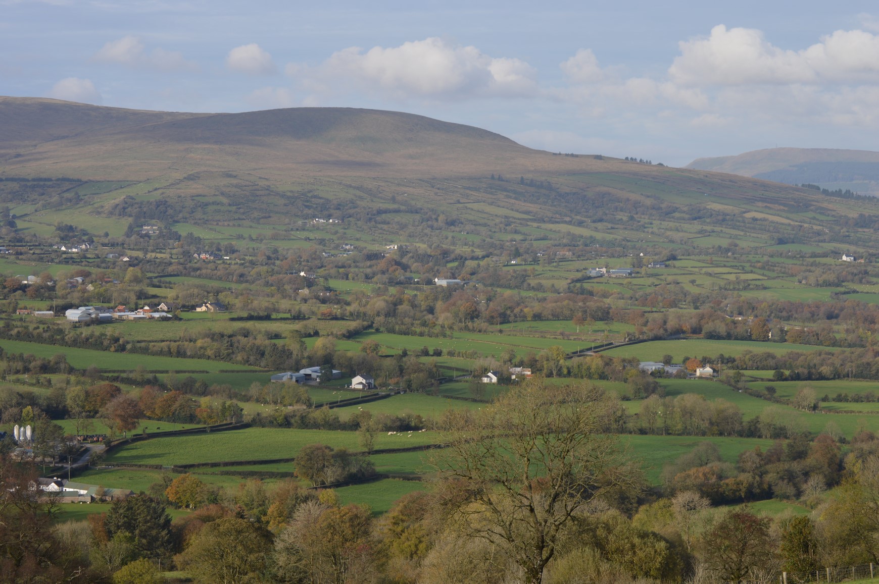
Most of the land seen here in this photograph would have been broken in from mountain pasture with the spade or plough.
If you were to travel up through the Sixtowns today you can still see the efforts of these wily people both in the farmland which is presently being used and also, in the ground which at one time supported families but now has almost disappeared back into its original state. There are fine examples of the remains of potato rigs in Stonehill in Boulie and on the northern side of the main road, along the Moyola, at the top of Moyard.
The farmers had not only to improve their land to make it worthwhile, but they had also to support their families and have enough to pay the rent. This left many with an insurmountable task and many were forced to emigrate or sell their farms. This meant that farms changed hands over time and names disappeared and emerged throughout the whole of the Sixtowns. Sometimes, if there was no male heir to a farm, a daughter might marry and bring her new husband into that farm and the original surname would disappear. If we go through the various surveys and census lists from 1832 onwards, we can see this was happening on an ongoing basis.
There were also people during this era who would lend money to some of the unfortunate farmers who were finding the going tough and then claim their farm from them when they were unable to pay their debts. This led to an exodus of some farmers from the area. Some would, perhaps, emigrate to America while others finished their days as hirelings all over the country. However, for most of the people of the Sixtowns, life was hard during the 1800`s and half way into the 1900`s. Every old site which still exists in the Sixtowns area will indeed have its own stories to tell. Unfortunately, the government agricultural land improvement schemes wiped out a considerable amount of these monuments to a past that is all but forgotten now.
Farming methods.
Farming methods would have changed very little in the first half of the twentieth century in the Sixtowns. The main reason for this was the lack of available capital to make improvements. The old people would tell you that money did not exist in those times and they were not telling lies. My father would say that it was not farming at all. It was barely existing. Many people were living on the point of starvation. There were no prices for anything and farms were poorly stocked. There was neither a demand nor even reasonable prices for farm produce and the onset of the “hungry 30`s” compounded a bad situation. It was a sort of moneyless economy where barter was the main method of doing business. People kept hens so that they could trade the eggs for provisions in the local shops. Pigs were fattened to be sold. Some people spun yarn to make socks which could be sold in Draperstown for ten pence a pair. One man told how his mother could knit a pair of socks from nightfall to bedtime after doing all the rest of her chores.
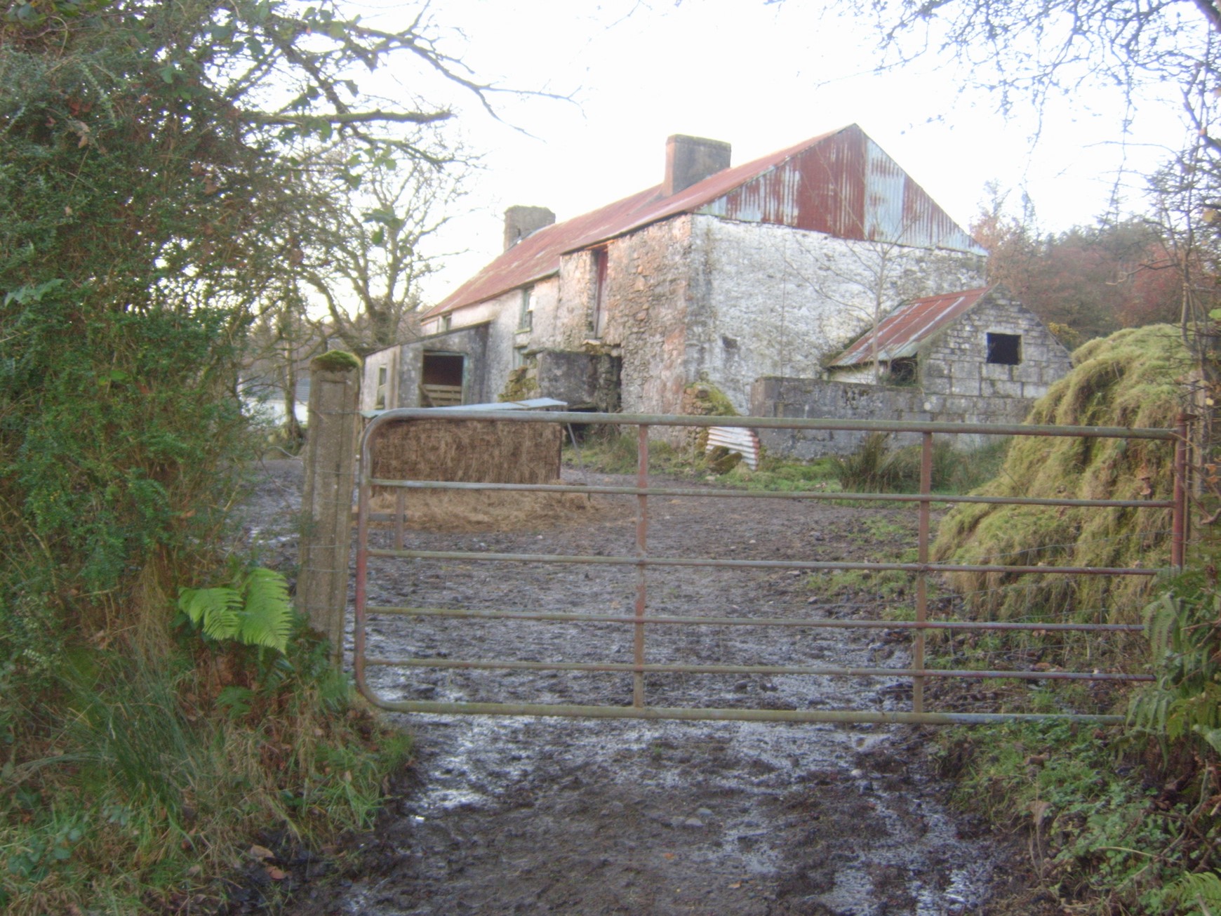
This farmstead dates back to the period when new tenants moved up to the upper parts of the Sixtowns. We can see the barn and the small pigsty by the gable. This house would have had a thatched roof at that time but little else would have been different.
A moneyless economy, country shops and the arrival of the grocery van.
The people worked and lived on the land but it was not farming as we would know it nowadays. For most young people the best option was to get out, to emigrate. Few houses were unaffected by emigration and there was a strong `Yankee` connection throughout the Sixtowns always.
The local shop was a very important part of the community from the turn of the 20th century right up to the middle of it. It provided a meeting place for the men of the area where they would sit and smoke their pipes and make their `ceildhi’. It was also the place to get the provisions and to sell eggs etc. Bread would be delivered by horse and cart from Draperstown by Jim McCreanor and also big Barney Gormley who ran a store in Draperstown. Meal and flour would also be delivered in the same way. People sold their butter and eggs to the local shops in return for the goods which they needed. Very little money changed hands
The death knell for these little shops came when the grocers decided that they would take advantage of the modern transport of the time, to bring their businesses to the country. The first man to do this was Johnnie Crilly who used an old Ford lorry with a tarpaulin cover on it to travel the whole Sixtowns and beyond to Broughdearg selling his wares. He would buy butter and eggs and sell his groceries in return. He was a very popular man with his customers. Many more followed like McAuley, Shields, Turkington, Coyle and also quite a number of breadmen. McNamee`s and Regan`s butcher vans brought meat around later on. The small shops could not compete with this new trend and one by one they disappeared, to the social detriment of the area. The places where men gathered to smoke, chat or play cards and where the women caught up on the local goings on, were gone for ever.
Story.
There is a good story told about an old man from Bancran who had, for his own personal reasons, quit going out to the chapel. Some time later, there was a station mass in a house close to him and he decided to go to it. (The stations were a custom where the mass was taken out to houses in the countryside every so often). Now, the parish priest, Rev. Michael Collins P.P. was one for giving the parishioners a dig or two, just to keep the craic going. He spies the old man and gives him a big welcome and slipped in the wee dig that maybe now that he had broken the ice we might see him come back to mass in Straw again. “Ah naw,” says the old man, “it’s a bit like the grocerymen, father. If you want the business you`ll have to send the van round”.
There were several shops in the upper part of the Sixtowns. Indeed one wonders how they were viable at all, being so close to each other. There was a public house and shop where the Shepherd`s Rest is now. It was owned by the Hughie Phaidi`s (Bradley). There was a shop at Johnnie Molly`s ( McNamees) at Bealnaslaght bridge. There was a shop at Joe (Dan) Conway`s. It had several owners one being the McGuigans of Broughdearg. There was another shop at Ann Campbell`s just west of the chapel. It had an off licence and was only knocked down in the late 1970`s. The licence to sell alcohol which it had held was sold to the Bradleys who owned the Doyle`s bar at the start of the 1900`s.
There was a shop and store at McBride’s (now McNally`s). There was also a shop at the mill in Cavanreagh. It had several owners namely Robert Sinclair, John Craig and later James (Thomas) McGlade. There were shops at an earlier time at John Hamish`s (at the site of the new bungalow about ¼ mile above the Shepherd`s rest. This one must have existed around the turn of the 19th century. There was another one between the school and the chapel, opposite Mickey Sother`s(Gillespie) owned by an old woman called Ann Holly.
Modern farming.
The arrival of the tractor changed farming in the Sixtowns for ever and the horse was confined to history. The older farmers did not like the tractor at first claiming that it would ruin the fields. Of course there was the issue of a series of skills which the older farmers had being made redundant for ever by the this new system of mechanisation. Many were very proud of their knowledge and skills with horses and were very fond of their horses. As well as that the blacksmith`s trade was gone as the number of horses in the Sixtowns declined. There was a smithy at Altaeskey(Bradley) and one at Glenviggan(Kelly) as wellas one at Cavanreagh (Barnett). It was the end of an era. The early tractors were crude models which only pulled ploughs. There were only a few tractors altogether in the parish and they were in constant demand at the time. The hydraulic lift for the tractor was a terrific invention and it improved mechanisation of farm work immensely. Machinery improved a lot and soon most farmers had a Ford Ferguson tractor to do their work.
Although most of the farms changed little up until the 1960`s in the Sixtowns, as prosperity increased, farmers snapped up small holdings which came on the market as a result of the existing owner passing on. This meant amalgamations of adjoining farms or simply became a piece of land owned by a farmer who lived some distance away. The end result was a decrease in the number of people farming in the Sixtowns as well as having a profound affect on the old patterns of settlement. There were less people now living on the land and therefore many farmsteads became unoccupied. Small farms of these sizes were no longer viable and as government land improvement schemes came into vogue in the mid 1970`s, sadly many of these old farmsteads disappeared from the landscape for ever and with them a huge part of our local heritage. The next trend was for the prospering farmer to build a bigger house as well as many new office housing to accommodate advances in farming.
In recent times, more change came. With the decline of farming prospects, local farmers turned more to subsistence farming, working in construction and other jobs and working their farms as well. This change of direction in farming and the gradual improvement in mobility, saw the development of many new houses throughout the Sixtowns which were built for local people who were not involved in farming in the area at all. This trend is still ongoing in the district, as so many people now have cars and are only less than an hour from their place of work. This is likely to lead to a repopulation of the countryside in the Sixtowns and the wheel will have turned full circle.
In 1750, everybody lived on and depended on the land for their existence. Nowadays very few people in the Sixtowns depend totally on the land for their survival and this trend is increasing rapidly. It is perhaps just as well, as the future of farming, which shaped settlement in the Sixtowns for centuries, is looking precarious indeed.